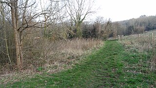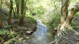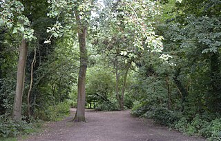
Horton Country Park is a 152.3-hectare (376-acre) Local Nature Reserve north-west of Epsom in Surrey. It is owned and managed by Epsom and Ewell Borough Council.

Kempton Park Reservoirs are a Site of Special Scientific Interest in the London Borough of Hounslow and Kempton Park in Surrey. It is owned by Thames Water. It is part of South West London Waterbodies Ramsar site and Special Protection Area Kempton Park East reservoir is also a local nature reserve.

Whitmoor Common is a 166-hectare (410-acre) biological Site of Special Scientific Interest on the northern outskirts of Guildford in Surrey. It is part of the Thames Basin Heaths Special Protection Area and the 184.9-hectare (457-acre) Whitmoor and Rickford Commons Local Nature Reserve, which is owned by Surrey County Council and managed by the Surrey Wildlife Trust.

Stanmore Country Park is a 30.7-hectare (76-acre) public park, Local Nature Reserve and Site of Metropolitan Importance for Nature Conservation in Stanmore in the London Borough of Harrow. It is owned and managed by Harrow London Borough Council.

Ali's Pond is a 0.4-hectare (0.99-acre) Local Nature Reserve in Sonning in Berkshire. It is owned by Sonning Parish Council and managed by the Friends of Ali's Pond.

Frays Farm Meadows is a 28.2-hectare (70-acre) biological Site of Special Scientific Interest near Denham in the London Borough of Hillingdon. It was notified as an SSSI in 1981, and has been managed by the London Wildlife Trust on behalf of Hillingdon Council since 1999. It is part of the Colne Valley Regional Park.

Perivale Wood is an 11.6 hectare Local Nature Reserve (LNR) and Site of Metropolitan Importance for Nature Conservation in Perivale in the London Borough of Ealing. It is one of the oldest nature reserves in Britain. The Selborne Society has managed it since 1902, at first as a bird sanctuary. In 1914 it leased the site and in 1923 it purchased it. The wood was designated an LNR in 1974.

Foxley Wood is an 11.36 hectare Local Nature Reserve and Site of Borough Importance for Nature Conservation, Grade 1, in Purley in the London Borough of Croydon. It is owned and managed by Croydon Council. The site was purchased by Coulsdon and Purley Urban District Council under the Green Belt Act in the 1930s.

Cuddington Meadows is a 1.4-hectare (3.5-acre) Local Nature Reserve and Site of Borough Importance for Nature Conservation, Grade I, in Belmont in the London Borough of Sutton. It is owned by Sutton Council and managed by the council together with Sutton Nature Conservation Volunteers.

Derwent Floodwash is a 1.8 hectare Local Nature Reserve and Site of Borough Importance for Nature Conservation, Grade II, in Morden Park in the London Borough of Merton. It is owned by the London Borough of Wandsworth and managed by Merton Council. The site borders Pyl Brook, and it is designed to store flood waters when the brook overflows, preventing flooding of properties downstream.

Castle Hill is a 3.5-hectare (8.6-acre) scheduled monument, local nature reserve and Site of Borough Importance for Nature Conservation, Grade 1, in Chessington in the Royal Borough of Kingston upon Thames, London. It is owned by Merton College, Oxford, and leased to Kingston Council. The site is managed by the Lower Mole Countryside Management Project.

Pevensey Road is a 10.2 hectare Local Nature Reserve in Hanworth in the London Borough of Hounslow. It is also part of the Crane Corridor Site of Metropolitan Importance for Nature Conservation. It is owned and managed by Hounslow Council.

The Wick is a 3.4 hectare Local Nature Reserve in St Albans in Hertfordshire. It is owned and managed by St Albans City Council. It is also designated a County Wildlife Site.

Ambarrow Court is a 7.8-hectare (19-acre) Local Nature Reserve in Little Sandhurst in Berkshire. It is owned and managed by Bracknell Forest Borough Council.

Cocksherd Wood is a 4.8-hectare (12-acre) Local Nature Reserve in Slough in Berkshire. It is owned by Slough Borough Council and managed by Evergreen 2000. The reserve is known locally as Bluebell Wood.

The Gullet is a 2.1-hectare (5.2-acre) Local Nature Reserve in Maidenhead in Berkshire. It is owned and managed by the Royal Borough of Windsor and Maidenhead.

Braywick Park is a 12.7-hectare (31-acre) Local Nature Reserve in the Braywick suburb of Maidenhead in Berkshire. It is owned and managed by Royal Borough of Windsor and Maidenhead.

Warnham LNR is a 38.4-hectare (95-acre) Local Nature Reserve in Horsham in West Sussex. It is owned and managed by Horsham District Council.

Liss Riverside Railway Walk North is a 6.9-hectare (17-acre) Local Nature Reserve which runs north from Liss in Hampshire. It is owned and managed by East Hampshire District Council.


