
Martham Broad is a 60-hectare (150-acre) National Nature Reserve north of Great Yarmouth in Norfolk. It is managed by the Norfolk Wildlife Trust, and is part of the Upper Thurne Broads and Marshes Site of Special Scientific Interest. It is also part of the Broadland Ramsar site and Special Protection Area, and The Broads Special Area of Conservation.

The Kennet and Avon Canal is a waterway in southern England with an overall length of 87 miles (140 km), made up of two lengths of navigable river linked by a canal. The name is used to refer to the entire length of the navigation rather than solely to the central canal section. From Bristol to Bath the waterway follows the natural course of the River Avon before the canal links it to the River Kennet at Newbury, and from there to Reading on the River Thames. In all, the waterway incorporates 105 locks.
The Kennet is a tributary of the River Thames in Southern England. Most of the river is straddled by the North Wessex Downs AONB. The lower reaches have been made navigable as the Kennet Navigation, which – together with the Avon Navigation, the Kennet and Avon Canal and the Thames – links the cities of Bristol and London.

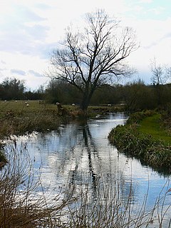
The River Lambourn is a chalk stream in the English county of Berkshire. It rises in the Berkshire Downs near its namesake village of Lambourn and is a tributary of the River Kennet, which is itself a tributary of the River Thames.

The Berkshire, Buckinghamshire and Oxfordshire Wildlife Trust (BBOWT), is a wildlife trust covering the counties of Berkshire, Buckinghamshire and Oxfordshire in England.

Seven Barrows is a 4-hectare (9.9-acre) biological Site of Special Scientific Interest north of Lambourn in Berkshire. It is managed by the Berkshire, Buckinghamshire and Oxfordshire Wildlife Trust and it is a Scheduled Monument.

Kennet and Lambourn Floodplain is a 23.4-hectare (58-acre) biological Site of Special Scientific Interest in six widely separated areas in the floodplains of the River Lambourn in Berkshire and the River Kennet in Wiltshire, England. It is a Nature Conservation Review site and part of the Kennet and Lambourn Floodplain Special Area of Conservation. One of the areas, Rack Marsh, is managed by the Berkshire, Buckinghamshire and Oxfordshire Wildlife Trust.

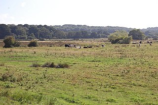
Freeman's Marsh is a 25.1-hectare (62-acre) biological Site of Special Scientific Interest on the northern outskirts of Hungerford in Berkshire. It is in the North Wessex Downs, which is an Area of Outstanding Natural Beauty. The site is owned by the Town and Manor of Hungerford.

Bowdown and Chamberhouse Woods is a 67.9-hectare (168-acre) biological Site of Special Scientific Interest south of Thatcham in Berkshire. An area of 55 hectares is a nature reserve managed by the Berkshire, Buckinghamshire and Oxfordshire Wildlife Trust.

Boxford Water Meadows is a 13.9-hectare (34-acre) biological Site of Special Scientific Interest in Boxford in Berkshire. It is part of the Kennet & Lambourn Floodplain Special Area of Conservation.
Combe Haven is a 153-hectare (380-acre) biological Site of Special Scientific Interest between Hastings and Bexhill-on-Sea in East Sussex. An area of 18.5 acres is Filsham Reedbed Local Nature Reserve, which is managed by the Sussex Wildlife Trust

Pilch Fields is an 11.1 hectare biological Site of Special Scientific Interest (SSSI) west of Great Horwood in Buckinghamshire. It is managed by the Berkshire, Buckinghamshire and Oxfordshire Wildlife Trust.

Gwernydd Penbre is a Site of Special Scientific Interest (SSSI) in Carmarthenshire, Wales. Official sources - DEFRA and Natural Resources Wales - list the SSSI as Gwernydd Pembre; the spelling used in the SSSI Citation is used in this article.
Rack Marsh is a 4-hectare (9.9-acre) nature reserve in Bagnor, on the north-western outskirts of Newbury in Berkshire. It is managed by the Berkshire, Buckinghamshire and Oxfordshire Wildlife Trust. It is part of Kennet and Lambourn Floodplain, which is a Biological Site of Special Scientific Interest, and a Nature Conservation Review site. It is also part of the Kennet and Lambourn Floodplain Special Area of Conservation.

Watts Bank is a 1.9-hectare (4.7-acre) nature reserve south of Lambourn in Berkshire. It is managed by the Berkshire, Buckinghamshire and Oxfordshire Wildlife Trust. It is designated a biological Site of Special Scientific Interest as White Shute.

Filsham Reedbed is an 18.5-hectare (46-acre) Local Nature Reserve on the western outskirts of St Leonards-on-Sea in East Sussex. It is owned by Hastings Borough Council and managed by Sussex Wildlife Trust. It is part of Combe Haven Site of Special Scientific Interest.

Parsonage Moor is a 6-hectare (15-acre) nature reserve north-west of Abingdon-on-Thames in Oxfordshire, United Kingdom. It is managed by the Berkshire, Buckinghamshire and Oxfordshire Wildlife Trust. It is part of Cothill Fen, which is a Site of Special Scientific Interest and Special Area of Conservation. Part of it is in Cothill Fen and Parsonage Moor Nature Conservation Review site, Grade I.

Lashford Lane Fen is a 7-hectare (17-acre) nature reserve north of Dry Sandford in Oxfordshire. It is managed by the Berkshire, Buckinghamshire and Oxfordshire Wildlife Trust. It is part of Cothill Fen, which is a Site of Special Scientific Interest and Special Area of Conservation.
