
The Berkshire, Buckinghamshire and Oxfordshire Wildlife Trust (BBOWT), is a Wildlife Trust covering the counties of Berkshire, Buckinghamshire and Oxfordshire in England.

Thatcham Reed Beds is a 67.4-hectare (167-acre) biological Site of Special Scientific Interest east of Newbury in Berkshire. It is part of the Kennet & Lambourn Floodplain Special Area of Conservation and an area of 14 hectares is a Local Nature Reserve. An area of 35 hectares is managed by the Berkshire, Buckinghamshire and Oxfordshire Wildlife Trust.

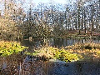
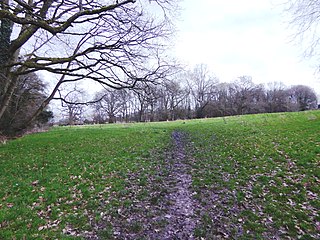
Sulham and Tidmarsh Woods and Meadows is a 75.7-hectare (187-acre) biological Site of Special Scientific Interest west of Reading in Berkshire. Previously known as Pang Valley SSSI, the site is mostly sandwiched between the River Pang and the Sulham Road and includes Broom Copse, Herridge's Copse, Hogmoor Copse, Park Wood, Moor Copse and Barton's Copse. Much of the southern part of the site is the Berkshire, Buckinghamshire and Oxfordshire Wildlife Trust's Moor Copse Nature Reserve. The whole site lies within the North Wessex Downs Area of Outstanding Natural Beauty.
Snelsmore Common is a 104-hectare (260-acre) biological Site of Special Scientific Interest north of Newbury in Berkshire. It is owned by West Berkshire Council and managed by the Berkshire, Buckinghamshire and Oxfordshire Wildlife Trust.

Sandhurst to Owlsmoor Bogs and Heaths is an 85.8-hectare (212-acre) biological Site of Special Scientific Interest (SSSI) on the northern outskirts of Sandhurst in Berkshire. Part of the SSSI is Wildmoor Heath nature reserve, which is managed by the Berkshire, Buckinghamshire and Oxfordshire Wildlife Trust. and the SSSI is part of Thames Basin Heaths Special Protection Area.

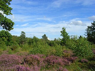
Greenham and Crookham Commons are two adjoining public park areas of 280.5-hectare (693-acre) common land designated as a biological Site of Special Scientific Interest (SSSI) in the civil parishes of Greenham and Thatcham, on the southern outskirts of Newbury in the English county of Berkshire.
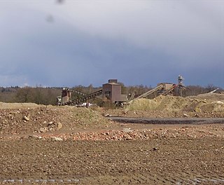
The Yateley Complex is a working gravel pit and a series of fishing lakes at Yateley, Hampshire, England, operated by CEMEX, the world's largest building materials supplier. The fishing side of the facility is under the management of CEMEX Angling, a subsidiary of the main company. CEMEX Angling operates 11 lakes at the site, which includes part of the River Blackwater and is stocked with a variety of fish. Around 5000 anglers a year visit the complex, which was also home to Heather the Leather, described as "Britain's most famous fish". In addition to angling use, some of the gravel pits have been restored as sports pitches and some were nominated as potential allotment sites.

Decoy Pit, Pools and Woods is a 17.7-hectare (44-acre) biological Site of Special Scientific Interest south of Aldermaston in Berkshire. An area of 8 hectares is a nature reserve called Decoy Heath, which is managed by the Berkshire, Buckinghamshire and Oxfordshire Wildlife Trust.

Bucklebury Common is an elevated common consisting of woodland with a few relatively small clearings in the English county of Berkshire, within the civil parish of Bucklebury centred 3 miles (4.8 km) northeast of Thatcham and encircling the settled localities of Upper Bucklebury and Chapel Row. It is one of the largest commons in Southern England covering 350 hectares. Since Inclosure the area is privately owned by the Bucklebury Manor estate, but has public access on a network of public rights of way bolstered by the Countryside and Rights of Way Act 2000.

Dancersend is an 81.3-hectare (201-acre) Site of Special Scientific Interest (SSSI) south of Aston Clinton in Buckinghamshire. Part of the site is managed by the Forestry Commission and part by the Berkshire, Buckinghamshire and Oxfordshire Wildlife Trust (BBOWT). The BBOWT's 47 hectare nature reserve, called Dancersend with Pavis Woods, extends into fields west of the SSSI. It is in the Chilterns Areas of Outstanding Natural Beauty.
Rushbeds Wood is a 56-hectare (140-acre) nature reserve near Wotton Underwood in Buckinghamshire, managed by the Berkshire, Buckinghamshire and Oxfordshire Wildlife Trust (BBOWT). It is a surviving fragment of the ancient Bernwood Forest. The reserve is part of Rushbeds Wood and Railway Cutting, an 80.2-hectare (198-acre) biological Site of Special Scientific Interest. This includes a section of the Chiltern Main Line railway cutting, which runs along the north-east side of the BBOWT reserve.

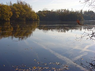
Wraysbury No 1 Gravel Pit is a 58.0-hectare (143-acre) biological Site of Special Scientific Interest in Wraysbury in Berkshire. It is part of South West London Waterbodies Ramsar site, and Special Protection Area. The lake has an area of 39.6 hectares. The pit was excavated in the 1920s and 1930s with gravel being removed from the site. Over the years plants and wildlife have colonised the area and it is now mature.

Hosehill Lake is a 23.6-hectare (58-acre) Local Nature Reserve west of Reading in Berkshire. It is owned by West Berkshire Council and managed by the Berkshire, Buckinghamshire and Oxfordshire Wildlife Trust.
Loddon Nature Reserve is a 14-hectare (35-acre) nature reserve on the edge of the village of Twyford in Berkshire. It is managed by the Berkshire, Buckinghamshire and Oxfordshire Wildlife Trust.

Rack Marsh is a 4-hectare (9.9-acre) nature reserve in Bagnor, on the north-western outskirts of Newbury in Berkshire. It is managed by the Berkshire, Buckinghamshire and Oxfordshire Wildlife Trust. It is part of Kennet and Lambourn Floodplain, which is a Biological Site of Special Scientific Interest, and a Nature Conservation Review site. It is also part of the Kennet and Lambourn Floodplain Special Area of Conservation.
Sole Common Pond is a 3-hectare (7.4-acre) nature reserve south-west of Boxford in Berkshire in Berkshire. It is managed by the Berkshire, Buckinghamshire and Oxfordshire Wildlife Trust.
Audrey's Meadow is a 2-hectare (4.9-acre) nature reserve in Newbury in Berkshire. It is owned by West Berkshire Council and managed by the Berkshire, Buckinghamshire and Oxfordshire Wildlife Trust.

Inkpen Common or Inkpen Great Common is a 12.8-hectare (32-acre) biological Site of Special Scientific Interest east of Inkpen in Berkshire. It is managed as a nature reserve by the Berkshire, Buckinghamshire and Oxfordshire Wildlife Trust.
