Watts Bank

Last updated
White Shute
Site of Special Scientific Interest
Watts Bank (3).jpg
Berkshire UK location map.svg
Red pog.svg
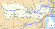
Location within Berkshire
Area of Search Berkshire
Grid reference SU 330 771 [1]
Coordinates 51°29′31″N1°31′30″W / 51.492°N 1.525°W / 51.492; -1.525 Coordinates: 51°29′31″N1°31′30″W / 51.492°N 1.525°W / 51.492; -1.525
InterestBiological
Area1.9 hectares (4.7 acres) [1]
Notification 1987 [1]
Location map Magic Map

Watts Bank is a 1.9-hectare (4.7-acre) nature reserve south of Lambourn in Berkshire. It is managed by the Berkshire, Buckinghamshire and Oxfordshire Wildlife Trust. [2] It is designated a biological Site of Special Scientific Interest as White Shute. [1] [3]

Contents

Watts Bank is a small chalk grassland bank. It has had over 30 butterfly species recorded. [4]

Fauna

The site has the following fauna: [2]

Butterflies

Flora

The site has the following flora: [2]

Plants

Related Research Articles

Berkshire, Buckinghamshire and Oxfordshire Wildlife Trust Wildlife conservation charity

The Berkshire, Buckinghamshire and Oxfordshire Wildlife Trust (BBOWT), is a wildlife trust covering the counties of Berkshire, Buckinghamshire and Oxfordshire in England.

Seven Barrows

Seven Barrows is a Bronze Age bowl barrow cemetery, 4-hectare (9.9-acre) of which are designated a biological Site of Special Scientific Interest, at Upper Lambourn in the civil parish of Lambourn in the English county of Berkshire. It is managed by the Berkshire, Buckinghamshire and Oxfordshire Wildlife Trust and it is a Scheduled Monument.

Hartslock

Hartslock is a 41.8-hectare (103-acre) biological Site of Special Scientific Interest south-east of Goring-on-Thames in Oxfordshire. An area of 29.4 hectares is a Special Area of Conservation and an area of 10 hectares is a nature reserve owned and managed by the Berkshire, Buckinghamshire and Oxfordshire Wildlife Trust,

Thatcham Reed Beds

Thatcham Reed Beds is a 67.4-hectare (167-acre) biological Site of Special Scientific Interest east of Newbury in Berkshire. It is part of the Kennet & Lambourn Floodplain Special Area of Conservation and an area of 14 hectares is a Local Nature Reserve. An area of 35 hectares is managed by the Berkshire, Buckinghamshire and Oxfordshire Wildlife Trust.

Averys Pightle

Avery's Pightle is a 1.3-hectare (3.2-acre) biological Site of Special Scientific Interest south of Enborne in Berkshire. It is managed by the Berkshire, Buckinghamshire and Oxfordshire Wildlife Trust.

Bix Bottom

Bix Bottom is a 102.3-hectare (253-acre) biological Site of Special Scientific Interest north-west of Henley-on-Thames in Oxfordshire. It is owned and managed as Warburg Nature Reserve by the Berkshire, Buckinghamshire and Oxfordshire Wildlife Trust.

Snelsmore Common

Snelsmore Common is a 104-hectare (260-acre) biological Site of Special Scientific Interest north of Newbury in Berkshire. It is owned by West Berkshire Council and managed by the Berkshire, Buckinghamshire and Oxfordshire Wildlife Trust.

Greenham and Crookham Commons

Greenham and Crookham Commons are two adjoining public park areas of 280.5-hectare (693-acre) common land designated as a biological Site of Special Scientific Interest (SSSI) in the civil parishes of Greenham and Thatcham, on the southern outskirts of Newbury in the English county of Berkshire.

Inkpen Crocus Field

Inkpen Crocus Fields is a 3.1-hectare (7.7-acre) biological Site of Special Scientific Interest near Inkpen in Berkshire. It is managed by the Berkshire, Buckinghamshire and Oxfordshire Wildlife Trust.

Chawridge Bourne

Chawridge Bourne is a 9.4-hectare (23-acre) biological Site of Special Scientific Interest in Berkshire. Part of the site is a 5-hectare (12-acre) nature reserve called Chawridge Bank, which is managed by the Berkshire, Buckinghamshire and Oxfordshire Wildlife Trust.

Wildmoor Heath

Wildmoor Heath is a 91-hectare (220-acre) nature reserve north of Crowthorne in Berkshire. It is managed by the Berkshire, Buckinghamshire and Oxfordshire Wildlife Trust. The reserve is part of two Sites of Special Scientific Interest: Wildmoor Heath itself is part of Sandhurst to Owlsmoor Bogs and Heaths and a separate area called Broadmoor Bottom is part of Broadmoor to Bagshot Woods and Heaths.

Inkpen Common SSSI

Inkpen Common or Inkpen Great Common is a 12.8-hectare (32-acre) biological Site of Special Scientific Interest east of Inkpen in Berkshire. It is managed as a nature reserve by the Berkshire, Buckinghamshire and Oxfordshire Wildlife Trust.

Hook Norton Cutting and Banks

Hook Norton Cutting and Banks is a 6.7-hectare (17-acre) biological and geological Site of Special Scientific Interest south of Hook Norton in Oxfordshire. The site is in three areas, two of which are managed as a nature reserve called Hook Norton Cutting by Berkshire, Buckinghamshire and Oxfordshire Wildlife Trust. and are designated a Geological Conservation Review site.

Cothill Fen

Cothill Fen is a 43.3-hectare (107-acre) biological and geological Site of Special Scientific Interest north-west of Abingdon-on-Thames in Oxfordshire. It is a Special Area of Conservation and parts of it are a Geological Conservation Review, site, a Nature Conservation Review site, Grade 1, and a National Nature Reserve. It also includes two areas which are nature reserves managed by the Berkshire, Buckinghamshire and Oxfordshire Wildlife Trust, Lashford Lane Fen and Parsonage Moor.

Hitchcopse Pit

Hitchcopse Pit is a 3-hectare (7.4-acre) nature reserve north-west of Abingdon-on-Thames in Oxfordshire. It is managed by the Berkshire, Buckinghamshire and Oxfordshire Wildlife Trust. It is part of Frilford Heath, Ponds and Fens, which is a Site of Special Scientific Interest.

Warren Bank

Warren Bank is a 3.1-hectare (7.7-acre) biological Site of Special Scientific Interest south-east of Wallingford in Oxfordshire. It is managed by the Berkshire, Buckinghamshire and Oxfordshire Wildlife Trust.

References

  1. 1 2 3 4 "Designated Sites View: White Shute". Sites of Special Scientific Interest. Natural England. Retrieved 3 December 2019.
  2. 1 2 3 "Watts Bank". Berkshire, Buckinghamshire and Oxfordshire Wildlife Trust. Retrieved 3 December 2019.
  3. "Map of White Shute". Sites of Special Scientific Interest. Natural England. Retrieved 3 December 2019.
  4. Davison, Steve (June 2015). Walking in the North Wessex Downs - Steve Davison - Google Books. ISBN   9781783622122 . Retrieved 2017-04-17.