The Berkshire, Buckinghamshire and Oxfordshire Wildlife Trust (BBOWT), is a wildlife trust covering the counties of Berkshire, Buckinghamshire and Oxfordshire in England.

Cleeve Hill is the highest point both of the Cotswolds hill range and of the county of Gloucestershire, at 330 m (1,080 ft). It is located on Cleeve Common which is a Site of Special Scientific Interest (SSSI) looked after by a small charity called Cleeve Common Trust. It commands a clear view to the west, over Cheltenham and the racecourse, over the River Severn and into Wales; and to the north over Winchcombe. It is a conspicuous outcrop on the edge of the limestone escarpment,. It is crossed by the Cotswold Way footpath.

Noar Hill is a 63-hectare (160-acre) biological Site of Special Scientific Interest south of Selborne in Hampshire. It is a Nature Conservation Review site, Grade 2, and part of East Hampshire Hangers Special Area of Conservation. An area of 20 hectares is a nature reserve managed by the Hampshire and Isle of Wight Wildlife Trust.

Pewsey Downs is a 305.3 hectare biological Site of Special Scientific Interest on the southern edge of the Marlborough Downs north of Pewsey in Wiltshire, notified in 1951. It includes the Pewsey Downs National Nature Reserve.

Old Cleeve is a village 5 miles (8 km) south east of Minehead in the Somerset West and Taunton district of Somerset, England, and also a civil parish. The civil parish of Old Cleeve covers an area of 2,092 hectares and includes the villages of Old Cleeve, Blue Anchor, Roadwater and Washford as well as hamlets such as Bilbrook, Chapel Cleeve, Golsoncott and Leighland Chapel. Approximately half the parish lies within the Exmoor National Park. The remaining half is on the southern edge of Exmoor. The village has been in existence since the early 13th century. The village held its first council meeting in 1711. By the 1720s the village had several churches, in which to meet. The town hall was built in 1727. The first church here was built in 1694, built by the Eastern Christian Society. This church was destroyed in a fire in 1847, and has been rebuilt and restored. In 2011, the population of the parish was 1,672.

Tunstall Hills is an area of open space in Sunderland, Tyne and Wear, England. It is a Local Nature Reserve and Tunstall Hills And Ryhope Cutting has been designated a Site of Special Scientific Interest both for its geological and biological importance. The area consists of Green Hill and Rocky Hill and surrounding land.

Foxhole Heath is an 85.2 hectare biological Site of Special Scientific Interest east of Eriswell in Suffolk. It is a Nature Conservation Review site, Grade I, and part of Breckland Special Area of Conservation and Breckland Special Protection Area under the European Union Directive on the Conservation of Wild Birds.
Cleeve Common is a 455-hectare (1,120-acre) biological and geological Site of Special Scientific Interest in Gloucestershire, England, notified in 1974. It is looked after by a small charity called Cleeve Common Trust, formally Cleeve Common Board of Conservators.

Hog's Hole is a 23.7-hectare (59-acre) biological Site of Special Scientific Interest in the civil parish of Combe in the English county of Berkshire.

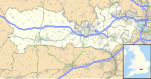
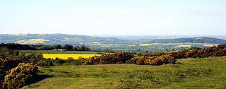
Streatley Warren is a 31.3-hectare (77-acre) biological Site of Special Scientific Interest west of Streatley in Berkshire. It is in the North Wessex Downs, which is an Area of Outstanding Natural Beauty.

Westfield Farm Chalk Bank is a 14.1-hectare (35-acre) biological Site of Special Scientific Interest west of East Garston in Berkshire.

Combe Wood and Linkenholt Hanging is a 106.5-hectare (263-acre) biological Site of Special Scientific Interest south of Hungerford in Berkshire. It is in the North Wessex Downs, which is an Area of Outstanding Natural Beauty.

Watts Bank is a 1.9-hectare (4.7-acre) nature reserve south of Lambourn in Berkshire. It is managed by the Berkshire, Buckinghamshire and Oxfordshire Wildlife Trust. It is designated a biological Site of Special Scientific Interest as White Shute.

West Stow Heath is a 44.3 hectare biological Site of Special Scientific Interest west of West Stow in Suffolk. It is part of the Breckland Special Protection Area under the European Union Directive on the Conservation of Wild Birds.