
The Halvergate Marshes are an area of grazing marsh in the east of the English county of Norfolk. They form part of the area of The Broads and lie between the River Bure and the River Yare, bordering Breydon Water on the east. The marshes cover an area of around 2,642 hectares An area of 1,432.7-hectare (3,540-acre) is a biological Site of Special Scientific Interest. Some areas are also in the Breydon Water Local Nature Reserve, the Broadland and Breydon Water Ramsar sites, The Broads Special Area of Conservation, and The Broads and Breydon Water Special Protection Areas.

The River Blackwater is a tributary of the Loddon in England and sub-tributary of the Thames. It rises at two springs in Rowhill Nature Reserve between Aldershot, Hampshire and Farnham, Surrey. It curves a course north then west to join the Loddon in Swallowfield civil parish, central Berkshire. Part of the river splits Hampshire from Surrey; a smaller part does so as to Hampshire and Berkshire.

The River Loddon is a tributary of the River Thames in southern England. It rises at Basingstoke in Hampshire and flows northwards for 28 miles (45 km) to meet the Thames at Wargrave in Berkshire. Together, the Loddon and its tributaries drain an area of 400 square miles (1,036 km2).
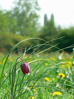
North Meadow, Cricklade is a hay meadow near the town of Cricklade, in Wiltshire, England. It is 24.6 hectares in size. It is a traditionally managed lowland hay-meadow, or lammas land, and is grazed in common between 12 August and 12 February each year, and cut for hay no earlier than 1 July. This pattern of land use and management has existed for many centuries and has resulted in the species rich grassland flora and fauna present on the site.

Thatcham Reed Beds is a 67.4-hectare (167-acre) biological Site of Special Scientific Interest east of Newbury in Berkshire. It is part of the Kennet & Lambourn Floodplain Special Area of Conservation and an area of 14 hectares is a Local Nature Reserve. An area of 35 hectares is managed by the Berkshire, Buckinghamshire and Oxfordshire Wildlife Trust.

Blackwater Valley is a 33.9-hectare (84-acre) biological Site of Special Scientific Interest between Sandhurst in Berkshire and Blackwater in Hampshire.
Thorpe Hay Meadow is a 6.4-hectare (16-acre) biological Site of Special Scientific Interest west of Staines-upon-Thames in Surrey. It is owned and managed by the Surrey Wildlife Trust.

Sandhurst to Owlsmoor Bogs and Heaths is an 85.8-hectare (212-acre) biological Site of Special Scientific Interest (SSSI) on the northern outskirts of Sandhurst in Berkshire. Part of the SSSI is Wildmoor Heath nature reserve, which is managed by the Berkshire, Buckinghamshire and Oxfordshire Wildlife Trust. and the SSSI is part of Thames Basin Heaths Special Protection Area.

Decoy Pit, Pools and Woods is a 17.7-hectare (44-acre) biological Site of Special Scientific Interest south of Aldermaston in Berkshire. An area of 8 hectares is a nature reserve called Decoy Heath, which is managed by the Berkshire, Buckinghamshire and Oxfordshire Wildlife Trust.

Blo' Norton and Thelnetham Fens are a 21.3 hectare biological Site of Special Scientific Interest (SSSI) on the Norfolk/Suffolk border. Blo' Norton Fen is in the parish of Blo' Norton in Norfolk and Thelnetham Fen is in Thelnetham parish in Suffolk. It is a Nature Conservation Review site, Grade 2, and part of the Waveney and Little Ouse Valley Fens Special Area of Conservation, Thelnetham Fen is managed by the Suffolk Wildlife Trust and Blo' Norton Fen by the Little Ouse Headwaters Project (LOHP).

Wykery Copse is a 3.2-hectare (7.9-acre) biological Site of Special Scientific Interest west of Bracknell in Berkshire.

Hog's Hole is a 23.7-hectare (59-acre) biological Site of Special Scientific Interest south-west of Newbury in Berkshire.

West's Meadow, Aldermaston is a 1.2-hectare (3.0-acre) biological Site of Special Scientific Interest south of Aldermaston in Berkshire.

Heath Lake is a 6-hectare (15-acre) biological Site of Special Scientific Interest (SSSI) in Berkshire. The SSSI is part of the 22.3-hectare (55-acre) Heathlake Local Nature Reserve, which is owned and managed by Wokingham District Council.

Wellington College Bog is a 6.2-hectare (15-acre) biological Site of Special Scientific Interest in the grounds of Wellington College on the northern outskirts of Sandhurst in Berkshire.

Easton Farm Meadow is a 1.6-hectare (4.0-acre) biological Site of Special Scientific Interest in Easton, west of Boxford in Berkshire. It is in the North Wessex Downs.

Lodge Wood and Sandford Mill is a 2.3-hectare (5.7-acre) biological Site of Special Scientific Interest east of Woodley in Berkshire.

Chawridge Bourne is a 9.4-hectare (23-acre) biological Site of Special Scientific Interest in Berkshire. Part of the site is a 5-hectare (12-acre) nature reserve called Chawridge Bank, which is managed by the Berkshire, Buckinghamshire and Oxfordshire Wildlife Trust.

Wraysbury and Hythe End Gravel Pits is a 117.2-hectare (290-acre) biological Site of Special Scientific Interest in Wraysbury in Berkshire. It is part of South West London Waterbodies Ramsar site and Special Protection Area.
