
Twyford is a large village and civil parish in the Borough of Wokingham in Berkshire, England. It had a population of 6,618 in the 2011 Census. It is in the Thames Valley and on the A4 between Reading and Maidenhead, close to Henley-on-Thames and Wokingham.

The Berkshire, Buckinghamshire and Oxfordshire Wildlife Trust (BBOWT), is a Wildlife Trust covering the counties of Berkshire, Buckinghamshire and Oxfordshire in England.

Hartslock, also known as Hartslock Woods, is a 41.8-hectare (103-acre) biological Site of Special Scientific Interest (SSSI) in a wooded area on the north bank of the River Thames to the south-east of Goring-on-Thames in the English county of Oxfordshire. An area of 29.4 hectares is a Special Area of Conservation and an area of 10 hectares is a nature reserve owned and managed by the Berkshire, Buckinghamshire and Oxfordshire Wildlife Trust (BBOWT). The site is well known for the variety of wild orchids that grow on its sloping grassland, and especially for the monkey orchid that grows in very few other places in England.

Dinton Pastures Country Park is a country park in the civil parish of St Nicholas Hurst, in the borough of Wokingham, near Reading in the English county of Berkshire.

Broadmoor to Bagshot Woods and Heaths is a 1,696.3-hectare (4,192-acre) biological Site of Special Scientific Interest (SSSI) in Berkshire and Surrey that extend from a minority of the parish of Crowthorne including around Broadmoor Hospital in the west to Bagshot south-east, Bracknell north-east, and Sandhurst, south. It is part of the Thames Basin Heaths Special Protection Area. Two nature reserves which are managed by the Surrey Wildlife Trust are in the SSSI, Barossa nature reserve and Poors Allotment. Broadmoor Bottom, which is part of Wildmoor Heath, also falls within the SSSI; this reserve is managed by the Berkshire, Buckinghamshire and Oxfordshire Wildlife Trust.
Chimney Meadows is a 49.6-hectare (123-acre) biological Site of Special Scientific Interest between Abingdon-on-Thames and Faringdon in Oxfordshire. It is also a national nature reserve, and part of the 308-hectare (760-acre) Chimney Meadows nature reserve, which is managed by the Berkshire, Buckinghamshire and Oxfordshire Wildlife Trust.

Sandhurst to Owlsmoor Bogs and Heaths is an 85.8-hectare (212-acre) biological Site of Special Scientific Interest (SSSI) on the northern outskirts of Sandhurst in Berkshire. Part of the SSSI is Wildmoor Heath nature reserve, which is managed by the Berkshire, Buckinghamshire and Oxfordshire Wildlife Trust. and the SSSI is part of Thames Basin Heaths Special Protection Area.

Long Grove Wood is a 1.5-hectare (3.7-acre) nature reserve managed by the Berkshire, Buckinghamshire and Oxfordshire Wildlife Trust in Seer Green in Buckinghamshire.

Yoesden, often known as Yoesden Bank, is a 13-hectare (32-acre) nature reserve in Bledlow Ridge in Buckinghamshire. It is managed by the Berkshire, Buckinghamshire and Oxfordshire Wildlife Trust. It is in the Chilterns Area of Outstanding Natural Beauty.

Padworth Common Local Nature Reserve is a 28-hectare (69-acre) Local Nature Reserve on the edge of the hamlet of Padworth Common, between Reading and Newbury in Berkshire. It is owned by West Berkshire Council and managed by Berkshire, Buckinghamshire and Oxfordshire Wildlife Trust.

McIlroy Park is a 12-hectare (30-acre) Local Nature Reserve in Tilehurst, a suburb of Reading in Berkshire. It is owned and managed by Reading Borough Council. Along with Blundells Copse and Lousehill Copse it is part of West Reading Woodlands.
Paices Wood Country Parkland is a country park on the edge of the village of Aldermaston in Berkshire, England. The parkland is under the management of the Berkshire, Buckinghamshire and Oxfordshire Wildlife Trust.

Rack Marsh is a 4-hectare (9.9-acre) nature reserve in Bagnor, on the north-western outskirts of Newbury in Berkshire. It is managed by the Berkshire, Buckinghamshire and Oxfordshire Wildlife Trust. It is part of Kennet and Lambourn Floodplain, which is a Biological Site of Special Scientific Interest, and a Nature Conservation Review site. It is also part of the Kennet and Lambourn Floodplain Special Area of Conservation.

Haymill Valley is a 7.8-hectare (19-acre) Local Nature Reserve in Slough in Berkshire. It is owned by Slough Borough Council and managed by the Berkshire, Buckinghamshire and Oxfordshire Wildlife Trust. The site is known locally as The Millie.

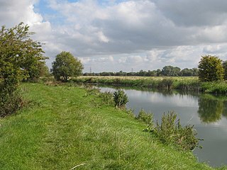
Lavells Lake is a 12.5-hectare (31-acre) Local Nature Reserve on the outskirts of Woodley, a suburb of Reading in Berkshire. It is owned by Wokingham District Council and managed by the council and The Friends of Lavell's Lake. The nature reserve is part of Dinton Pastures Country Park.

Hurley Chalk Pit is a 1-hectare (2.5-acre) nature reserve west of Maidenhead in Berkshire. It is managed by the Berkshire, Buckinghamshire and Oxfordshire Wildlife Trust.

Dry Sandford Pit is a 4.2-hectare (10-acre) biological and geological Site of Special Scientific Interest north-west of Abingdon-on-Thames in Oxfordshire. It is a Geological Conservation Review site and it is managed as a nature reserve by the Berkshire, Buckinghamshire and Oxfordshire Wildlife Trust.

Hitchcopse Pit is a 3-hectare (7.4-acre) nature reserve north-west of Abingdon-on-Thames in Oxfordshire. It is managed by the Berkshire, Buckinghamshire and Oxfordshire Wildlife Trust. It is part of Frilford Heath, Ponds and Fens, which is a Site of Special Scientific Interest.

