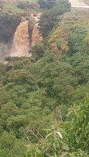
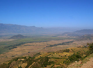
Ambassel is a woreda in Amhara Region, Ethiopia, and an amba, or mountain fortress, located in the woreda. The word Ambasel is derived from two words "Amba" from the Amharic word for plateau, and “Asel” from the Arabic language, which means honey. Together, it means “plateau of honey” or the “land of honey” the woreda is named for this feature. Located in the Debub Wollo Zone, Ambassel woreda is bordered on the west by the Bashilo which separates it from Tenta, on the north by the Semien Wollo Zone, on the southeast by the Mille River which separates it from Tehuledere, and on the south by Kutaber; the Walano, a tributary of the Bashilo, defines most of its southern border. Its largest town is Wuchale.

Oromia Zone is a zone in Amhara Region of Ethiopia. Oromia is named for the Oromo people, who settled along the edge of the Ethiopian Highlands that form this Zone. Oromia Zone is bordered on the southwest by North Shewa Zone, on the northwest by South Wollo and Argobba special woreda, and on the east by the Afar Region. The Zone conists of 7 Woredas which are Artuma Fursi, Bati, Bati Town, Dewa Cheffa, Dewa Harewa, Jilye Tumuga and Kemisie town. Kamisee is the administrative center of the Zone.
Debre Berhan Zuria or Basona Werana is a woreda in the Amhara Region of Ethiopia. Located at the eastern edge of the Ethiopian highlands in the Semien Shewa Zone, Basona Werana is bordered on the south by Angolalla Tera, on the southwest by the Oromia Region, on the west by Siyadebrina Wayu, on the northwest by Moretna Jiru, on the north by Mojana Wadera, on the northeast by Termaber, and on the east by Ankober. The town and woreda of Debre Berhan is an enclave inside this woreda. Towns in this woreda include Gudoberet.
Hulet Ej Enese is one of the woredas in the Amhara Region of Ethiopia. Part of the Misraq Gojjam Zone, it is bordered on the south by Debay Telatgen, on the west by Bibugn and Goncha, on the northwest by the Mirab Gojjam Zone, on the north by the Abay River, on the east by Goncha Siso Enese, and on the southeast by Enarj Enawga. Among the towns in this administrative division are Keraniyo, Mota and Sede.
Tenta is a woreda in Amhara Region, Ethiopia. Part of the Debub Wollo Zone, Tenta is bordered on the south by Legambo, on the southwest by Sayint, on the west by Magdala, on the north by the Bashilo River which separates it from Semien Wollo Zone, on the northeast by Ambassel, on the east by Kutaber and on the southeast by Dessie Zuria. The administrative center of this woreda is Ajebar; other towns in Tenta include Amba Mariam, and Tenta.
Legambo is a woreda in Amhara Region, Ethiopia. This woreda is named for one of the "Houses" or subgroups of the Wollo Amhara, who was located there. Part of the Debub Wollo Zone, Legambo is bordered on the south by Legahida and Kelala, on the southwest by Wegde, on the west by Debre Sina, on the northwest by Sayint, on the north by Tenta, on the northeast by Dessie Zuria, and on the southeast by Were Ilu. Towns in Legambo include Akesta and Embacheber.
Jama is one of the woredas in the Amhara Region of Ethiopia. Part of the Debub Wollo Zone, Jama is bordered on the southeast by the Qechene River which separates it from the Semien Shewa Zone, on the west by Kelala, on the north by Legahida, and on the northeast by Were Ilu. Towns in Jama include Dagolo, Faj, and Shul Afaf.
Gishe is one of the woredas in the Amhara Region of Ethiopia. Located at the eastern edge of the Ethiopian highlands in the Semien Shewa Zone, Gishe is bordered on the south by the Menz Gera Midir, on the west and north by the Debub Wollo Zone, and on the east by Antsokiyana Gemza; the Wanchet River defines its western boundary. The name of this woreda is coming from the name of a district of the former province or kingdom of Shewa, Gishe. It contains Abuye Meda, the largest plateau in Ethiopia. The administrative center of Gishe is Rabel.
Termaber is a woreda in Amhara Region, Ethiopia. It includes a homonymous mountain pass and road tunnel. Located at the eastern edge of the Ethiopian Highlands in the Semien Shewa Zone, Termaber is bordered on the south by Ankober, on the southwest by Basona Werana, on the west by Mojana Wadera, on the northwest by Menz Mam Midir, on the northeast by Kewet, and on the southeast by the Afar Region. Towns in this woreda include Debre Sina and Doqaqit.
Minjarna Shenkora, also Menjarna Shenkora is one of the woredas in the Amhara Region of Ethiopia. It is named in part after the historic Shewan district of Minjar, which was the southernmost district of Shewa and near the location of the modern woreda. Located at the southern end of the Semien Shewa Zone, Minjarna Shenkora is bordered on the east, south and west by the Oromia Region, on the northwest by Hagere Mariamna Kesem, and on the northeast by Berehet; the Germama river forms the boundary between this woreda and Hagere Mariamna Kesem and Berehet. The administrative center of this woreda is Arerti; other towns in the woreda include Balchi and Eranbuti.

Baso Liben is one of the woredas in the Amhara Region of Ethiopia. A triangular-shaped district at the southernmost point of the Misraq Gojjam Zone, Baso Liben is bordered on the south by a bend of the Abay River which separates it from the Oromia Region, on the northwest by Guzamn, and on the northeast by Aneded; the Chamwaga river defines part of its western border. The major town in Baso Liben is Yejube. additional towns include Kork and hamusin both found in the hills of the woreda before reaching the gorges of Abay river.
Liben is one of the woredas in the Oromia Region of Ethiopia. Part of the Guji Zone, Liben is bordered on the south by the Dawa River which separates it from the Borena Zone, on the west by Odo Shakiso, on the northwest by Adolana Wadera, on the north by the Ganale Dorya River which separates it from the Bale Zone, and on the east by the Somali Region. The map of the Oromia Region published by Disaster Prevention and Disaster Agency shows that this woreda is part of the Guji Zone, and that the eastern part has been transferred to the Somali Region to create the Liben woreda of that region. The town of Negele Boran was separated from Liben woreda and is separate woreda now.
Moyale(Oromo: Moyyaalee) is one of the Districtss in the Oromia Region of Ethiopia. It is named after the administrative center of the woreda, Moyale. Located in the southeast corner of the Borena Zone, Moyale is bordered on the south by Kenya, on the west by Dire, on the northwest by Arero, on the north by the Dawa River which separates it from Liben, and on the east by Dawa Zone Somali Region.
Dawa Harewa is a district located in the Oromia Zone of the Amhara region of Ethiopia. Dawa Harewa is bordered on the south by Artuma Fursi, on the west by Dawa Chaffa, on the northwest by the Argobba special woreda, on the northeast by Baati, and on the east by the Afar Region. Towns in Dawa Harewa include Bora. Dawa Harewa was part of former Chaffa Gola Dewerahmedo woreda.
Baati is a district located in the Oromia Zone of the Amhara region of Ethiopia. Baati is bordered on the south by Dawa Harewa, on the southeast by the Argobba special woreda, on the west and north by the Debub Wollo Zone, and on the east by the Afar Region. Towns in this woreda include its administrative center, the market town of Baati. The towns of Degan and Gerba was administratively part of Baati prior to the 2007 census but was then transferred to Kalu woreda.
Dawa Chaffa is a district located in the Oromia Zone of the Amhara region of Ethiopia. Dawa Chaffa is bordered on the south by Artuma Fursi, on the southwest by the Semien Shewa Zone, on the northwest by the Debub Wollo Zone, on the northeast by the Argobba special woreda, and on the east by Dawa Harewa. Towns in Dawa Cheffa include Welede. Dawa Chaffa was part of former Chaffa Gola Dewerahmedo woreda. The town of Kamisee is surrounded by Dawa Chaffa.
Jilee Dhummuugaa is a district located in the Oromia Zone of the Amhara region of Ethiopia. Jilee Dhummuugaa is bordered on the east and south by the Afar Region, on the west by the North shewa Zone, and on the north by Artuma Fursi. Towns in Jilee Dhummuugaa include Senbete. Jilee Dhummuugaa was part of the former Artuma Fursi Jilee woreda.

Kemise is the administrative center of the Oromia Zone in the Amhara Region of Ethiopia. Kemise is 224 kilometres (139 mi) northeast of the Ethiopian capital, Addis Ababa and has a latitude and longitude of 10°43′N39°52′E with an elevation of 1424 meters above sea level. It was part of the former Chaffa Gola Dewerahmedo district and is now surrounded by the Dawa Chaffa district.
Artuma Fursi Jilee is a district Located in the Oromia Zone of the Amhara region of Ethiopia. Artuma Fursi Jilee was bordered on the west by the North Shewa Zone, on the north by Chaffa Gola Dewerahmedo, and on the east by the Afar Region. Towns in Artuma Fursi Jilee included Adebela, Chefa Robit, Kichicho and Senbete. Artuma Fursi Jilee was divided into Artuma Fursi and Jilee Dhummuugaa woredas.

Chaffa Gola Dewerahmedo was a woreda in the Amhara Region of Ethiopia. Part of the Oromia Zone, Chaffa Gola Dewerahmedo was bordered on the south by Artuma Fursi Jilee, on the southwest by the Semien Shewa Zone, on the west by the Debub Wollo Zone, on the north by Baati, and on the east by the Afar Region. Towns in Chaffa Gola Dewerahmedo included Bora and Kamisee; the villages of Shonke and T’ollaha were also located in this woreda, and notable as being communities where the Argobba language is spoken. Chaffa Gola Dewerahmedo was divided for Dawa Chaffa and Dawa Harewa woredas and Kamisee town.


