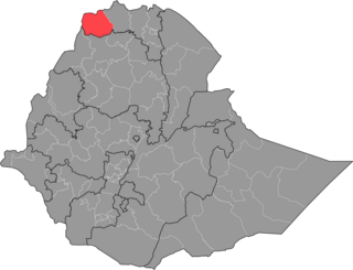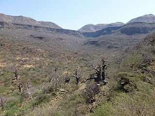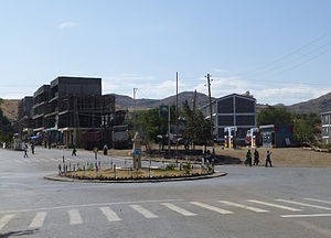
Adwa is a town and separate woreda in Tigray Region, Ethiopia. It is best known as the community closest to the site of the 1896 Battle of Adwa, in which Ethiopian soldiers defeated Italian troops, thus being one of the few African nations to thwart European colonialism. Located in the Central Zone of the Tigray Region, Adwa has a longitude and latitude of 14°10′N38°54′E, and an elevation of 1907 meters. Adwa is surrounded by Adwa woreda.

Weldiya or Woldia is a town, woreda, and capital of the North Wollo Zone in northern Ethiopia. Located north of Dessie and southeast of Lalibela in the Amhara Region, this town has an elevation of 2112 meters above sea level.

Kombolcha is a town and district in north-central Ethiopia. Located in the Debub Wollo Zone of the Amhara Region, it has a latitude and longitude of 11°5′N39°44′E with an elevation between 1842 and 1915 meters above sea level. Some guide books describe Kombolcha as the twin town of Dessie which lies some 12 kilometres (7.5 mi) to the northwest.
Wuchale, also spelled Uccialli, is a town in northern Ethiopia. Located about 40 km north of Dessie in the Debub Wollo Zone of the Amhara Region, this town has a latitude and longitude of 11°30′N39°36′E and an elevation of 1711 m. It is the largest settlement in Ambassel woreda and is located along Ethiopian Highway 2.

The Western Zone is a zone in the Tigray Region of Ethiopia. It is subdivided into three woredas (districts); from north to south they are Kafta Humera, Welkait and Tsegede. The largest town is Humera. The Western Zone is bordered on the east by the North Western Zone, the south by the Amhara Region, the west by Sudan and on the north by Eritrea. Starting from the late 17th C., internal boundaries are clearly shown, with 37 maps displaying a boundary that is located well south of the Tekeze River, or even south of the Simien mountains. Welkait is explicitly included within a larger Tigray confederation ; it is briefly mapped as part of Amhara in 1891-1894 and part of Gondar from 1944-1990. At other periods it appears independent or part of a larger Mezaga lowland region.

Abiy Addi is a town in central Tigray, Ethiopia. Abiy Addi is at the southeastern edge of the Kola Tembien woreda, of which it is the capital.

Saesi Tsaedaemba is one of the Districts of Ethiopia, or woredas, in the Tigray Region of Ethiopia. Located in the Misraqawi Zone at the eastern edge of the Ethiopian highlands, Saesi Tsaedaemba is bordered on the south by Kilte Awulaelo, on the southwest by Hawzen, on the west by Ganta Afeshum, on the northwest by Gulomahda, on the north by Irob, on the east by the Afar Region, and on the southeast by Atsbi Wenberta. Towns in Saesi Tsaedaemba include Edaga Hamus and Freweyni also known as Sinkata) where the woreda office is located.

Saharti Samre is one of the Districts of Ethiopia, or woredas, in the Tigray Region of Ethiopia. Part of the Debub Misraqawi (Southeastern) Zone, Samre is bordered on the south by the Amhara Region, on the west and north by the Mehakelegnaw (Central) Zone, on the northeast by Enderta, on the east by Hintalo Wajirat, and on the southeast by Debubawi (Southern) Zone. Towns in this woreda include Gijet and Samre.

Ofla is one of the Districts of Ethiopia, or woredas, in the Tigray Region of Ethiopia. Part of the Debubawi Zone, Ofla is bordered on the south by Alamata, on the west by the Amhara Region, on the north by Endamehoni, and on the east by Raya Azebo. Small towns in Ofla include Sesela and Zikuya. The town of Korem is surrounded by Ofla woreda.
Legambo is a woreda in Amhara Region, Ethiopia. This woreda is named for one of the "Houses" or subgroups of the Wollo Amhara, who were located there. Part of the Debub Wollo Zone, Legambo is bordered on the south by Legahida and Kelala, on the southwest by Wegde, on the west by Debre Sina, on the northwest by Sayint, on the north by Tenta, on the northeast by Dessie Zuria, and on the southeast by Were Ilu. Towns in Legambo include Aqesta and Embacheber.
SekotaZuria is one of the woredas in the Amhara Region of Ethiopia. Located in the Wag Hemra Zone, Sekota is bordered on the south by Gazbibla, on the southwest by Dehana, on the west by Zikuala, on the north by Abergele, and on the east by the Tigray Region. The separate woreda of town of Soqota is surrounded by Sekota. Abergele woreda was separated from Sekota.
Dehana is one of the woredas in the Amhara Region of Ethiopia. It is named for one of the five clans of the Agaw. Part of the Wag Hemra Zone, Dehana is bordered on the south by the Semien (North) Wollo Zone, on the west by the Tekezé River which separates it from the Debub (South) Gondar Zone and the Semien (North) Gondar Zone, on the north by Zikuala, on the northeast by Soqota, and on the east by Gazbibla. The Gazbibla woreda was separated from Dehana.

Baso Liben is one of the woredas in the Amhara Region of Ethiopia. A triangular-shaped district at the southernmost point of the Misraq Gojjam Zone, Baso Liben is bordered on the south by a bend of the Blue Nile river which separates it from the Oromia Region, on the northwest by the Chamwaga river which separates it from Gozamn, and on the northeast by Aneded. The major town in Baso Liben is Yejube. there are two other small towns; Kork and Yelamgeji with significant trading activity
Chagni is a town in North Western Ethiopia. Located in the Agew Awi Zone of the Amhara Region, this town has a longitude and latitude of 10°57′N36°30′E and an elevation of 1583 meters above sea level. It is the administrative center of Guangua woreda; in the past Chagni was the administrative center of the Metekel awraja.
Bure, also transliterated Burye is a town in western Ethiopia. Located in the Mirab Gojjam Zone of the Amhara Region, this town has a longitude and latitude of 10°42′N37°4′E with an elevation of 2091 meters above sea level.
Dengel Ber is a town in western Ethiopia. Located on the south-western shore of Lake Tana in the Semien Gondar Zone of the Amhara Region, this town has a latitude and longitude of 11°57′N37°00′E. Access to this town includes track roads to both Shawra and Kunzela and weekly service by the Bahir Dar-Gorgora ferry on Lake Tana. While the name of the town is indisputably Amharic, there is some disagreement over the meaning of its name: while "Pass of the Virgin" has been the most common interpretation since at least the days James Bruce visited Ethiopia, Huntingford and Beckingham state that it means "pass of canna plants".
Were Ilu is a town in north-central Ethiopia. Located in the Debub Wollo Zone of the Amhara Region, this town has a latitude and longitude of 10°36′N39°26′E. From the 1870s, Were Ilu had a Thursday market.
Samre is a town in northern Ethiopia. Located in the Debub Misraqawi (south-eastern) Zone of the Tigray Region, this town has a latitude and longitude of 13°11′N39°12′E with an elevation of 1855 meters above sea level. It is one of two towns in Saharti Samre woreda.
The Transitional Government of Tigray was a caretaker administration that was formally declared by the House of Federation of Ethiopia on 7 November 2020, in the context of a conflict between the Tigray People's Liberation Front (TPLF), in power in the Tigray Regional State and the federal government of Ethiopia. In late November 2020, the administration, headed by Mulu Nega, planned public consultation and participation in choosing new leaders at the regional and zonal level and preservation of woreda and kebele administrations. The Transitional Government left Tigray in late June 2021 during Operation Alula.
This Timeline of the Tigray War is part of a chronology of the military engagements of the Tigray War, a civil war that began in the Tigray Region of Ethiopia in early November 2020.


