
Ravenswood Park is a nature reserve in the western section of Gloucester, Massachusetts owned and managed by the Trustees of Reservations, which acquired the property in 1993. It can be accessed from Western Avenue, the road to Manchester through the Magnolia area. Ravenswood Park is frequented by cross-country skiers during the winter.
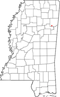
Strong is an unincorporated community in Monroe County, Mississippi.
Craíbas is a municipality located in the western of the Brazilian state of Alagoas. Its population is 22,652 (2005) and its area is 275 km².

The Idaho Senate is the upper chamber of the Idaho State Legislature. It consists of 35 Senators elected to two-year terms, each representing a district of the state. The Senate meets at the Idaho State Capitol in Boise, Idaho.

Fesdis is a town in north-eastern Algeria.
Kolonia Bujnice is a settlement in the administrative district of Gmina Gorzkowice, within Piotrków County, Łódź Voivodeship, in central Poland.

Niewiadów is a village in the administrative district of Gmina Ujazd, within Tomaszów Mazowiecki County, Łódź Voivodeship, in central Poland. It lies approximately 3 kilometres (2 mi) north-west of Ujazd, 14 km (9 mi) north-west of Tomaszów Mazowiecki, and 36 km (22 mi) south-east of the regional capital Łódź.

Boże is a village in the administrative district of Gmina Stromiec, within Białobrzegi County, Masovian Voivodeship, in east-central Poland. It lies approximately 7 kilometres (4 mi) north-east of Stromiec, 14 km (9 mi) east of Białobrzegi, and 59 km (37 mi) south of Warsaw.
Fabianów is a village in the administrative district of Gmina Błędów, within Grójec County, Masovian Voivodeship, in east-central Poland.
Mazewo Dworskie A is a village in the administrative district of Gmina Nasielsk, within Nowy Dwór Mazowiecki County, Masovian Voivodeship, in east-central Poland.
Drwęsa is a village in the administrative district of Gmina Dopiewo, within Poznań County, Greater Poland Voivodeship, in west-central Poland. It lies approximately 7 kilometres (4 mi) north-west of Dopiewo and 21 km (13 mi) west of the regional capital Poznań.
Osiedle Słoneczne is a settlement in the administrative district of Gmina Chojnice, within Chojnice County, Pomeranian Voivodeship, in northern Poland. It lies approximately 10 kilometres (6 mi) south of Chojnice and 109 km (68 mi) south-west of the regional capital Gdańsk. It belongs to the sołectwo of Ogorzeliny.

Szczerbięcin is a village in the administrative district of Gmina Tczew, within Tczew County, Pomeranian Voivodeship, in northern Poland. It lies approximately 7 kilometres (4 mi) west of Tczew and 29 km (18 mi) south of the regional capital Gdańsk.

Bàu Lâm is a commune (xã) and village in Xuyên Mộc District, Bà Rịa–Vũng Tàu Province, in Vietnam.

Crown Village is an unincorporated community in El Dorado County, California. It lies at an elevation of 745 feet.
Pinehurst is an unincorporated community in Fresno County, California. It is located 6.5 miles (10 km) east-southeast of Dunlap, at an elevation of 4003 feet.
Wolf is an unincorporated community in Fresno County, California. It is located on the Atchison, Topeka and Santa Fe Railroad 5.5 miles (9 km) east of Malaga, at an elevation of 335 feet.
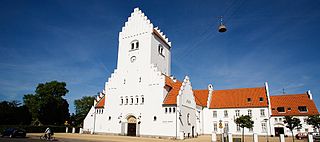
Philip's Church is a Church of Denmark parish church on Amager in Copenhagen, Denmark.
Three States is an extinct town in Mississippi County, in the U.S. state of Missouri. The GNIS classifies it as a populated place.

Çamlıca is a village in Karaman Province, Turkey


