Badoda

Last updated
Badoda
city
Madhya Pradesh districts location map big.svg
Red pog.svg
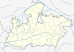
Badoda
Location in Madhya Pradesh, India
India location map.svg
Red pog.svg
Badoda
Badoda (India)
Coordinates: 25°29′26″N76°39′27″E / 25.49056°N 76.65750°E / 25.49056; 76.65750 Coordinates: 25°29′26″N76°39′27″E / 25.49056°N 76.65750°E / 25.49056; 76.65750
CountryFlag of India.svg  India
State Madhya Pradesh
District Sheopur
Population (2001)
  Total 15,672
Languages
  Official Hindi
Time zone IST (UTC+5:30)
ISO 3166 code IN-MP
Vehicle registration MP

Badoda is a city and a municipality in Sheopur district in the state of Madhya Pradesh, India.

Municipality An administrative division having corporate status and usually some powers of self-government or jurisdiction

A municipality is usually a single administrative division having corporate status and powers of self-government or jurisdiction as granted by national and regional laws to which it is subordinate. It is to be distinguished (usually) from the county, which may encompass rural territory or numerous small communities such as towns, villages and hamlets.

Sheopur district District of Madhya Pradesh in India

Sheopur District is a district of Madhya Pradesh state in central India. The district is located in the north of the state and forms part of Chambal Division.

Madhya Pradesh State in India

Madhya Pradesh is a state in central India. Its capital is Bhopal, and the largest city is Indore, with Jabalpur, Gwalior, Ujjain and Sagar being the other major cities. Nicknamed the "Heart of India" due to its geographical location, Madhya Pradesh is the second largest Indian state by area and the fifth largest state by population with over 75 million residents. It borders the states of Uttar Pradesh to the northeast, Chhattisgarh to the southeast, Maharashtra to the south, Gujarat to the west, and Rajasthan to the northwest. Its total area is 308,252 km2. Before 2000, when Chhattisgarh was a part of Madhya Pradesh, Madhya Pradesh was the largest state in India and the distance between the two furthest points inside the state, Singoli and Konta, was 1500 km. Konta is presently in Sukma district of Chhattisgarh state.

Demographics

As of 2001 India census, [1] Badoda had a population of 15,672. Males constitute 53% of the population and females 47%. Badoda has an average literacy rate of 48%, lower than the national average of 59.5%; with 67% of the males and 33% of females literate. 19% of the population is under 6 years of age.

Census Acquiring and recording information about the members of a given population

A census is the procedure of systematically acquiring and recording information about the members of a given population. The term is used mostly in connection with national population and housing censuses; other common censuses include agriculture, business, and traffic censuses. The United Nations defines the essential features of population and housing censuses as "individual enumeration, universality within a defined territory, simultaneity and defined periodicity", and recommends that population censuses be taken at least every 10 years. United Nations recommendations also cover census topics to be collected, official definitions, classifications and other useful information to co-ordinate international practice.

Related Research Articles

Alipurduar City in West Bengal, India

Alipurduar is a city and a municipality in the Indian state of West Bengal. It is the headquarters of the Alipurduar district. Situated on the east bank of Kaljani River on the foothills of the Himalayas, the city is a gateway to Bhutan and northeastern states of India.

Jangipur(WB) City in West Bengal, India

Jangipur is a city and a municipality in Murshidabad district in the state of West Bengal, India. It is the headquarters of the Jangipur subdivision. It is situated on the banks of the Bhagirathi. The city is said to have been founded by the Mughal emperor Jahangir. That is why this city also known as Jahangirpur. During the early years of British rule it was an important centre of the silk trade, and the site of one of the East India Company's commercial residencies.

Athipattu Suburb in Tiruvallur, Tamil Nadu, India

Athipattu is a census town in Chennai in Thiruvallur district in the state of Tamil Nadu, India. The neighbourhood is served by Athipattu railway station of the Chennai Suburban Railway network. it is a suburb in northern part of Chennai.

Birwadi city in Maharashtra, India

Birwadi is a census town in Raigad district in the state of Maharashtra, India.

Desur town panchayat in Tamil Nadu, India

Desur is a Town panchayat in Tiruvanamalai district in the Indian state of Tamil Nadu.

Dhampur city in Uttar Pradesh, India

Dhampur is a city and a municipal board in Bijnor district in the state of Uttar Pradesh, India. It is located at 29.30°N 78.50°E, and lies in Northern India.

Jalalpur Town in Uttar Pradesh, India

Jalalpur is a town and a municipal board in Ambedkar Nagar district in the Indian state of Uttar Pradesh.

Kothavalasa Census Town in Andhra Pradesh, India

Kothavalasa is a census town in Vizianagaram district of the Indian state of Andhra Pradesh. It is located in Kothavalasa mandal of Vizianagaram revenue division. It is located 30 km from City Visakhapatanam

Maheshtala Neighbourhood in Kolkata in Presidency, West Bengal, India

Maheshtala is a city and a municipality of South 24 Parganas district in the Indian State of West Bengal. It is a part of the area covered by Kolkata Metropolitan Development Authority (KMDA).

Manapakkam Neighbourhood in Chennai, Tamil Nadu, India

Manapakkam is a census town and part of the Chennai Metro city, in the Indian state of Tamil Nadu. Manapakkam is located along the Mount-Poonamallee Road in Chennai.It is now a home to a lot of IT companies.

Naravarikuppam city in Tamil Nadu, India

Naravarikuppam is a town in Thiruvallur district in the Indian state of Tamil Nadu.also called redhills

Neiyyur city in Tamil Nadu, India

Neyyoor is a panchayat town in Kanniyakumari district in the Indian state of Tamil Nadu.

Peerkankaranai neighbourhood in Chennai, Tamil Nadu, India

Peerkankaranai is a town in Southern part of the metropolitan city of Chennai in the Indian state of Tamil Nadu.

Pujali Neighbourhood in Kolkata in Presidency, West Bengal, India

Pujali is a city and a municipality of South 24 Parganas district in the Indian State of West Bengal. It is a part of the area covered by Kolkata Metropolitan Development Authority (KMDA).

Ramjibanpur City in West Bengal, India

Ramjibanpur is a city and a municipality in Paschim Medinipur district in the Indian state of West Bengal.

Vengathur is a census town in Thiruvallur district in the Indian state of Tamil Nadu.

Venkatapur, Bhatkal, Karnataka town in Karnataka, India

Venkatapur is a census town in Bhatkal Taluk in Uttara Kannada district of Karnataka.

Gangapur, Varanasi city in Uttar Pradesh, India

Gangapur is a town and a nagar panchayat in Varanasi district in the state of Uttar Pradesh, India.

Fatehabad, Haryana Town in Haryana, India

Fatehabad is a town and a municipal committee in Fatehabad district in the state of Haryana, India.

Kerura City in Karnataka, India

Kerur is a City in Bagalkot district in Karnataka, which located on NH 218. It has an average elevation of 617 meters (2024 feet). Its a birthplace of Jagadish Shettar, a former Chief Minister of Karnataka. Kerur is a Town Panchayat city in district of Bagalkot, Karnataka. The Kerur city is divided into 16 wards for which elections are held every five years. The Kerur Town Panchayat has population of 19,731 of which 9,929 are males while 9,802 are females as per report released by Census India 2011.

References

  1. "Census of India 2001: Data from the 2001 Census, including cities, villages and towns (Provisional)". Census Commission of India. Archived from the original on 2004-06-16. Retrieved 2008-11-01.