Bahadurpur, Paschim Bardhaman

Last updated

Bahadurpur
Village
West Bengal location map.svg
Red pog.svg
Bahadurpur
Location in West Bengal, India
India location map.svg
Red pog.svg
Bahadurpur
Bahadurpur (India)
Coordinates: 23°41′30.5″N87°08′17.9″E / 23.691806°N 87.138306°E / 23.691806; 87.138306
CountryFlag of India.svg  India
State West Bengal
District Paschim Bardhaman
Population
 (2011)
  Total2,514
Languages*
  Official Bengali, Hindi, English
Time zone UTC+5:30 (IST)
Telephone/STD code0341
Lok Sabha constituency Asansol
Vidhan Sabha constituency Jamuria
Website bardhaman.gov.in

Bahadurpur is a village, in the Jamuria CD block in the Asansol subdivision of the Paschim Bardhaman district in the state of West Bengal, India.

Contents

Geography

Bahadurpur, Paschim Bardhaman
Cities and towns in the eastern portion of Asansol Sadar subdivision in Paschim Bardhaman district
MC: Municipal Corporation, CT: census town, N: neighbourhood, R: rural centre
Owing to space constraints in the small map, the actual locations in a larger map may vary slightly

Location

Bahadurpur is located at 23°41′30.5″N87°08′17.9″E / 23.691806°N 87.138306°E / 23.691806; 87.138306 .

Urbanisation

According to the 2011 census, 83.33% of the population of Asansol Sadar subdivision was urban and 16.67% was rural. [1] In 2015, the municipal areas of Kulti, Raniganj and Jamuria were included within the jurisdiction of Asansol Municipal Corporation. [2] Asansol Sadar subdivision has 26 (+1 partly) Census Towns.(partly presented in the map alongside; all places marked on the map are linked in the full-screen map).

Civic administration

CD block HQ

The headquarters of Jamuria CD block are located at Bahadurpur. [3]

Demographics

According to the 2011 Census of India, Bahadurpur had a total population of 2,514 of which 1,318 (52%) were males and 1,196 (48%) were females. Population in the age range 0–6 years was 260. The total number of literate persons in Bahadurpur was 1,622 (71.96% of the population over 6 years). [4]

*For language details see Jamuria (community development block)#Language and religion

Education

Bahadurpur High School is a co-educational higher secondary school. [5]

Healthcare

Bahadurpur Rural Hospital, with 30 beds, is the major government medical facility in the Jamuria CD block. Akalpur Block Primary Health Centre functions at Akalpur with 10 beds. There are primary health centres at Churulia (with 6 beds), Sirishdanaga, PO Mandi (with 6 beds), Birkulti (with 2 beds) and Chinchuria (with 6 beds). [6] [7]

Related Research Articles

Amkula is a census town in the Raniganj CD block in the Asansol Sadar subdivision of the Paschim Bardhaman district in the state of West Bengal, India.

Ballavpur is a census town in the Raniganj CD block in the Asansol Sadar subdivision of the Paschim Bardhaman district in the state of West Bengal, India.

Belebathan is a census town in the Raniganj CD block in the Asansol Sadar subdivision of the Paschim Bardhaman district in the state of West Bengal, India.

Bhanowara is a census town in the Barabani CD block in the Asansol Sadar subdivision of the Paschim Bardhaman district in the state of West Bengal, India.

Chelad is a census town in the Raniganj CD block in the Asansol Sadar subdivision of the Paschim Bardhaman district in the state of West Bengal, India.

<span class="mw-page-title-main">Jamuria</span> Neighbourhood in Asansol in Paschim Bardhaman, West Bengal, India

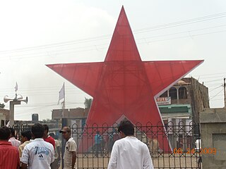
Jamuria is a neighbourhood in Asansol of Paschim Bardhaman district in the Indian state of West Bengal. It is governed by Asansol Municipal Corporation

Kunustara is a census town in the Jamuria CD block in the Asansol Sadar subdivision of the Paschim Bardhaman district in the Indian state of West Bengal.

Murgathaul is a census town in the Raniganj CD block in the Asansol Sadar subdivision of the Paschim Bardhaman district in the Indian state of West Bengal.

Parasia is a census town in the Jamuria CD block in Asansol Sadar subdivision of Paschim Bardhaman district in the Indian state of West Bengal.

Raghunathchak is a census town in the Raniganj CD block in the Asansol Sadar subdivision of the Paschim Bardhaman district in the Indian state of West Bengal.

Ratibati is a census town in the Raniganj CD block in the Asansol Sadar subdivision of the Paschim Bardhaman district in the Indian state of West Bengal.

Churulia is a suburb of Asansol under the Jamuria CD block, in the Asansol Sadar subdivision of the Paschim Bardhaman district in the state of West Bengal, India.

<span class="mw-page-title-main">Asansol Sadar subdivision</span> Subdivision in West Bengal, India

Asansol Sadar subdivision is an administrative subdivision of the Paschim Bardhaman district in the state of West Bengal, India.

<span class="mw-page-title-main">Jamuria (community development block)</span> Community development block in West Bengal, India

Jamuria is a community development block that forms an administrative division in Asansol subdivision of Paschim Bardhaman district in the Indian state of West Bengal.

Chinchuria is a census town in the Jamuria CD block in the Asansol Sadar subdivision of the Paschim Bardhaman district in the Indian state of West Bengal.

Domohani is a census town in the Barabani CD block in the Asansol Sadar subdivision of the Paschim Bardhaman district in the state of West Bengal, India.

Topsi is a census town in the Jamuria CD block in the Asansol Sadar subdivision of Paschim Bardhaman district in the Indian state of West Bengal.

Baktarnagar is a census town in the Raniganj CD block in the Asansol Sadar subdivision of the Paschim Bardhaman district in the Indian state of West Bengal.

Sahebganj is a census town in the Raniganj CD block in the Asansol Sadar subdivision of the Paschim Bardhaman district in the Indian state of West Bengal.

Majiara is a census town in the Barabani CD block in the Asansol Sadar subdivision of the Paschim Bardhaman district in the Indian state of West Bengal.

References

  1. "District Statistical Handbook 2014 Burdwan". Table 2.2, 2.4(a). Department of Statistics and Programme Implementation, Government of West Bengal. Archived from the original on 21 January 2019. Retrieved 4 September 2018.
  2. "The Kolkata Gazette" (PDF). Notification No. 335/MA/O/C-4/1M-36/2014 dated 3 June 2015. Department of Municipal Affairs, Government of West Bengal. Archived from the original (PDF) on 12 March 2017. Retrieved 4 September 2018.
  3. "District Census Handbook: Barddhaman" (PDF). Map of Barddhaman with CD Block HQs and Police Stations (on the fourth page). Directorate of Census Operations, West Bengal, 2011. Retrieved 22 January 2017.
  4. "2011 Census – Primary Census Abstract Data Tables". West Bengal – District-wise. Registrar General and Census Commissioner, India. Retrieved 18 February 2017.
  5. "West Bengal Cuncil of Higher Secondary Education". Exam Venue. WBCHSE. Retrieved 29 July 2018.
  6. "Health & Family Welfare Department" (PDF). Health Statistics – Rural Hospitals. Government of West Bengal. Archived from the original (PDF) on 8 October 2022. Retrieved 12 May 2020.
  7. "Health & Family Welfare Department" (PDF). Health Statistics – Primary Health Centres. Government of West Bengal. Archived from the original (PDF) on 21 April 2018. Retrieved 12 May 2020.