Palashban

Last updated

Palashban
Census Town
West Bengal location map.svg
Red pog.svg
Palashban
Location in West Bengal, India
India location map 3.png
Red pog.svg
Palashban
Palashban (India)
Coordinates: 23°35′05″N87°09′47″E / 23.584678°N 87.163186°E / 23.584678; 87.163186 Coordinates: 23°35′05″N87°09′47″E / 23.584678°N 87.163186°E / 23.584678; 87.163186
CountryFlag of India.svg  India
State West Bengal
District Paschim Bardhaman
Area
  Total2.83 km2 (1.09 sq mi)
Population
 (2011)
  Total4,811
  Density1,700/km2 (4,400/sq mi)
Languages*
  Official Bengali, Hindi, English
Time zone UTC+5:30 (IST)
PIN
713424
Telephone/STD code0341
Vehicle registration WB
Lok Sabha constituency Asansol
Vidhan Sabha constituency Raniganj
Website paschimbardhaman.co.in

Palashban is a census town in the Andal CD block in the Durgapur subdivision of the Paschim Bardhaman district in the Indian state of West Bengal.

Contents

Geography

Cities and towns in the southern and eastern portions of Durgapur subdivision in Paschim Bardhaman district
MC: Municipal Corporation, CT: census town, R: rural centre, A: airport, B: barrage, H: historical site
Owing to space constraints in the small map, the actual locations in a larger map may vary slightly

Location

Palashban is located at 23°35′05″N87°09′47″E / 23.584678°N 87.163186°E / 23.584678; 87.163186 .

Urbanisation

According to the 2011 census, 79.22% of the population of Durgapur subdivision was urban and 20.78% was rural. Durgapur subdivision has 1 municipal corporation at Durgapur and 38 (+1 partly) census towns (partly presented in the map alongside; all places marked on the map are linked in the full-screen map). [1]

Andal, a part of Andal (gram), Dignala, Palashban and Baska lying south of National Highway 19 (old numbering NH 2)/ Grand Trunk Road form a cluster of census towns. This cluster is linked to a cluster of census towns located north of NH 19. [2]

Demographics

According to the 2011 Census of India, Palashban had a total population of 4,811, of which 2,531 (53%) were males and 2,280 (47%) were females. Population in the age group 0–6 years was 478. The total number of literate persons in Palashban was 3,580 (82.62% of the population over 6 years). [3]

*For language details see Andal (community development block)#Language and religion

As of 2001 India census, [4] Palashban had a population of 4,856. Males constitute 53% of the population and females 47%. Palashban has an average literacy rate of 75%, higher than the national average of 59.5%: male literacy is 84%, and female literacy is 66%. In Palashban, 10% of the population is under 6 years of age.

Infrastructure

According to the District Census Handbook 2011, Bardhaman, Palashban covered an area of 2.83 km2. Among the civic amenities, the protected water-supply involved service reservoir, tube well, borewell. It had 384 domestic electric connections and 27 road lighting (points). Among the medical facilities, it had 1 hospital, 1 charitable hospital/ nursing home, 7 medicine shops. Among the educational facilities it had was 1 primary school, the other school facilities were available at Andal located nearby. Among the important commodities it produced were bricks. [5]

Economy

It is in the heart of the coal mining zone. [6]

Education

Palashban has three primary and one higher secondary schools. [7]

Rahmatnagar Iqbal Academy is an Urdu-medium coeducational institution established in 1978. It has facilities for teaching from class V to class XII. The school has 15 computers, a library with 1,000 books and a playground. [8]

Madanpur Mahesh Vidyamandir is a Bengali-medium coeducational institution established in 1957. It has facilities for teaching from class V to class X. [9]

Related Research Articles

Bilpahari Census Town in West Bengal, India

Bilpahari is a census town in the Pandabeswar CD block in the Durgapur subdivision of the Paschim Bardhaman district in the state of West Bengal, India.

Chak Bankola Census Town in West Bengal, India

Chak Bankola is a census town located partly in the Pandabeswar CD block and partly in the Andal CD block of the Durgapur subdivision in the Paschim Bardhaman district in the state of West Bengal, India.

Dalurband Census Town in West Bengal, India

Dalurband is a census town in the Pandabeswar CD block of the Durgapur subdivision in the Paschim Bardhaman district in the state of West Bengal, India.

Dignala Census Town in West Bengal, India

Dignala is a census town in the Andal CD block in the Durgapur subdivision of the Paschim Bardhaman district in the state of West Bengal, India.

Harishpur Census Town in West Bengal, India

Harishpur is a census town in the Andal CD block in the Durgapur subdivision of the Paschim Bardhaman district in the Indian state of West Bengal.

Kajora Census Town in West Bengal, India

Kajora is a census town in the Andal CD block in the Durgapur subdivision of the Paschim Bardhaman district in the Indian state of West Bengal.

Kendra Khottamdi Census Town in West Bengal, India

Kendra Khottadihi is a census town located partly in the Pandabeswar CD block of the Durgapur subdivision and partly in the Jamuria CD block of the Asansol Sadar subdivision in Paschim Bardhaman district in the Indian state of West Bengal.

Khandra Census Town in West Bengal, India

Khandra is a census town in the Andal CD block in the Durgapur subdivision of the Paschim Bardhaman district in the Indian state of West Bengal.

Mahira Census Town in West Bengal, India

Mahira is a census town in the Andal CD block in the Durgapur subdivision of the Paschim Bardhaman district in the Indian state of West Bengal.

Mandarbani Census Town in West Bengal, India

Mandarbani is a census town in the Faridpur Durgapur CD block in the Durgapur subdivision of the Paschim Bardhaman district in the Indian state of West Bengal.

Siduli Census Town in West Bengal, India

Siduli is a census town in the Andal CD block in the Durgapur subdivision of the Paschim Bardhaman district in the Indian state of West Bengal.

Ukhra Census Town in West Bengal, India

Ukhra is a census town in the Andal CD block in the Durgapur subdivision of the Paschim Bardhaman district in the Indian state of West Bengal.

Baska, Andal Census Town in West Bengal, India

Baska is a census town in the Andal CD block of Durgapur subdivision in Paschim Bardhaman district in the state of West Bengal, India.

Ramnagar, Pandaveswar Census Town in West Bengal, India

Ramnagar is a census town in the Pandabeswar CD block in the Durgapur subdivision of the Paschim Bardhaman district in the Indian state of West Bengal.

Andal, Paschim Bardhaman Census Town in West Bengal, India

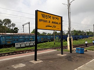
Andal is a census town in the Andal CD block in the Durgapur subdivision of the Paschim Bardhaman district in the Indian state of West Bengal.

Dakshin Khanda Census Town in West Bengal, India

Dakshin Khanda is a census town in the Andal CD block in the Durgapur subdivision of the Paschim Bardhaman district in the Indian state of West Bengal.

Arra, Paschim Bardhaman Census Town in West Bengal, India

Arra is a census town in the Kanksa CD block in the Durgapur subdivision of the Paschim Bardhaman district in the Indian state of West Bengal.

Gopalpur, Paschim Bardhaman Census Town in West Bengal, India

Gopalpur is a census town in the Kanksa CD block in the Durgapur subdivision of the Paschim Bardhaman district in the Indian state of West Bengal.

Bamunara, Paschim Bardhaman Census Town in West Bengal, India

Bamunara is a census town in the Kanksa CD block in the Durgapur subdivision of the Paschim Bardhaman district in the Indian state of West Bengal.

Amlajora Census Town in West Bengal, India

Amlajora is a census town in the Kanksa CD block in the Durgapur subdivision of the Paschim Bardhaman district in the Indian state of West Bengal.

References

  1. "District Statistical Handbook 2014 Burdwan". Table 2.2, 2.4(a). Department of Statistics and Programme Implementation, Government of West Bengal. Retrieved 15 September 2018.
  2. "District Census Handbook Bardhaman, Series 20, Part XII A, Census of India 2011" (PDF). Map of Ondal CD Block, page 229. Directorate of Census Operations, West Bengal. Retrieved 16 September 2018.
  3. "2011 Census – Primary Census Abstract Data Tables". West Bengal – District-wise. Registrar General and Census Commissioner, India. Retrieved 20 February 2017.
  4. "Census of India 2001: Data from the 2001 Census, including cities, villages and towns (Provisional)". Census Commission of India. Archived from the original on 16 June 2004. Retrieved 1 November 2008.
  5. "District Census Handbook Barddhaman, Census of India 2011, Series 20, Part XII A" (PDF). Section II Town Directory, Pages 1179-1210; Statement I: Status and Growth History, Page 1179; Statement II: Physical Aspects and Location of Towns, Page 1188; Statement III: Civic and other Amenities, Page 1191; Statement IV: Medical Facilities, Page 1196; Statement V: Educational, Recreational and Cultural Facilities, Page 1200; Statement VI:Industry and Banking, Page 1209. Directorate of census Operations V, West Bengal. Retrieved 14 May 2020.
  6. Chattopadhyay, Akkori, p. 666
  7. 7th All-India School Education Survey 2003 Archived 2007-09-27 at the Wayback Machine
  8. "Rahmatnagar Iqbal Academy". Schools.org.in. Retrieved 14 June 2020.
  9. "Madanpur Mahesh Vidyamandir". Schools.org.in. Retrieved 14 June 2020.