Khagaria is a town in Indian state of Bihar and the administrative headquarters of Khagaria district. Khagaria is a part of Munger division. It is located at 25.5°N 86.48°E and has an average elevation of 36 metres. The Khagaria Junction railway station serves the town. It is situated about 25 km north of Munger.
Thiruneermalai is a neighborhood in the city of Tambaram, situated within the Chennai Metropolitan Area, Tamil Nadu, India.

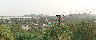
Anupgarh is a town in the state of Rajasthan in India. It is administrative headquarters of the Anupgarh district, which was formed on 17 March 2023.
Azizpur is a census town in Agra district in the state of Uttar Pradesh, India.
Bharuhana is a census town in Mirzapur district in the state of Uttar Pradesh, India.
Chak Imam Ali is a census town in Prayagraj district in the state of Uttar Pradesh, India.
Chinchani is a Census Town in the Dahanu Taluka of Palghar District of Maharashtra, India.
Dhanuha is a census town in Jaunpur district in the state of Uttar Pradesh, India.
Dhanauli is a census town in Agra district in the Indian state of Uttar Pradesh, India.
Jalalpur is a town, tehsil and a municipal board in Ambedkar Nagar district in the Indian state of Uttar Pradesh, India.

Jhusi Kohna is a census town in Prayagraj district in the Indian state of Uttar Pradesh.
Koraon is a town and a nagar panchayat in Prayagraj district in the Indian state of Uttar Pradesh.
Nainana Jat is a census town in Agra district in the Indian state of Uttar Pradesh.
Old Malda is a census town in Malda district in the Indian state of West Bengal. It is a part of the Malda Metropolitan Area. It is located on the eastern bank of the river Mahananda.
Peerkankaranai is a neighborhood in the city of Tambaram, situated within the Chennai Metropolitan Area, Tamil Nadu, India.
Pinahat is a town and a nagar panchayat in Agra district in the Indian state of Uttar Pradesh and situated on the Bank of Chambal River. It is about 55 km from Agra. The distance between Pinahat and Chambal is only 2 km.
Shahganj is a town and a municipal board in Jaunpur district in the Indian state of Uttar Pradesh.
Soamibagh is a town and a nagar panchayat in Agra district in the Indian state of Uttar Pradesh.
Vijaigarh is a town and a nagar panchayat in Aligarh district in the Indian state of Uttar Pradesh.
Jafarabad is a town and nagar panchayat in Jaunpur district in the Indian state of Uttar Pradesh.

