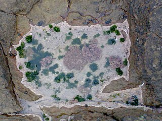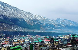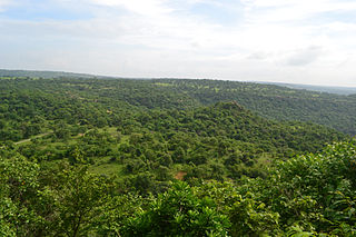
A microclimate is a local set of atmospheric conditions that differ from those in the surrounding areas, often slightly but sometimes substantially. The term may refer to areas as small as a few square meters or smaller or as large as many square kilometers. Because climate is statistical, which implies spatial and temporal variation of the mean values of the describing parameters, within a region there can occur and persist over time sets of statistically distinct conditions, that is, microclimates. Microclimates can be found in most places but are most pronounced in topographically dynamic zones such as mountainous areas, islands, and coastal areas.

Mirzapur Cum Vindhyachal is a city in Uttar Pradesh, India, 827 km from Delhi and 733 km from Kolkata, almost 91 km from Prayagraj and 61 km from Varanasi. It is known for its carpets and brassware industries, and the folk tradition of kajri and birha music. The city is surrounded by several hills of the Maikal range and is the headquarters of Mirzapur district.

Manali is a town, near Kullu town in Kullu district in the Indian state of Himachal Pradesh. It is situated in the northern end of the Kullu Valley, formed by the Beas River. The town is located in the Kullu district, approximately 270 kilometres (170 mi) north of the state capital of Shimla and 544 kilometres (338 mi) northeast of the national capital of New Delhi. With a population of 8,096 people recorded in the 2011 Indian census Manali is the beginning of an ancient trade route through Lahaul (H.P) and Ladakh, over the Karakoram Pass and onto Yarkand and Hotan in the Tarim Basin of China. Manali is a popular tourist destination in India and serves as the gateway to the Lahaul and Spiti district as well as the city of Leh in Ladakh.

Sonbhadra or Sonanchal or Switzerland of India is the second largest district by area of Uttar Pradesh after Lakhimpur Kheri. It is the only district in India which borders four states, namely Madhya Pradesh to the west, Chhattishgarh to the south, Jharkhand in the south-east and Bihar to the north-east. The district has an area of 6,788 km2 (2,621 sq mi) and a population of 1,862,559, with a population density of 270 inhabitants per square kilometre (700/sq mi). It lies in the extreme south-east of the state, and is bounded by Mirzapur district to the northwest, Chandauli district to the north, Kaimur and Rohtas districts of Bihar state to the north-east, Garhwa district of Jharkhand state to the east, Balrampur District of Chhattisgarh state to the south, and Singrauli district of Madhya Pradesh state to the west. The district headquarters is in the town of Robertsganj. Sonbhadra district is an industrial zone and it has much bauxite, limestone, coal, gold, etc. It is called the "Energy Capital of India" because there are multiple power plants.

Rewa district is a district of the Madhya Pradesh state in central India. The city of Rewa is the district headquarter. Rewa is sometimes called – 'Land of White Tigers' as the first White Tiger was discovered here in 1951 by Maharaja of the province, Martand Singh in the nearby jungle of Govindgarh. Rewa was the capital city of once a state – Vindhya Pradesh.
Chunar is a city located in Mirzapur district of Indian state of Uttar Pradesh. It is nearby Mirzapur city. The railway tracks passing through Chunar Junction railway station leads to major destinations of India, including Howrah, Delhi, Tatanagar and Varanasi. National Highway 35 also passes through Chunar. It is connected to the city of Mirzapur and Varanasi by roads and rails. Chunar is well known for its handicraft products made from clay and plaster of paris. It is also famous for its historical place - Chunar Fort.

Mirzapur district is one of the 75 districts in the Indian state of Uttar Pradesh. The district is bounded on the north by Bhadohi and Varanasi districts, on the east by Chandauli district, on the south by Sonbhadra district and on the northwest by Prayagraj. The district occupies an area of 4521 km2. Mirzapur city is the district headquarters. Mirzapur district is a part of Mirzapur division. This district is known for the Vindhyavasini temple in Vindhyachal and several tourist attractions like water falls like Rajdari & Devdari and dams. It consist of several Ghats where historical sculptures are still present. During the Ganges festival these Ghats are decorated with lights and diyas.

Robertsganj also known as Sonbhadra City is a city and a municipal board in Sonbhadra district in the Indian state of Uttar Pradesh.

Padampur is a City and a municipality, just 39 km from Sri Ganganagar city in Sri Ganganagar District in the Indian state of Rajasthan. The city was named after Rajkumar Padam Singh of royal family of Bikaner.
Mohania is a city and corresponding community development block in Kaimur district of Bihar, India. It serves as headquarters for the Mohania sub-division in Kaimur district. It is 17 km (11 mi) by road north of the city of Bhabua, at the intersection of National Highway 19, National Highway 219, and National Highway 319. The bank of the Durgavati River is just to the south of Mohania. The total block population was 218,479, in 32,198 households.

Janghai is a market and Gram Panchayat in the district of Prayagraj, in the Indian state of Uttar Pradesh. It is located 226 km kilometres southeast of the state capital, Lucknow, and 24 kilometres from Handia Tehsil. As of 2022, Janghai's population was about 29,000.
Bharkhar is a village near Mohania in the state of Bihar, India.
Meja Road is an eastern part of the Prayagraj district and very well connected with the city by road and Indian railways. Meja Road has its railway station 1 km away from downtown in the north which is on the Prayagraj – Pandit Deen Dayal Upadhyaya Nagar section of the Northern Railway in Uttar Pradesh, India, between Unchdih and Bhirpur stations. It connects with Sirsa, Ramnagar, Unchdeeh(North), Prayagraj City (West), Meja (South) and Mirzapur (East) by road. It is 35 kilometres (22 mi) far from the Prayagraj city and comes under Meja constituency. Hindi, Urdu, and English are the languages that are spoken in Meja Road. The dialect of Hindi spoken in Meja Road is Awadhi and all major religions are practiced here. Hindus comprise 86.81% and Muslims 12.72%. There are small groups of Christians, Sikhs, and Buddhists with 0.18%, 0.13%, and 0.04% of the population, respectively. Education in Meja Road - B.N.T. Inter College and some more colleges are providing a good educational platform.
The climate of Uttar Pradesh (U.P.) is primarily defined as humid subtropical with dry winter (Cwa) type with parts of Western U.P. as hot semi-arid (BSh) type. Alternatively, some authors refer to it as tropical monsoon. Variations do exist in different parts of the large state, however the uniformity of the vast Indo-Gangetic Plain forming bulk of the state gives a predominantly single climatic pattern to the state with minor regional variations. U.P. has a climate of extremes. With temperatures fluctuating anywhere from 0 °C or 32 °F to 50 °C or 122 °F in several parts of the state and cyclical droughts and floods due to unpredictable rains, the summers are extremely hot, winters are cold and the rainy season can be either very wet or very dry.
Adalhat, now a rising rural market place, was a small village located in Mirzapur district of Uttar Pradesh state in northern India. Its name is derived from famous Sufi saint Adalshah Baba, whose Majar is still maintained in vill. Ibrahimpur, which is a cent percent Hindu village. Adalhat is located on SH 5A, also known as Shakti Nagar Highway, being upgraded from two lane to four lane, it has Varanasi in its north at a distance of 30 km and Robertsganj in south at a distance of 60 km. Legal administration of the place lies with Chunar Tahsil.
Jamalpur Mirzapur is a village in Mau district, in Indian state of Uttar Pradesh, India. It is situated in a remote area of Uttar Pradesh and approximately 330 km from the state capital Lucknow. Jamalpur Mirzapur is locally known for its political, social and economic importance. It is a block village of almost 120 villages. There are government hospitals and government primary schools. There is also one school for special training for girls and disabled children for free. the developing villages in the block Ghosi itself. Its nearby town block is the famous block "Ghosi" situated on NH-7 & Varanasi-gorakahpur Highway NH29 and basically famous for bricks. Manufacturing area covering some villages of Jamalpur MIRZAPUR as well as forty percent villages of GHOSI.

The Chunar Fort is located in Mirzapur district of Uttar Pradesh, in India. Along with Chunar town, near Mirzapur city, situated below the fort, the two are historic places with common history and legends. It is located 34 kilometres (21 mi) North west of Mirzapur. The southeastern part of the fort is on the rocky bank of the Ganges River. The fort's history spans from 56 BC and then between Afghan decedent Sher Shah Suri's (1532) rule, the Mughal Empire rule up to 1772, and Marathas in 1782 to 1804. Lastly, the British Raj occupied the fort to 1947 when India gained independence. Chunar railway station is on the Pt. Deen Dayal Upadhyaya–Kanpur section of Howrah–Delhi main line.
Ratanpura is a village in Rajgarh tehsil of Churu district in Rajasthan. It was established in 1848, and is situated 45 km northeast of Churu and 17 km southwest of Rajgarh.
Durgawati is a community development block in Kaimur district in Indian state of Bihar. It is geographically located between 25° 12' 41" north latitude and 83° 31' 51" east longitude. It is located at an altitude of 76 m (249 ft) above mean sea level. Its headquarters is 30.6 km by road north of the district headquarters, Bhabua, on National Highway 19.
Rattowal is a village of Mandi Bahauddin District, in Punjab, Pakistan. The village has a population of approximately 10,000 people. It is a modern village of northern Punjab.


