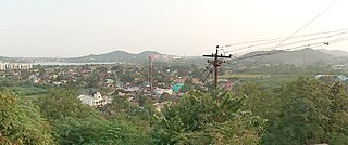
Bharuhana

Last updated

Bharuhana
city
India Uttar Pradesh location map.svg
Red pog.svg
Bharuhana
Location in Uttar Pradesh, India
Coordinates: 25°08′06″N82°35′46″E / 25.13500°N 82.59611°E / 25.13500; 82.59611 Coordinates: 25°08′06″N82°35′46″E / 25.13500°N 82.59611°E / 25.13500; 82.59611
CountryFlag of India.svg  India
State Uttar Pradesh
District Mirzapur
Population
 (2001)
  Total5,734
Language
  Official Hindi [1]
  Additional official Urdu [1]
Time zone UTC+5:30 (IST)

Bharuhana is a census town in Mirzapur district in the state of Uttar Pradesh, India.

A census town is a type of town that satisfies certain characteristics, depending on the country in which it is located.

Mirzapur district District of Uttar Pradesh in India

Mirzapur district is one of the 75 districts of Uttar Pradesh state in northern India. The district is bounded on the north by Sant Ravidas Nagar and Varanasi districts, on the east by Chandauli district, on the south by Sonbhadra district and on the northwest by Allahabad. The district occupies an area of 4521 km2. Mirzapur city is the district headquarters. Mirzapur district is a part of Mirzapur division. This district is known for the Vindhyavasini temple in Vindhyachal and several tourist attractions like water falls and dams. It consist of several Ghats where historical sculptures are still present. During the Ganges festival these Ghats are decorated with lights and diyas. It is a part of the Red Corridor.

Uttar Pradesh State in India

Uttar Pradesh is a state in northern India. With roughly 200 million inhabitants, it is the most populous state in India as well as the most populous country subdivision in the world. It was created on 1 April 1937 as the United Provinces of Agra and Oudh during British rule, and was renamed Uttar Pradesh in 1950. The state is divided into 18 divisions and 75 districts with the capital being Lucknow. The main ethnic group is the Hindavi people, forming the demographic plurality. On 9 November 2000, a new state, Uttarakhand, was carved out from the state's Himalayan hill region. The two major rivers of the state, the Ganga and Yamuna, join at Allahabad (Prayagraj) and then flow as the Ganga further east. Hindi is the most widely spoken language and is also the official language of the state.

Demographics

As of 2001 India census, [2] Bharuhana had a population of 5,734. Males constitute 54% of the population and females 46%. Bharuhana has an average literacy rate of 56%, lower than the national average of 59.5%; with male literacy of 65% and female literacy of 44%. 15% of the population is under 6 years of age.

Related Research Articles

Hamirpur, Uttar Pradesh City in Uttar Pradesh, India

Hamirpur is a city and a municipal board in Hamirpur district in the Indian state of Uttar Pradesh. It is the administrative headquarters of Hamirpur district.

Chak Imam Ali city in Uttar Pradesh, India

Chak Imam Ali is a census town in Allahabad district in the state of Uttar Pradesh, India.

Dhanauha city in Uttar Pradesh, India

Dhanuha is a census town in Jaunpur district in the state of Uttar Pradesh, India.

Jattari Town in Uttar Pradesh, India

Jattari is a town and a Nagar Panchayat in Khair Tehsil of Aligarh district in the Indian state of Uttar Pradesh. It lies on Aligarh – Palwal road 45 km ahead from Aligarh towards Palwal.

Jhusi Kohna city in Uttar Pradesh, India

Jhusi Kohna is a census town in Allahabad district in the Indian state of Uttar Pradesh.

Kachu Pukur Census Town in West Bengal, India

Kachu Pukur is a census town in Habibpur CD Block in Malda Sadar subdivision of Malda district in the Indian state of West Bengal.

Kadipur Town in Uttar Pradesh, India

Kadipur is a town and a nagar panchayat (tehsil) in Sultanpur district in the Indian state of Uttar Pradesh.

Kakod Town in Uttar Pradesh, India

Kakod is a town and a nagar panchayat in Bulandshahr district in the Indian state of Uttar Pradesh. Mr. Rizwanurrehman is the Chairman of this Nagar Panchayat.

Kheragarh city in Uttar Pradesh, India

Kheragarh is a town and a nagar panchayat in Agra district in the Indian state of Uttar Pradesh. The distance of the town from Agra is 40 kilometers.

Koeripur shivala is a town and a nagar panchayat in Sultanpur district in the Indian state of Uttar Pradesh.

Koraon city&village in Uttar Pradesh, India

Koraon is a town and a nagar panchayat in Prayagraj district in the Indian state of Uttar Pradesh.

Mehnagar Town in Uttar Pradesh, India

Mehnagar is a town and a nagar panchayat in Azamgarh district in the Indian state of Uttar Pradesh.

Nainana Jat city in Uttar Pradesh, India

Nainana Jat is a census town in Agra district in the Indian state of Uttar Pradesh.

Phulpur, Allahabad Town Area in Uttar Pradesh, India

Phulpur is a town area in Allahabad district in the Indian state of Uttar Pradesh. It is known for being the Lok Sabha seat from which Jawaharlal Nehru got elected to the Indian Parliament. Phulpur is Lok Sabha and Vidhan Sabha seat both.

Phulpur, Azamgarh Town in Uttar Pradesh, India

Phulpur is a town and a nagar panchayat in Azamgarh district in the Indian state of Uttar Pradesh.

Pujali Neighbourhood in Kolkata in Presidency, West Bengal, India

Pujali is a city and a municipality of South 24 Parganas district in the Indian State of West Bengal. It is a part of the area covered by Kolkata Metropolitan Development Authority (KMDA).

Sarai Mir Town in Uttar Pradesh, India

Sarai Mir is a town and a Nagar Panchayat in Azamgarh district in the Indian state of Uttar Pradesh.

Siana City in Uttar Pradesh, India

Siana is a city and a municipal board with 26 wards, situated in Siana tehsil in the district of Bulandshahr in the Indian state of Uttar Pradesh.

Swamibagh city in Uttar Pradesh, India

Swamibagh is a town and a nagar panchayat in Agra district in the Indian state of Uttar Pradesh.

Vijaigarh city in Uttar Pradesh, India

Vijaigarh is a town and a nagar panchayat in Aligarh district in the Indian state of Uttar Pradesh.

References

  1. 1 2 "52nd REPORT OF THE COMMISSIONER FOR LINGUISTIC MINORITIES IN INDIA" (PDF). nclm.nic.in. Ministry of Minority Affairs. Archived from the original (PDF) on 25 May 2017. Retrieved 26 December 2018.
  2. "Census of India 2001: Data from the 2001 Census, including cities, villages and towns (Provisional)". Census Commission of India. Archived from the original on 16 June 2004. Retrieved 1 November 2008.