Adalhat

Last updated

Adalhat
Ibrahimpur
Suburbs
India Uttar Pradesh location map.svg
Red pog.svg
Adalhat
India location map.svg
Red pog.svg
Adalhat
Coordinates: 25°16′55″N82°57′23″E / 25.282°N 82.9563°E / 25.282; 82.9563
CountryFlag of India.svg  India
State Uttar Pradesh
District Mirzapur
Founded byBaba Adalshah
Area
  Total44 km2 (17 sq mi)
Elevation
80.71 m (264.80 ft)
Population
 (2011)
  Total22,194
Languages
  Official Hindi, English, Urdu
Time zone UTC+5:30 (IST)
PIN
231302
Telephone code05443
Vehicle registration UP 63
Sex ratio 0.926 (2011) /
Literacy77.05 (2011)%

Adalhat, now a rising rural market place, was a small village located in Mirzapur district of Uttar Pradesh state in northern India. Its name is derived from famous Sufi saint Adalshah Baba, whose Majar is still maintained in vill. Ibrahimpur, which is a cent percent Hindu village. Adalhat is located on SH 5A, also known as Shakti Nagar Highway, being upgraded from two lane to four lane, it has Varanasi in its north at a distance of 30 km and Robertsganj in south at a distance of 60 km. Legal administration of the place lies with Chunar Tahsil.

Contents

Adalhat is not a revenue village, so not on all administrative records, but it comprises villages Ibrahimpur, Naithi, Hansapur, Garaundi, and Pathraura of Tahsil Chunar. It has police station and post office in name of Adalhat. About 50 years ago this place was confined to village Ibrahimpur only. There was only one primary school for about a dozen villages, nearby till 1951.

A social worker and Sarpanch of this area Sri Sita Ram Gupta took initiative and a middle school was started in 1951 which gradually rose up to 10+2 standard now and named as Adarsh Inter College. The college is co-educational with about 3000 students and about an equal number of girls and boys. The connectivity by canal service roads and Sharma Road extended up to Bihar in east and being on main Varanasi-Shaktinagar road, opened doors to good business. There is a post graduate level government-run degree college for women Lalta Singh Rajkiya Mahila Mahavidyalaya. The strength of girls in this college is about 1500.

There are three nationalised banks (Union Bank, [1] State bank of India Bank [2] and Allahabad Bank), one cooperative bank and A post-office branch in Adalhat market. This is not a big business center but its proximity to Varanasi (30 km) and being a hub of agricultural activities has a good potential for a food processing unit. Adalhat is also known for its most secular image. On the eve of Moharram every year, more than hundred Tazias are brought here from nearby villages for burial at Garaundi Imambara. They proceed from the northern end of Adalhat market in shape of a procession, which is led by Tazia of Ibrahimpur where only a couple citizens having faith in Islam live. In this village (Ibrahimpur) Hindus fully cooperate for this Tazia and the following events.

The place has also been in news for revamping education system in rural India, many schools like Royal Public school, Eden school, Kalidasa have transformed the education system in the area covering approximately 50 km. Some coaching institutes like Gyanoday Institute of Computer & Technology, BASE School of Spoken English, Advance Coaching centre, RB Singh Coaching Centre & Mishra Coaching Centre and private primary school like Swami Vivekanand Adarsh Baal Vidyalaya(Founded by Ramesh Pandey), Kalidas public School (Founded by Kalicharan Gupta),Gyanoday Public School(Founded by Abhijeet Srivastava) etc.

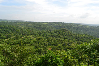
This place is located on Varanasi-Shaktinagar highway, nearest railway station being Ahraura Road (at Narayanpur). The place is famous for its nearby (20 km) waterfall, Lakhania dari.

Climate

Adalhat experiences a humid subtropical climate (Köppen climate classification Cwa) with large variations between summer and winter temperatures. Summers are long, from early April to October, with intervening monsoon seasons and are also extremely hot, even by South Asian standards. The temperature ranges between 22°C  46 °C (72°F  115 °F) in the summers. Winters in this place see very large diurnal variations, with warm days and downright cold nights. Cold waves from the Himalayan region cause temperatures to dip across the city in the winter from December to February and temperatures below 5 °C are not uncommon.[ citation needed ] The average annual rainfall is 1,110 mm (44 in). [3] [ unreliable source? ] Fog is common in the winters, while hot dry winds, called loo, blow in the summers.

Through a combination of water pollution, new constructions of upstream dams, and increase in the local temperature, the water level of the Ganges has recently gone down significantly, and small islands have become visible in the middle of the river.

Events

17 May 2012 was the hottest day of the season so far with mercury soaring up to 45.6 °C. [4]

Climate data for Adalhat
MonthJanFebMarAprMayJunJulAugSepOctNovDecYear
Average high °C (°F)19
(67)
24
(76)
31
(87)
37
(98)
38
(100)
36
(97)
32
(90)
31
(88)
31
(88)
31
(87)
27
(81)
22
(71)
30
(86)
Average low °C (°F)8
(47)
12
(54)
17
(62)
22
(72)
25
(77)
27
(80)
26
(78)
26
(78)
24
(76)
21
(70)
15
(59)
11
(51)
20
(67)
Average precipitation mm (inches)19.3
(0.76)
13.5
(0.53)
10.4
(0.41)
5.4
(0.21)
9.0
(0.35)
100.0
(3.94)
320.6
(12.62)
260.4
(10.25)
231.6
(9.12)
38.3
(1.51)
12.9
(0.51)
4.0
(0.16)
1,025.4
(40.37)
Source: [5] [6]

Related Research Articles

<span class="mw-page-title-main">Sonbhadra district</span> District in Uttar Pradesh, India

Chunar is a city located in Mirzapur district of Indian state of Uttar Pradesh. It is nearby Mirzapur city. The railway tracks passing through Chunar Junction railway station leads to major destinations of India, including Howrah, Delhi, Tatanagar and Varanasi. National Highway 35 also passes through Chunar. It is connected to the city of Mirzapur and Varanasi by roads and rails. Chunar is well known for its handicraft products made from clay and plaster of paris. It is also famous for its historical place - Chunar Fort.

<span class="mw-page-title-main">Robertsganj</span> City in Uttar Pradesh, India

Robertsganj also known as Sonbhadra City is a city and a municipal board in Sonbhadra district in the Indian state of Uttar Pradesh.

<span class="mw-page-title-main">Dildarnagar Fatehpur Bazar</span> Nabourhood in Uttar Pradesh, India

Dildarnagar is a town located in the Ghazipur district of the Indian state of Uttar Pradesh. It is situated on the banks of the River Ganges and is approximately 35 kilometers from the city of Ghazipur. The town is known for its historical and cultural significance, and it has several temples, mosques, and other landmarks that attract visitors from different parts of India. Dildarnagar is also an important commercial center and has a bustling market where locals and visitors can purchase a variety of goods and products. As of 2011 estimate the Population of Dildarnagar is 12855 and have an area of 1000 hectares.

Shaktinagar is a small town in Sonbhadra, Mirzapur Division, Uttar Pradesh near Varanasi, India. The city borders with Madhya Pradesh at Jayant Border.

Vengola is a Panchayat and Village in Kunnathunad Taluk of Ernakulam district in the Indian state of Kerala. It lies in the bus route from Perumbavoor to Kolenchery. Nearby villages are Kizhakkambalam (4.4 km), Vadavucode/Puthencruz (6.4 km), Kunnathunad (6.4 km), Rayamangalam (6.9 km), Choornikkara (7.1 km), Vazhakulam (2.7 km).

<span class="mw-page-title-main">Varavoor</span> Residential Village in Kerala, India

Varavoor, a lush green residential village in Thrissur district is in the state of Kerala, India. It is widely believed that this village was situated on the banks of Bharathapuzha during prehistoric times. Shrinking of the river over several millennia of human settlements has moved the village more distant from its banks. It is surrounded by small green hills and is 30 mins drive away from the cultural capital of Kerala. Varavoor was declared "litigation-free" village on 7 May 2000. Climatic conditions in and around Varavoor varies around the year. The well-known Palakkal Pooram is usually held in the month of February welcoming tourists from different parts of the country. During the month of February, paddy fields surrounding the Palakkal temple is usually fallow after harvest, making it ideal location for gathering for the pooram festivities and for fireworks at night.

Bharkhar is a village near Mohania in the state of Bihar, India.

Chaudharipur is a village, part of Tehsil Chunar, in the Mirzapur district of the Indian state of Uttar Pradesh.

<span class="mw-page-title-main">Chadi, Rajasthan</span> Village in Rajasthan, India

Chadi also known as Lakshman Nagar is a village in Phalodi tehsil of Jodhpur district in Rajasthan. It contain a vast area in the marwar region. It has a variety of flora and fauna like desert deer, black buck deer and trees and bushes like khejdi and other desert plants.

Jamalpur Mirzapur is a village in Mau district, in Indian state of Uttar Pradesh, India. It is situated in a remote area of Uttar Pradesh and approximately 330 km from the state capital Lucknow. Jamalpur Mirzapur is locally known for its political, social and economic importance. It is a block village of almost 120 villages. There are government hospitals and government primary schools. There is also one school for special training for girls and disabled children for free. the developing villages in the block Ghosi itself. Its nearby town block is the famous block "Ghosi" situated on NH-7 & Varanasi-gorakahpur Highway NH29 and basically famous for bricks. Manufacturing area covering some villages of Jamalpur MIRZAPUR as well as forty percent villages of GHOSI.

<span class="mw-page-title-main">Chunar Fort</span>

The Chunar Fort is located in Mirzapur district of Uttar Pradesh, in India. Along with Chunar town, near Mirzapur city, situated below the fort, the two are historic places with common history and legends. It is located 34 kilometres (21 mi) North west of Mirzapur. The southeastern part of the fort is on the rocky bank of the Ganges River. The fort's history spans from 56 BC and then between Afghan decedent Sher Shah Suri's (1532) rule, the Mughal Empire rule up to 1772, and Marathas in 1782 to 1804. Lastly, the British Raj occupied the fort to 1947 when India gained independence. Chunar railway station is on the Pt. Deen Dayal Upadhyaya–Kanpur section of Howrah–Delhi main line.

<span class="mw-page-title-main">Triveni Express</span> Express train in india

Triveni Express (15075) is an express train in India that runs from Shaktinagar/Singrauli (Sonbhadra) to Tanakpur via Chopan, Mirzapur, Vindhyachal, Allahabad, Lucknow and Shahjahanpur. It is categorized under the Mail/Express category of Indian Railways.

<span class="mw-page-title-main">Madhupur, Sonbhadra</span> Town in Uttar Pradesh, India

Madhupur is a census town in Sonbhadra district in the Indian state of Uttar Pradesh. It is located 17 km from Robertsganj which is the administrative headquarters of Sonbhadra District. The district Sonbhadra was created by carving off the southern part of the earlier Mirzapur district on 4 March 1989. Son, Karmnasha, Chandra Prabha, Rihand, Kanhar, Renu, Ghagar and Belan Rivers drain this area. in which Son River in main.

Jayapur is a village in Varanasi tehsil, Varanasi district of Uttar Pradesh, India. It is about 28 km from the Varanasi cantt railway station and about 7 km from the Rajatalab railway station in the Sevapuri assembly segment and Aaraji Line Block. This place is situated at the border of the Varanasi District and Mirzapur District. Jayapur is surrounded by Arajiline Tehsil towards the east and Shikhar Tehsil towards the south.

Gill Kalan is a village in Rampura, Tehsil in Bathinda District of Punjab State, India. It is located 38 km towards East from District headquarters Bathinda. 5 km from Rampura. 177 km from State capital Chandigarh.

<span class="mw-page-title-main">Aahi Village</span> Village in Uttar Pradesh, India

Aahi is a village in Mirzapur district of Uttar Pradesh state. It is the headquarter of Aahi gram panchayat. It comes under Majhawa assembly constituency & Mirzapur lok sabha constituency area. Jamua Bazar is the postal office of this village and Kachhwa is the police station. According to Census 2011, its population is 4936. The literacy of the village is 65%. It is situated at border of Mirzapur and Varanasi District.Even though it is in Mirzapur district but it is painted in the manner locality Banarasi culture. Nearby village is Jamua Bazar(1 km), Narayanpur(2 km), Jakhini(5 km), PM Modi adopted village Jayapur(3 km) under Sansad Adarsh Gram Yojana.

Dariyamau, also spelt Dariya-Mau, is a village of Vijayipur block in Khaga Tahsil in Fatehpur District of Uttar Pradesh, India. It is a village in Allahabad Division. It is 114 m (374 ft) above sea level.

The 23345 / 46 Varanasi Junction–Shaktinagar Terminal Intercity Express is an Express train belonging to Indian Railways East Central Railway zone that runs between Varanasi Junction and Shaktinagar Terminal in India.

Jagannath Prasad is a small semi-urban town in Odisha, India. Jagannath Prasad is located on State Highway No.21, connecting Bhanjanagar to Nayagarh.

References

  1. "Union Bank Of India Adalhat Mirzapur Branch IFSC/MICR Code Details" . Retrieved 7 September 2020.
  2. "State Bank Of India Adalhat Mirzapur Branch IFSC/MICR Code Details" . Retrieved 7 September 2020.
  3. "Varanasi tourism". DelhiTourism.com. Archived from the original on 18 April 2010. Retrieved 18 August 2006.
  4. "Adalhat sizzles at 45.6 degrees Celsius". The Times of India . 17 May 2012. Archived from the original on 26 January 2013. Retrieved 17 May 2012.
  5. "Seasonal Weather Averages". Weather Underground. December 2010. Archived from the original on 4 July 2017. Retrieved 22 December 2010., temperature data from Weather Underground
  6. "Varanasi". Indian Meteorology Department. Archived from the original on 9 July 2012. Retrieved 22 December 2010., precipitation data from Indian Meteorology Department