
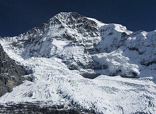
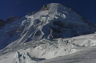
The Finsteraarhorn is a mountain lying on the border between the cantons of Bern and Valais. It is the highest mountain of the Bernese Alps and the most prominent peak of Switzerland. The Finsteraarhorn is the ninth-highest mountain and third-most prominent peak in the Alps. In 2001 the whole massif and surrounding glaciers were designated as part of the Jungfrau-Aletsch World Heritage Site.

The Diablerets are a huge ice-covered mountain massif of the Alps, culminating at the Sommet des Diablerets (VS) at 3,216 metres (10,551 ft) above sea level and almost straddling the border between the Swiss cantons of Vaud (VD) and Valais (VS). The northeastern part of the massif stretches also into the canton of Bern (BE).
The Mönch at 4,110 metres (13,480 ft) is a mountain in the Bernese Alps, in Switzerland. Together with the Eiger and the Jungfrau, it forms a highly recognisable group of mountains, visible from far away.

Lyskamm, also known as Silberbast, is a mountain in the Pennine Alps lying on the border between Switzerland and Italy. It consists of a five-kilometre-long ridge with two distinct peaks. The mountain has gained a reputation for seriousness because of the many cornices lying on the ridge and the frequent avalanches, thus leading to its nickname the Menschenfresser.

The Ober Gabelhorn is a mountain in the Pennine Alps in Switzerland, located between Zermatt and Zinal.

Piz Palü is a mountain in the Bernina Range of the Alps, located between Switzerland and Italy. It is a large glaciated massif composed of three main summits, on a ridge running from west to east. The main summit is 3,900 metres high and is located within the Swiss canton of Graubünden, although the border with the Italian region of Lombardy runs about 100 metres west of it at almost the same height. The western summit is named Piz Spinas and is the only one not covered by ice. The eastern summit is named Piz Palü Orientale. The name Palü derives from the Latin palus, meaning a swamp, and the mountain is said to be named after the Alpe Palü, a high alpine pasture some 4 km to its east.
The Dent d'Hérens is a mountain in the Pennine Alps, lying on the border between Italy and Switzerland. The mountain lies a few kilometres west of the Matterhorn.

The Wildstrubel is a mountain of the Alps, straddling the border between the Swiss cantons of Bern and Valais. It forms a large glaciated massif, about 15 km wide, extending between the Rawil Pass and the Gemmi Pass. Along with the Muverans, the Diablerets and the Wildhorn, the Wildstrubel is one of the four distinct mountain massifs of the Bernese Alps that lie west of the Gemmi Pass. The massif of the Wildstrubel is at the centre between the valleys of Simmental (BE), Engstligental (BE) and the Rhone (VS), the exact location of the tripoint being the summit of the Schneehorn. It comprises several distinct summits, including the Wetzsteinhorn, the Rohrbachstein, the Weisshorn, the Pointe de la Plaine Morte, Mont Bonvin, the Trubelstock and the Schneehorn. The main crest with the almost equally high summits of the Mittelgipfel and the Grossstrubel forms an amphitheatre oriented eastward which ends at the Steghorn and the Daubenhorn. This area encloses the Wildstrubel Glacier. To the southwest, the Wildstrubel overlooks the high plateau of the Plaine Morte Glacier, which also includes an unnamed lake below the Schneehorn.

The Dammastock is the highest mountain in the Urner Alps in Switzerland and is part of the Winterberg massif. Its summit ridge forms the border between the cantons of Uri and the Valais. It is the highest summit in the canton of Uri. The tripoint between the cantons of Bern, Valais and Uri lies near the Eggstock, north of the Dammastock. Politically, the Dammastock is split between the municipalities of Göschenen (Uri) and Obergoms (Valais).

The Tschingelhorn is a mountain of the Bernese Alps, located on the border between the Swiss cantons of Bern and Valais. The summit of the Klein Tschingelhorn on the west is the tripoint between the valleys of Kandertal, Lauterbrunnental and Lötschental. The main summit lies between the Lauterbrunnental and the Lötschental.

The Weisshorn is a major peak of Switzerland and the Alps, culminating at 4,506 metres above sea level. It is part of the Pennine Alps and is located between the valleys of Anniviers and Zermatt in the canton of Valais. In the latter valley, the Weisshorn is one of the many 4000ers surrounding Zermatt, with Monte Rosa and the Matterhorn.
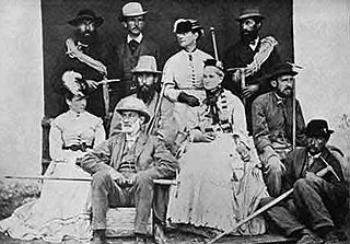
Horace Walker (1838–1908) was an English mountaineer who made many notable first ascents, including Mount Elbrus and the Grandes Jorasses.

The Plaine Morte Glacier is a glacier located at an elevation of 2,750 m (9,020 ft), in the canton of Bern above Lenk and in the Valais above Crans-Montana in Switzerland. The ice field, which covers 7.88 square kilometres (3.04 sq mi), is located below the mountain of Wildstrubel in the Bernese Alps. Its largest tongue is also called in German Rezligletscher or Rätzligletscher.

The Ebnefluh, also known as the Äbeni Flue and the Ebenefluh, is a mountain of the Bernese Alps, located on the border between the Swiss cantons of Bern and Valais. It lies towards the eastern end of the Lauterbrunnen Wall.

The Hockenhorn is a mountain of the Bernese Alps, located on the border between the Swiss cantons of Bern and Valais. Its summit is 3,293 metres high and lies between the upper Kandertal and the Lötschental. On its southern (Valais) side lies a glacier named Milibachgletscher.

The Altels is a mountain of the Bernese Alps, located on the border between the Swiss cantons of Bern and Valais. It is situated in the Balmhorn massif, approximately halfway between Kandersteg and Leukerbad.

The Agassizhorn is a mountain of the Bernese Alps in Switzerland. It lies just north-west of the Finsteraarhorn, the main summit of the range. The Agassizhorn is the tripoint between the valleys of the Lower Grindelwald Glacier, the Unteraar Glacier and the Fiescher Glacier. Because the Lower Grindelwald and Unteraar glaciers drain into the Aar and hence the Rhine and North Sea, whilst the Fiescher glacier drains into the Rhone and hence the Mediterranean Sea, the Sidelhorn lies on the European continental divide.
Jakob Anderegg was a Swiss mountain guide and the first ascensionist of many prominent mountains in the western Alps during the golden and silver ages of alpinism. Jakob Anderegg made the first ascent of the following peaks or routes:


