Barbing

Last updated
Barbing
Barbing-Kirche-Sankt-Martin.jpg
Church of Saint Martin
Wappen Barbing.svg
Coat of arms
Location of Barbing within Regensburg district
Barbing in R.svg
Germany adm location map.svg
Red pog.svg
Barbing
Bavaria location map.svg
Red pog.svg
Barbing
Coordinates: 49°00′12″N12°11′57″E / 49.00333°N 12.19917°E / 49.00333; 12.19917 Coordinates: 49°00′12″N12°11′57″E / 49.00333°N 12.19917°E / 49.00333; 12.19917
Country Germany
State Bavaria
Admin. region Oberpfalz
District Regensburg
Subdivisions8 Ortsteile
Government
   Mayor (202026) Johann Thiel [1] (CSU)
Area
  Total30.51 km2 (11.78 sq mi)
Elevation
332 m (1,089 ft)
Population
 (2020-12-31) [2]
  Total5,572
  Density180/km2 (470/sq mi)
Time zone UTC+01:00 (CET)
  Summer (DST) UTC+02:00 (CEST)
Postal codes
93092
Dialling codes 09401, 09403 (Sarching, Friesheim), 09481 (Illkofen, Auburg, Altach, Eltheim)
Vehicle registration R
Website www.barbing.de

Barbing is a municipality in the district of Regensburg in Bavaria in Germany. It lies on the Danube river.

The town is home to the luxury watchmaker, Damasko.

Subdivisions

Barbing has eleven Ortsteile: [3]

Related Research Articles

Ergolding Place in Bavaria, Germany

Ergolding is a municipality in the district of Landshut, in Bavaria, Germany. It is situated on the left bank of the Isar, 5 km northeast of Landshut.

Wald, Upper Palatinate Place in Bavaria, Germany

Wald is a municipality in the district of Cham in Bavaria in Germany.

Wörth, Upper Bavaria Place in Bavaria, Germany

Wörth is a municipality in the district of Erding in Bavaria in Germany.

Hohenthann Place in Bavaria, Germany

Hohenthann is a municipality in the district of Landshut in Bavaria in Germany.

Niederaichbach Place in Bavaria, Germany

Niederaichbach is a municipality in the district of Landshut in Bavaria in Germany.

Sauerlach Place in Bavaria, Germany

Sauerlach is a municipality in the district of Munich in Bavaria in Germany.

Kirchendemenreuth Place in Bavaria, Germany

Kirchendemenreuth is a municipality in the district of Neustadt an der Waldnaab in Bavaria, Germany. It includes the village (Dorf) of Steinreuth.

Leuchtenberg Place in Bavaria, Germany

Leuchtenberg is a municipality in the district of Neustadt an der Waldnaab in Bavaria, Germany, essentially a suburb of nearby Weiden in der Oberpfalz, and a larger historical region in the Holy Roman Empire governed by the Landgraves of Leuchtenberg.

Püchersreuth Place in Bavaria, Germany

Püchersreuth is a municipality in the district of Neustadt an der Waldnaab in Bavaria, Germany.

Fürstenstein Place in Bavaria, Germany

Fürstenstein is a municipality in the district of Passau in Bavaria in Germany.

Brennberg Place in Bavaria, Germany

Brennberg is a municipality in the district of Regensburg in Bavaria in Germany.

Schierling Place in Bavaria, Germany

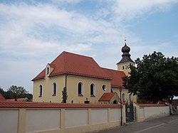
Schierling is a municipality in the district of Regensburg in Bavaria in Germany.

Tegernheim Place in Bavaria, Germany

Tegernheim is a municipality in the district of Regensburg in Bavaria in Germany. The Danube flows through the cadastrial area of the village.

Babensham Place in Bavaria, Germany

Babensham is a municipality in the district of Rosenheim in Bavaria in Germany. It lies on the river Inn.

Massing, Germany Place in Bavaria, Germany

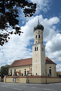
Massing is a municipality in the district of Rottal-Inn in Bavaria in Germany.

Altenmarkt an der Alz Place in Bavaria, Germany

Altenmarkt an der Alz is a municipality in the district of Traunstein in Bavaria, Germany.

Nußdorf (Chiemgau) Place in Bavaria, Germany

Nußdorf is a municipality in the district of Traunstein in Bavaria in Germany.

Perkam Place in Bavaria, Germany

Perkam is a municipality in the district of Straubing-Bogen in Bavaria, Germany.

Unterwössen Place in Bavaria, Germany

Unterwössen is a municipality in the district of Traunstein in Bavaria, Germany.

Iffeldorf Place in Bavaria, Germany

Iffeldorf is a municipality in the Weilheim-Schongau district of Bavaria, Germany.

References

  1. Liste der ersten Bürgermeister/Oberbürgermeister in kreisangehörigen Gemeinden, Bayerisches Landesamt für Statistik, 15 July 2021.
  2. "Tabellenblatt "Daten 2", Statistischer Bericht A1200C 202041 Einwohnerzahlen der Gemeinden, Kreise und Regierungsbezirke". Bayerisches Landesamt für Statistik und Datenverarbeitung (in German). June 2021.
  3. Bayerische Landesbibliothek Online Retrieved 15 January 2013