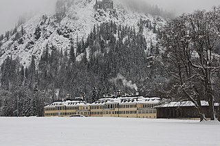
Flossenbürg is a municipality in the district of Neustadt an der Waldnaab in Bavaria in Germany. The state-approved leisure area is located in the Bavarian Forest and borders Bohemia in the east. During World War II, the Flossenbürg concentration camp was located here.

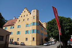
Mantel is a municipality located in the district of Neustadt an der Waldnaab in Bavaria, Germany. It is known as a Markt, a town that was historically granted 'market rights'. The town was first mentioned in official documents in 1212, and in 1945 it was incorporated into the municipality of Rupprechtsreuth. As part of the regional reform in Bavaria, parts of the dissolved municipality of Hütten were added to it in 1972. The town's population fell by 77 people, 2.8%, to 2728 between 1988 and 2018. Mantel is best known for its nature preserve, Naturwaldreservat Gscheibte Loh, as well as its castle, Schloss Steinfels.
Pöcking is a municipality in the district of Starnberg in Bavaria in Germany. Duchess Elisabeth in Bavaria, consort of Emperor Franz Josef I of Austria-Hungary, grew up here in the Possenhofen Castle as daughter of Duke Max in Bavaria and Princess Ludovika of Bavaria.
Grünwald is a municipality in the district of Munich, in the state of Bavaria, Germany. It is located on the right bank of the Isar, 12 km southwest of Munich (centre). As of 31 December 2011 it had a population of 11,109.

Henfenfeld is a municipality near Nuremberg in the Frankenalb directly south of Hersbruck. The town was first mentioned in a letter dating from 13 April 1059. The town is best known for its castle.

Kipfenberg is a town and municipality in the district of Eichstätt in Bavaria, Germany. It is known for its hillside castle and fortress, and for being the geographical centre of Bavaria. The river Altmühl flows through the municipality and its market town of Kipfenberg.

Taufkirchen is a municipality in the district of Erding in Bavaria in Germany.
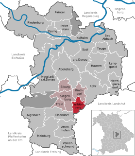
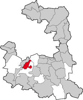
Wildenberg is a municipality in the district of Kelheim in Bavaria in Germany.

Stockheim is a municipality in the district of Kronach in Bavaria in Germany. It is located on Bundesstraße 85, and on the touristic route Bier- und Burgenstraße.

Bayerbach is a municipality in the district of Landshut in Bavaria in Germany.

Neufahrn i. NB or Neufahrn in Niederbayern is a municipality in the district of Landshut in Bavaria in Germany. Its Bavarian name is Neifing.

Valley is a municipality in the district of Miesbach in Bavaria in Germany. The municipality of Valley holds, as of 2006, 2949 inhabitants.
Kreuth is a municipality in the district of Miesbach in Bavaria in Germany.

Kallmünz is a municipality in the district of Regensburg in Bavaria, Germany. Situated at the river Naab about 25 km north of Regensburg Kallmünz has conserved a beautiful medieval center. The main attractions are the ruins of the Kallmünz Castle above the town on a cliff and the old stone bridge over the Naab River. It was in Kallmünz that the Russian painter Wassily Kandinsky and the German expressionist painter Gabriele Münter met during the summer of 1903. Since then Kallmünz has been the constant home to a small art colony.

Laaber is a municipality in the district of Regensburg in Bavaria in Germany. It lies on the River Schwarze Laber.

Amerang is a municipality in the district of Rosenheim in Bavaria in Germany.

Berg is a municipality in the district of Starnberg in Bavaria, Germany, on the shore of the Starnberg Lake. It is most famous for the royal Berg Castle.
Seefeld is a municipality in the district of Starnberg in Bavaria, Germany. The town lies on the western shore of the Pilsensee. It is connected to the Bavarian capital city of Munich by the S-Bahn line S8. Seefeld is notable for the Seefeld Castle, a seat of the Toering noble family of Bavaria.

Neubeuern is a municipality in the district of Rosenheim in Bavaria in Germany. It lies on the inn river.

Schonstett is a municipality in the district of Rosenheim in Bavaria in Germany.