
Bacuag, officially the Municipality of Bacuag, is a 5th class municipality in the province of Surigao del Norte, Philippines. According to the 2015 census, it has a population of 14,486 people.

Burgos, officially the Municipality of Burgos, is a 6th class municipality in the province of Surigao del Norte, Philippines. According to the 2015 census, it has a population of 4,034 people.

Cagdianao, officially the Municipality of Cagdianao, is a 3rd class municipality in the province of Dinagat Islands, Philippines. According to the 2015 census, it has a population of 16,808 people.
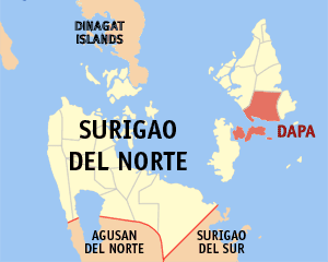
Dapa, officially the Municipality of Dapa, is a 4th class municipality in the province of Surigao del Norte, Philippines. According to the 2015 census, it has a population of 23,787 people.

Del Carmen, officially the Municipality of Del Carmen, is a 5th class municipality in the province of Surigao del Norte, Philippines. According to the 2015 census, it has a population of 18,392 people.

Dinagat, officially the Municipality of Dinagat, is a 5th class municipality in the province of Dinagat Islands, Philippines. According to the 2015 census, it has a population of 10,632 people.

General Luna, officially the Municipality of General Luna, is a 5th class municipality in the province of Surigao del Norte, Philippines. According to the 2015 census, it has a population of 16,771 people.

Gigaquit, officially the Municipality of Gigaquit, is a 4th class municipality in the province of Surigao del Norte, Philippines. According to the 2015 census, it has a population of 20,864 people.
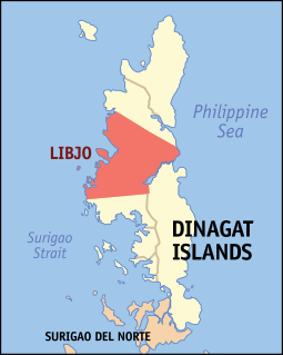
Libjo, officially the Municipality of Libjo, is a 5th class municipality in the province of Dinagat Islands, Philippines. According to the 2015 census, it has a population of 17,760 people.

Loreto, officially the Municipality of Loreto, is a 4th class municipality in the province of Dinagat Islands, Philippines. According to the 2015 census, it has a population of 9,309 people.
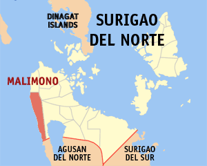
Malimono, officially the Municipality of Malimono, is a 5th class municipality in the province of Surigao del Norte, Philippines. According to the 2015 census, it has a population of 18,054 people.
Placer, officially the Municipality of Placer, is a 4th class municipality in the province of Surigao del Norte, Philippines. According to the 2015 census, it has a population of 27,094 people.

San Benito, officially the Municipality of San Benito, is a 6th class municipality in the province of Surigao del Norte, Philippines. According to the 2015 census, it has a population of 5,404 people.

San Isidro, officially the Municipality of San Isidro, is a 5th class municipality in the province of Surigao del Norte, Philippines. According to the 2015 census, it has a population of 7,325 people.

San Jose, officially the Municipality of San Jose, is a 4th class municipality and capital of the province of Dinagat Islands, Philippines. According to the 2015 census, it has a population of 27,487 people.

Santa Monica, officially the Municipality of Santa Monica, is a 5th class municipality in the province of Surigao del Norte, Philippines. According to the 2015 census, it has a population of 8,808 people.

Socorro, officially the Municipality of Socorro, is a 4th class municipality in the province of Surigao del Norte, Philippines. According to the 2015 census, it has a population of 22,314 people.

Tagana-an, officially the Municipality of Tagana-an, is a 5th class municipality in the province of Surigao del Norte, Philippines. According to the 2015 census, it has a population of 16,428 people.

Tubajon, officially the Municipality of Tubajon, is a 5th class municipality in the province of Dinagat Islands, Philippines. According to the 2015 census, it has a population of 8,276 people.

The Dinagat Islands are a group of islands constituting a province in the Caraga region in the Philippines, located on the south side of Leyte Gulf. The island of Leyte is to its west, across Surigao Strait, and Mindanao is to its south. Its main island, Dinagat, is about 60 kilometres (37 mi) from north to south. Declared a province in 2006, the Dinagat Islands comprise the second newest province of the Philippines, with Davao Occidental (2013) being the newest.


