Bayankhongor Province

Last updated
Bayankhongor Province
Баянхонгор аймаг
ᠪᠠᠶᠠᠨᠬᠣᠩᠭᠣᠷᠠᠶᠢᠮᠠᠭ
Nomgon from the west.jpg
Nomgon from the west
Mn flag bayankhongor aymag.png
Bayankhongor Aimag CoA.png
Bayankhongor in Mongolia.svg
Coordinates: 46°06′N100°41′E / 46.100°N 100.683°E / 46.100; 100.683
CountryMongolia
Established1941 (1941)
Capital Bayankhongor
Area
  Total115,977.80 km2 (44,779.28 sq mi)
Population
 (2017)
  Total87,243
  Density0.75/km2 (1.9/sq mi)
GDP
[1]
  Total MNT 541 billion
US$ 0.2 billion (2022)
  Per capitaMNT 6,027,060
US$ 1,930 (2022)
Time zone UTC+8
Area code +976 (0)144
ISO 3166 code MN-069
Vehicle registration БХ_
Website www.bayankhongor.com/en

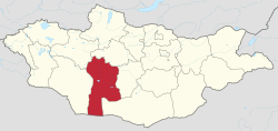
The Bayankhongor Province or Bayanhongor Aimag [lower-alpha 1] is one of the 21 aimags (provinces) of Mongolia. It is located in the southwest of the country and, at 116,000 square kilometers, it is one of the largest aimags. The capital of the aimag shares the provincial name, Bayankhongor.

Contents

History

Bayankhongor aimag was formed in 1941 with the establishment of the Bayankhongor Citizen's Assembly. There were originally 16 Bayankhongor Area Soums and about 41 thousand people in the aimag. The aimag was originally named Govi-Bumbugur, however it was soon changed to Bayankhongor.[ citation needed ]

In April 1976, Bayankhongor was awarded the Outstanding Red Award for livestock, meat, and wool production.[ citation needed ] The aimag received substantial investment from the former USSR, including infrastructure and education. However, the USSR also systematically repressed the religion and cultural heritage of the aimag, purging famous monasteries such as the Geegin Monastery and killing thousands of monks.

The zud , winter snow disasters, of the early 2000s devastated Bayankhongor's livestock and economy. The zud also precipitated social changes in the aimag since fewer people now rely on herding as a major source of income and more people have moved to the aimag capital in search of work. Out of the total aimag population estimated at 80,000, somewhere between 25 and 35,000 people live in the provincial capital.

Geography

The Bayankhongor aimag includes very diverse geographic areas. It is typically divided into three areas: the mountainous and wooded Khangai in the north, the central steppe region, and the arid Gobi Desert in the south.

Albino camel in the Bayankhongor Province landscape. Albino camel in Bayankhongor Aimag, Mongolia.jpg
Albino camel in the Bayankhongor Province landscape.

Bayankhongor contains two mountain ranges, the Khangai Mountains in the north and the Gobi Altai Mountains in the central region. Ikh Bogd, the aimag's tallest mountain at 3957 meters, is part of the Gobi Altai range and is located outside of Bogd sum.

The largest lakes in Bayankhongor are Orog Nuur and Böön Tsagaan Nuur, which are found in the central semi-desert region of the aimag (the Valley of Lakes between the Khangai and Gobi Altai ranges), as are several other lakes. Due to the surrounding mountain areas, the lakes in the Valley of Lakes have no outlet and are therefore saline.

Khangai, in the north, contains several hot and cold mineral springs. Shargaljuut, a town about 54 km north of the aimag capital, boasts over 300 springs and has developed a popular resort to take advantage of this natural feature. The mineral waters of the various springs are used by the local people to treat a variety of ailments. Furthermore, there are a handful of genuine oases in the south of the province, most of which are in the Shinejinst area. The most famous oasis, Ekhiin-Gol, was once home to the Lama Dambijant or Ja Lama, an early 20th-century revolutionary turned bandit.

Wildlife

Bayankhongor aimag boasts a diverse wildlife population, although, unfortunately, many species are endangered. Despite protected areas in the aimag, the populations of animals such as the snow leopard, long-eared jerboa, Mongolian wild ass, and wild Bactrian camels are rapidly diminishing. The Gobi bear population is estimated at less than 50 animals. On the other hand, Bayankhongor residents have been heard to say that the aimag has the most marmots out of any aimag. The middle salt lake depression plane, particularly areas like Boon Tsaagan Nuur and Orog Nuur are excellent birding areas with endangered birds such as the Dalmatian pelican and relict gull. Both these lakes are protected through the World Ramsar Convention for Wildlife Diversity. Domesticated animals in Bayakhongor include Bactrian camels, horses, sheep, goats, yaks, cattle, and a yak-cattle hybrid called a khainag.

Attractions

The attractions of Bayankhongor vary from the natural (Gobi bear) to the man-made (Chess Stones of Erdentsogt); from the old (prehistoric petroglyphs in Bayan Lig) to the older (dinosaur bones in Bugiin Tsav). Since the aimag contains all three major geographic zones of Mongolia (forest, steppe, and desert) it is a great place to commune with nature.

Museums

There are two museums in the aimag capital, a History and Ethnographic Museum and a Museum of Natural History. The History and Ethnographic Museum contains exhibits of traditional nomadic life such as information on weddings, ger life, and traditional clothes. It also has some interesting artifacts from Bayankhongor during Manchu Rule, and religious exhibits including a pair of famous Green and White Tara statues, the Jadamba Sutras, and shaman robes. The Museum of Natural History contains various mineral specimens from the aimag such as marble and volcanic rock, as well as various mounted endemic animals. The highlights of the museum are the complete skeleton of a Tarbosaurus dinosaur and a 130-million-year-old fossil of a turtle discovered in the Bugiin Tsav (Bugiin Ravine) in the Gobi Desert.

Parks

The aimag capital has a few parks, namely the Dinosaur Park and the Children's Park. The Dinosaur Park consists of models of the many dinosaur species found in the south of the province. There is also a model ger open to visitors. The Children's Park, despite the name, is a nature park with scenic pathways and endemic trees and plants. The Tuil Gol (gol meaning river in Mongolian) running alongside the town makes for excellent picnic grounds, and Ikh Nomgun Mountain serves as a somewhat challenging day climb.

There are also many protected areas in Bayankhongor (see above).

Monasteries

Although the famous monasteries of Bayankhongor were all destroyed during the Soviet purges, since Mongolia's independence in 1990, there has been a flurry of rebuilding and reconnecting with the area's Buddhist heritage.

There are two monasteries in the aimag capital, Bayankhongor. The entire town surrounds a sacred hill on which it is forbidden to build. Atop the hill sits a giant stupa of some significance, and there is a small monastery with about ten resident monks at the base of the hill. The other, larger, monastery is called Lamyn Gegeenii Gon Gandan Dedlin Khiid, and was built in 1991. The original monastery of this name was located about 30 km outside of the city and was home to over 10,000 monks and lamas making it one of the largest and most prominent monasteries in the county. However, the buildings were demolished and the monks killed or forced to renounce their vows by the Communist government in 1937. The current monastery is home to about 50 monks, and features a giant statue of Sakyamuni Buddha and two Green and White Tara statues modeled after those in the History and Ethnographical Museum of Bayankhongor.

Amarbuyant Khiid, located 50 km west of Shinejist, once housed the 13th Dalai Lama and over 1,000 monks. The 13th Dalai Lama stayed there for ten days in 1904 during a journey from Lhasa to Urga. While visiting, he built a small ovoo (rock cairn) which remains among the ruins of the monastery, which was destroyed along with Gegeen Monastery in 1937 during the Communist purges. The gradual restoration process of the complex began in the 1990s after the Communist regime fell.

Protected areas

There are two protected areas in Bayankhongor. The Gobi A: Strictly Protected Areas in the south borders China and Ömnögovi aimag. In it live many endangered species such as the Gobi bear and the Zam gecko. The second area is the Gobi Gurvansaikhan National Park, which is known for its extensive fossil sites, iconic sand dunes, ice canyon, and stunning mountain scenery not to mention the over 200 bird species and 600 varieties of plants. Both of these areas are popular tourist destinations both for foreigners and Mongolians.

Petroglyphs and fossils

Tsagaan Agui (White Cave) once housed Stone Age people beginning approximately 700,000 years ago. According to researchers, its crystal-lined inner chamber was a holy site for these inhabitants as well as a pilgrimage spot for historical period Buddhists.

The nearby site of Tsagaan Bulag (White Stream) was perhaps another sacred site for the region's ancient inhabitants. On a white outcrop, the faint drawings of figures are still visible. These figures, although anthropomorphic, bear unusual features such as massive ears and misshaped hands.

Bayangiin Nuruu (roughly translated as Rich Mountainside) is another site with well-preserved petroglyphs from approximately 3000BCE. Although not nearly as ancient as other sites, Bayangiin Nuruu's drawings are extensive and well-preserved, depicting scenes from daily life.

Dinosaur fossils are also found in the ravines and valleys of southeastern Bayankhongor. Famous sites include Bugiin Tsav, Yasnee Tsav, and Khermen Tsav.

Transportation

The Bayankhongor Airport (BVN/ZMBH) has two runways, and is served by two or three weekly flights to and from Ulaanbaatar that vary from season to season. [2] There are also daily buses to and from Ulaanbaatar (departing from the Dragon Center in Ulaanbaatar at 08.00) which stop in the town of Arvaikheer, as well as less regular buses west towards Gobi-Altai and Khovd aimags. Travel to soums (sub-provincial districts) is possible by mini-vans (microbuses) which gather in the open market in the southern district of the aimag capital.

Administrative subdivisions

Sums of Bayankhongor Mongolia Bayankhongor sum map.png
Sums of Bayankhongor
The sums of Bayankhongor aimag [3]
Sum Mongolian Population
(end of 2000) [4]
Population
(end of 2006)
Sum center
population
(end of 2006)
Area (km2)Density (/km2)
Baatsagaan Баацагаан4,5263,5684227,4470.48
Bayan-Öndör Баян-Өндөр2,6922,55954816,8910.15
Bayan-Ovoo Баян-Овоо3,0432,9127313,2440.90
Bayanbulag Баянбулаг2,2522,1434633,1700.68
Bayangovi Баянговь2,9032,7036284,6620.58
Bayankhongor *Баянхонгор20,50126,58826,58864415.44
Bayanlig Баянлиг3,8423,31680511,9180.28
Bayantsagaan Баянцагаан3,9463,5996345,3950.67
Bogd Богд3,2262,9006133,9830.73
Bömbögör Бөмбөгөр2,7552,5846563,0440.85
Buutsagaan Бууцагаан4,2583,4529015,8400.59
Erdenetsogt Эрдэнэцогт5,1584,2359334,1001.03
Galuut Галуут5,2754,0126445,0470.79
Gurvanbulag Гурванбулаг2,9152,5943504,4420.58
Jargalant Жаргалант4,3743,1736974,1750.76
Jinst Жинст2,3522,0233765,3130.38
Khüreemaral Хүрээмарал2,4662,0643254,3280.48
Ölziit Өлзийт3,7213,3536613,8530.87
Shinejinst Шинэжинст2,4692,18731916,5010.13
Zag Заг2,4402,2645922,5610.88

* - The aimag capital Bayankhongor

Notes

  1. Mongolian: Баянхонгор аймаг, romanized: Bayanhongor aimag, pronounced [ˌpajə̆ɴˈχɔɴɢɞrˈæˑməq] , lit. "Rich Darling Province"

Related Research Articles

<span class="mw-page-title-main">Geography of Mongolia</span>

Mongolia is a landlocked country in East Asia, located between China and Russia. The terrain is one of mountains and rolling plateaus, with a high degree of relief. The total land area of Mongolia is 1,564,116 square kilometres. Overall, the land slopes from the high Altai Mountains of the west and the north to plains and depressions in the east and the south. The Khüiten Peak in extreme western Mongolia on the Chinese border is the highest point. The lowest point is at 560 m (1,840 ft), is the Hoh Nuur or lake Huh. The country has an average elevation of 1,580 m (5,180 ft).

<span class="mw-page-title-main">Ulaanbaatar</span> Capital and largest city of Mongolia

Ulaanbaatar, previously anglicized as Ulan Bator, is the capital and most populous city of Mongolia. With a population of 1.6 million, it is the coldest capital city in the world by average yearly temperature. The municipality is located in north central Mongolia at an elevation of about 1,300 metres (4,300 ft) in a valley on the Tuul River. The city was founded in 1639 as a nomadic Buddhist monastic centre, changing location 28 times, and was permanently settled at its modern location in 1778.

Articles related to Mongolia include:

<span class="mw-page-title-main">Övörkhangai Province</span> Province (aimag) of Mongolia

Övörkhangai is one of the 21 aimags (provinces) of Mongolia, located in the south of the country. Its capital is Arvaikheer.

<span class="mw-page-title-main">Töv Province</span> Province (aimag) of Mongolia

Töv is one of the 21 aimags (provinces) of Mongolia. The national capital Ulaanbaatar is located roughly at its center, but the city itself is administered as an independent municipality.

<span class="mw-page-title-main">Zavkhan Province</span> Mongolian province

Zavkhan is one of the 21 aimags (provinces) of Mongolia, located in the west of the country, 1,104 km from Ulaanbaatar. Its capital is Uliastai. The aimag is named after the Zavkhan River, which forms the border between Zavkhan and Gobi-Altai aimag.

Bayangovi is a sum (district) of Bayankhongor Province in south-eastern Mongolia. It is situated approximately 40 kilometres south of the lake Orog Nuur, 170 km from provincial capital Bayankhongor and 650 km south-west of Ulaanbaatar. Bayangovi is surrounded by the Ikhee Bogd mountain range, and by desert.

<span class="mw-page-title-main">Arvaikheer</span> Provincial capital of Övörkhangai Province, Mongolia

Arvaikheer, also spelt Arwaiheer is the capital of Övörkhangai Aimag (province) and one of the most central points of Mongolia.

The Khangai Mountains ; form a range in central Mongolia, some 400 km (250 mi) west of Ulaanbaatar.

Terkhiin Tsagaan Lake (Mongolian: Тэрхийн Цагаан нуур, romanized: Terkhiin Tsagaan nuur,, is a fresh-water lake in the Khangai Mountains in central Mongolia, located in Tariat soum of Arkhangai province. In 670 km to the capital city Ulaanbaatar and 180 km to the center of Tariat soum.

<span class="mw-page-title-main">Jargalant, Bayankhongor</span> District in Bayankhongor Province, Mongolia

Jargalant is a sum of Bayankhongor Province in southern Mongolia. Jargalant is also called Baidrag. The sum is bordered by Zag to the west; Gurvanbulag to the northwest; Khangai, Arkhangai province; Chuluut sum to the northeast; Galuut, and Bömbögör sum to the east and south. The northern edge of the district contains parts of the Untaa Yamaat mountain range, the eastern section contains the Egi pass, the southern border is 2.7 km south of the south shore of Davsan lake, and the western border is the Zag river. It is further divided into 4 bag, the Nam Tolgoi bag the Ulziit Heights bag, the Crossing Spring team, and the Emeel Togol bag.

Tsagaan-Uul is a sum of Khövsgöl aimag. The area is about 5,870 km², of which 5,190 km² are pasture. In 2005, the sum had 5145 inhabitants, mainly Khalkha and Khotgoid. The center officially named Sharga, is located 138 km west of Mörön and 840 kilometers from Ulaanbaatar.

<span class="mw-page-title-main">Great Lakes Depression</span>

The Great Lakes Depression, also called the Great Lakes' Hollow, is a large semi-arid depression in Mongolia that covers parts of the Uvs, Khovd, Bayan-Ölgii, Zavkhan and Govi-Altai aimags. Bounded by the Altai in the West, Khangai in the East and Tannu-Ola Mountains in the North, it covers the area of over 100,000 km2 (39,000 sq mi) with elevations from 750 to 2,000 m (2,460–6,560 ft).

<span class="mw-page-title-main">Central Asian Internal Drainage Basin (Mongolia)</span> Endorheic basin in Mongolia

The Central Asian Internal Drainage Basin or Central Asian Inland Basin is the largest of 3 major hydrological basins that cover Mongolia. It is an endorheic basin.

The Valley of the Lakes is an intermontane depression located in southwestern Mongolia, separating the Khangai and Govi-Altai mountains. The valley stretches 500 km long, has a width of approximately 100 km, and is located at altitudes ranging between 1000 and 1400 meters above sea level. The topography is dominated by sandy and rocky plains, with solonchak and takir soils present. Along the valley floor lies a chain of large and small saline lakes, which are generally shallow, with a saucer-shaped depth profile. The largest of these lakes are Böön Tsagaan Lake and Orog Lake. Water levels vary considerably in size both seasonally and from year to year, and some lakes may dry out completely in certain years. They all receive their inflow from rivers which rise in the Khangai Mountains, and no permanent inflow comes from the Gobi-Altai. Barchan sand dunes are located on the valley's margins. The region near the Govi-Altai is a seismically active zone and is where the 1957 Mongolia earthquake occurred.

<span class="mw-page-title-main">Wildlife of Mongolia</span>

The wildlife of Mongolia consists of flora, fauna and funga found in the harsh habitats dictated by the diverse climatic conditions found throughout the country. In the north, there are salty marshes and fresh-water sources. The centre has desert steppes. In the south, there are semi deserts as well as the hot Gobi desert in the south, the fifth-largest desert in the world.

The history of Ulaanbaatar, the capital of Mongolia, dates to 1639 when it was first established as a moveable monastery.

<span class="mw-page-title-main">Taatsiin Tsagaan Lake</span> Lake in Övörkhangai Province, Mongolia

Taatsiin Tsagaan Lake is a large saline lake in Övörkhangai Province in the Gobi Desert of southern Mongolia.

<span class="mw-page-title-main">Gobi Lakes Valley desert steppe</span> Ecoregion in Mongolia

The Gobi Lakes Valley desert steppe ecoregion covers the narrow, flat valley in southwestern Mongolia that lies between the Khangai Mountains, and the Gobi-Altai Mountains. The region is known as the "Valley of the Lakes" because runoff from the mountains collect in lakes that have no outlet to the sea. Although the valley is a semi-arid desert steppe, it has areas of wetlands near the lakes that are important habit for water birds.

References

  1. "GROSS DOMESTIC PRODUCT, by region, aimags and the Capital". www.1212.mn. Mongolian Statistical Information Service. Retrieved 2023-12-06.
  2. "Eznis Airways - Mongolian Airline | Fly Ez, Fly Smart!". Archived from the original on 2011-06-10. Retrieved 2018-11-03.
  3. Bayankhongor Aimag Statistical Office 2006 annual report: population Archived May 28, 2008, at the Wayback Machine
  4. Bayankhongor Aimag Statistical Office 2006 annual report: population 2000-2006 Archived May 28, 2008, at the Wayback Machine