
Savannah is the oldest city in the U.S. state of Georgia and the county seat of Chatham County. Established in 1733 on the Savannah River, the city of Savannah became the British colonial capital of the Province of Georgia and later the first state capital of Georgia. A strategic port city in the American Revolution and during the American Civil War, Savannah is today an industrial center and an important Atlantic seaport. It is Georgia's fifth most populous city, with a 2020 U.S. census population of 147,780. The Savannah metropolitan area, Georgia's third-largest, had a 2020 population of 404,798.

Interstate 16 (I-16), also known as Jim Gillis Historic Savannah Parkway, is an east–west Interstate Highway located entirely within the US state of Georgia. It carries the hidden designation of State Route 404 (SR 404) for its entire length. I-16 travels from downtown Macon, at an interchange with I-75 and SR 540 to downtown Savannah at Montgomery Street (exit 167B). It also passes through or near the communities of Dublin, Metter, and Pooler. I-16's unsigned designation of SR 404 has a spur that is signed in Savannah.

Effingham County is a county located in the southeastern part of the U.S. state of Georgia. As of the 2020 census, the population was 64,769. The seat is Springfield.

Garden City is a city in Chatham County, Georgia, United States, located just northwest of Savannah. As of the 2020 census, the city had a population of 10,289. Part industrial and part residential, the city is home to much of the heavy industry in Chatham County. It hosts the largest and busiest ocean terminal of the Port of Savannah, the flagship operation of the Georgia Ports Authority.
Evans is an unincorporated community and census-designated place (CDP) in Columbia County, Georgia, United States. It is a suburb of Augusta and is part of the Augusta metropolitan area. The population was 29,011 at the 2010 census, up from 17,727 at the 2000 census.

Grovetown is a city in Columbia County, Georgia, United States. It is part of the Augusta metropolitan area and the Central Savannah River Area. The 2019 population estimate was 15,152. The mayor is Gary Jones.

Millen is a city, and the county seat of Jenkins County, Georgia, United States. The population was 3,120 at the 2010 census, down from 3,492 at the 2000 census.
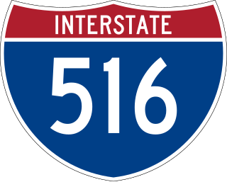
Interstate 516 is a 6.49-mile-long (10.44 km) auxiliary Interstate Highway mostly in the coastal city of Savannah, located in the east-central portion of the U.S. state of Georgia. It is the only auxiliary route of I-16. For its entire length, I-516 is concurrent with State Route 21 (SR 21), which I-516 superseded in 1985. It was formerly also signed as State Route 26 Loop. The highway also carries unsigned State Route 421 (SR 421) to ensure that all Interstates in Georgia had 400-series reference numbers.
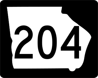
State Route 204 (SR 204) is a 32.4-mile-long (52.1 km) state highway in the east-central part of the U.S. state of Georgia. It runs from a point east of Pembroke and ends in Savannah. Its routing is located within portions of Bryan and Chatham counties.

U.S. Highway 1 (US 1) is a 170.540-mile (274.458 km) north–south U.S. Highway that crosses South Carolina from southwest to northeast and connects the cities of North Augusta, Aiken, Lexington, Columbia, Camden, and Cheraw.

U.S. Highway 17 (US 17) is a 124.20-mile-long (199.88 km) United States Numbered Highway in the U.S. state of Georgia. It travels south–north near the Atlantic Ocean, serving the Brunswick and Savannah metropolitan areas on its path from Florida at the St. Marys River to South Carolina at the Savannah River. Except for part of the highway in Savannah, which is concurrent with Interstate 16 and SR 404 Spur to the Talmadge Memorial Bridge to Hutchinson Island, US 17 is concurrent with SR 25. SR 25 uses an older western alignment of US 17 into South Carolina.

State Route 25 (SR 25) is a state highway in the eastern part of the U.S. state of Georgia. It travels south-to-north near the Atlantic Ocean, serving the Brunswick and Savannah metropolitan areas on its path from the Florida state line at the St. Marys River to the South Carolina state line at the Little Back River, a channel of the Savannah River. Except for the northern part of the highway, from Savannah to Port Wentworth, it is concurrent with U.S. Route 17 (US 17) for its entire length.
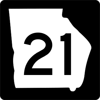
State Route 21 (SR 21) is an 84.4-mile-long (135.8 km) state highway that travels southeast-to-northwest through portions of Chatham, Effingham, Screven, and Jenkins counties in the eastern part of the U.S. state of Georgia. The highway connects the Savannah and Millen areas, via Garden City, Port Wentworth, Rincon, Springfield, and Sylvania.

State Route 26 (SR 26) is a 271.1-mile-long (436.3 km) state highway that travels west-to-east through portions of Chattahoochee, Marion, Schley, Macon, Houston, Pulaski, Bleckley, Laurens, Johnson, Emanuel, Bulloch, Bryan, Effingham, and Chatham counties through the central part of the U.S. state of Georgia. It crosses nearly the entire width of the state, connecting Cusseta, on the southeastern edge of Fort Benning, near Columbus to Tybee Island on the Atlantic coast near Savannah, via Buena Vista, Ellaville, Oglethorpe, Hawkinsville, Cochran, Dublin, Swainsboro, Statesboro, and Savannah.
Hutchinson Island is a river island in the Savannah River, north of downtown Savannah in Chatham County, Georgia, United States. The island is formed where the Back River breaks off to the north from the Savannah River. Historically, Hutchinson Island's land use has been primarily industrial, much of which supported the Port of Savannah, one of the busiest containerization cargo ports in the world. The island is roughly 7 miles long and 1 mile wide at its widest point.

U.S. Route 80 (US 80) is a 296-mile-long (476 km) U.S. Highway in the U.S. state of Georgia. It travels west-to-east from the Alabama state line in Columbus across the central portion of the state through cities such as Macon, Dublin, Statesboro, and Savannah to connect to its eastern terminus at an intersection with Tybrisa Street and Inlet Avenue in Tybee Island, near the Atlantic Ocean. Here, the roadway continues as Butler Avenue. US-80 is the main east-west non-Interstate route through Georgia.

The Wormsloe Historic Site, originally known as Wormsloe Plantation, is a state historic site near Savannah, Georgia, in the southeastern United States. The site consists of 822 acres (3.33 km2) protecting part of what was once the Wormsloe Plantation, a large estate established by one of Georgia's colonial founders, Noble Jones. The site includes a picturesque 1.5 miles (2.4 km) oak avenue, the ruins of Jones' fortified house built of tabby, a museum, and a demonstration area interpreting colonial daily life.
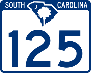
South Carolina Highway 125 (SC 125) is a 56.212-mile (90.464 km) primary state highway in the U.S. state of South Carolina. The highway serves as a direct route between Allendale and Augusta, Georgia, through the Savannah River Site (SRS); and an alternate to U.S. Route 278 (US 278).
Beaulieu is a census-designated place and unincorporated community in Beaulieu and Chief townships, Mahnomen County, Minnesota, United States. Its population was 103 as of the 2020 census.

Bull Street is a major street in Savannah, Georgia, United States. Named for Colonel William Bull (1683–1755), it runs from Bay Street in the north to Derenne Avenue in the south. It is around 3.40 miles in length, not including the section interrupted by Forsyth Park. It is the center of a National Historic Landmark District.


