Sremski Karlovci is a town and municipality located in the Srem District of the autonomous province of Vojvodina, Serbia. It is situated on the banks of the Danube, 8 kilometres from Novi Sad. According to the 2011 census results, it has a population of 8,750 inhabitants. The town has traditionally been known as the seat of the Serbian Orthodox Church in the Habsburg Monarchy. It was the political and cultural capital of Serbian Vojvodina after the May Assembly and during the Revolution in 1848.

Vojvodina, officially the Autonomous Province of Vojvodina, is an autonomous province that occupies the northernmost part of Serbia, located in Central Europe. It lies within the Pannonian Basin, bordered to the south by the national capital Belgrade and the Sava and Danube Rivers. The administrative centre, Novi Sad, is the second-largest city in Serbia.
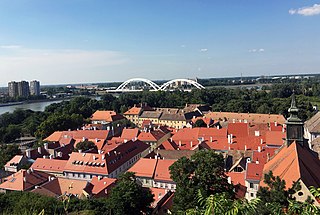
Petrovaradin is a historic town in the Serbian province of Vojvodina, now a part of the city of Novi Sad. As of 2011, the urban area has 14,810 inhabitants. Lying on the right bank of the Danube, across the main part of Novi Sad, it is built around the Petrovaradin Fortress, the historical anchor of the modern city.

Inđija is a town and a municipality located in the Srem District of the autonomous province of Vojvodina, Serbia. As of 2024, the town has total population of 35.461, while the municipality has 47,433 inhabitants. It is located in the geographical region of Syrmia.

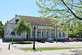
Ruma is a town and municipality in the Srem District of the Autonomous Province of Vojvodina, Serbia. As of 2011, the town has a population of 30,076, while the municipality has a population of 54,339.

Syrmia is a region of the southern Pannonian Plain, which lies between the Danube and Sava rivers. It is divided between Serbia and Croatia. Most of the region is flat, with the exception of the low Fruška gora mountain stretching along the Danube in its northern part.
The Srem District is one of seven administrative districts of the autonomous province of Vojvodina, Serbia. It lies in the geographical regions of Srem and Mačva. According to the 2022 census results, it has a population of 282,547 inhabitants. The administrative center is the city of Sremska Mitrovica.

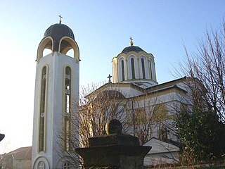
Sremska Kamenica is a town and urban neighborhood of Novi Sad, in Serbia.
Vojvodina's demographic history reflects its rich history and its former location at the border of the Ottoman and Habsburg empires and at the confluence of various peoples, making it a hotbed of invasion, colonization, and assimilation processes. Currently there are more than 25 ethnic groups living in Vojvodina and six official languages.
Podunavlje is the name of the Danube river basin parts located in Croatia and Serbia. Podunavlje is located on the southern edge of Pannonian Basin. In its wider meaning, the Croatian term refers to the area around the entire flow of the river Danube.
Beočin is a town and municipality located in the South Bačka District of the autonomous province of Vojvodina, Serbia. The population of the town is 7,839, whilst Beočin's municipality population is 15,726. There is also a Beočin Monastery from the 16th century in the municipality.
Vojvodina is an autonomous province located in northern Serbia. It consists of the Pannonian Plain in the south, and the Danube and Sava rivers in the north.

The Serbs of Vojvodina are the largest ethnic group in this northern province of Serbia. For centuries, Vojvodina was ruled by several European powers, but Vojvodina Serbs never assimilated into cultures of those countries. Thus, they have consistently been a recognized indigenous ethnic minority with its own culture, language and religion. According to the 2022 census, there were 1,190,785 Serbs in Vojvodina or 68.43% of the population of the province.
Novi Slankamen is a village in Serbia. It is located in the municipality of Inđija, Syrmia District, Autonomous Province of Vojvodina. Novi Slankamen is situated about 15 kilometers east of Inđija, on the bank of Danube (Dunav) and has a total population of 3,421.

Maradik is a village in Serbia. It is situated in the Autonomous Province of Vojvodina, in the region of Syrmia, in Inđija municipality. Maradik is located about 10 km west of Inđija. The village has a 60% Serb ethnic majority and its total population in 2011 was 2,095.

Gospođinci is a village in the municipality of Žabalj, in the South Bačka District of Serbia. It is situated in the Autonomous Province of Vojvodina. The village has a Serb ethnic majority and its population is 3,896.

Stari Slankamen, also known as Slankamen, is a village located in the Inđija municipality, in the Syrmia District of Serbia. It is situated in the Autonomous Province of Vojvodina, across the mouth of the Tisa into the Danube.

Bačko Novo Selo is a village in Serbia. It is situated in the Bač municipality, South Bačka District, Vojvodina province. The village has a Serb ethnic majority and a Bosniak minority. Its population numbering 1,228 people. The village was formally known as Batsch Neudorf prior to World War Two. The etymology of the village comes from Slavic languages meaning new village, Novo Selo and Bačko from the region it’s in Bačka.

Hrtkovci is a village located in the municipality of Ruma, Serbia. As of a 2011 census, it has a population of 3,036 inhabitants.

Donji Petrovci is a village in Serbia. It is situated in Ruma municipality, Srem District, Vojvodina province. The village has a Serb ethnic majority and a population of 991 people. There is a significant ancient Roman archaeological site near the village - the remains of large city Bassianae, which in the 3rd century had the highest status of colonia.