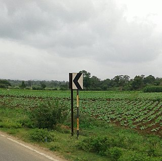
Bidarur

Last updated

Bidarur
village
India Karnataka location map.svg
Red pog.svg
Bidarur
Location in Karnataka, India
India location map.svg
Red pog.svg
Bidarur
Bidarur (India)
Coordinates: 12°43′08″N75°52′58″E / 12.718780°N 75.882640°E / 12.718780; 75.882640 Coordinates: 12°43′08″N75°52′58″E / 12.718780°N 75.882640°E / 12.718780; 75.882640
CountryFlag of India.svg  India
State Karnataka
District Kodagu
Talukas Somvarpet
Government
  Body Gram panchayat
Population
(2001)
  Total5,051
Languages
  Official Kannada
Time zone UTC+5:30 (IST)
ISO 3166 code IN-KA
Vehicle registration KA
Website karnataka.gov.in

Bidarur is a village in the southern state of Karnataka, India. [1] [2] It is located in the Somvarpet taluk of Kodagu district.

Karnataka State in southern India

Karnataka is a state in the south western region of India. It was formed on 1 November 1956, with the passage of the States Reorganisation Act. Originally known as the State of Mysore, it was renamed Karnataka in 1973. The state corresponds to the Carnatic region. The capital and largest city is Bangalore (Bengaluru).

Kodagu district District in Karnataka, India

Kodagu is an administrative district in Karnataka, India. Before 1956, it was an administratively separate Coorg State, at which point it was merged into an enlarged Mysore State. It occupies an area of 4,102 square kilometres (1,584 sq mi) in the Western Ghats of southwestern Karnataka. In 2001 its population was 548,561, 13.74% of which resided in the district's urban centres, making it the least populous of the 30 districts in Karnataka.

Contents

Demographics

As of 2001 India census, Bidarur had a population of 5051 with 2515 males and 2536 females. [1]

Census Acquiring and recording information about the members of a given population

A census is the procedure of systematically acquiring and recording information about the members of a given population. The term is used mostly in connection with national population and housing censuses; other common censuses include agriculture, business, and traffic censuses. The United Nations defines the essential features of population and housing censuses as "individual enumeration, universality within a defined territory, simultaneity and defined periodicity", and recommends that population censuses be taken at least every 10 years. United Nations recommendations also cover census topics to be collected, official definitions, classifications and other useful information to co-ordinate international practice.

See also

Related Research Articles

Payyavoor village in Kerala, India

Payyavoor is a village in Kannur district in the Indian state of Kerala.

Konanur, Hassan town in Karnataka, India

Konanur is a mid level town in the southern state of Karnataka, India. It is located in the Arkalgud taluk of Hassan district in Karnataka.

Badagabanangala is a village in the southern state of Karnataka, India. It is located in the Virajpet taluk of Kodagu district in Karnataka.

Channayan Kote village in Karnataka, India

Channayan Kote is a village in the southern state of Karnataka, India. It is located in the Virajpet taluk of Kodagu district.

Choudlu is a village in the southern state of Karnataka, India. It is located in the Somvarpet taluk of Kodagu district.

Halligattu village in Karnataka, India

Halligattu is a village in the southern state of Karnataka, India. It is located in the Virajpet taluk of Kodagu district.

Kaikeri is a village in the southern state of Karnataka, India. It is located in the Virajpet taluk of Kodagu district.

Kudige is a village in the southern state of Karnataka, India. It is located in the Somvarpet taluk of Kodagu district in Karnataka.

Kudumangalore is a village in the southern state of Karnataka, India. It is located in the Somvarpet taluk of Kodagu district.

Mullusoge is a village in the southern state of Karnataka, India. It is located in the Somvarpet taluk of Kodagu district.

Nelliyahadikeri is a village in the southern state of Karnataka, India. It is located in the Somvarpet taluk of Kodagu district.

Ulugulli is a village in the southern state of Karnataka, India. It is located in the Somvarpet taluk of Kodagu district.

Hosakote, Kodagu village in Karnataka, India

Hosakote is a village in the southern state of Karnataka, India. It is located in the Somavarapete taluk of Kodagu district in Karnataka.

Abbimatta is a village in the southern state of Karnataka, India. It is located in the Somvarpet taluk of Kodagu district.

Abyathamangala is a village in the southern state of Karnataka, India. It is located in the Somvarpet taluk of Kodagu district.

Agalli is a village in the southern state of Karnataka, India. It is located in the Somvarpet taluk of Kodagu district.

Aigur village in Karnataka, India

Aigur is a village in the southern state of Karnataka, India. It is located in the Somvarpet taluk of Kodagu district.

Aimangala, Virajpet village in Karnataka, India

Aimangala, Virajpet is a village in the southern state of Karnataka, India. It is located in the Virajpet taluk of Kodagu district in Karnataka.

Aiyangeri village in Karnataka, India

Ayyangeri is a village in the southern state of Karnataka, India. It is located in the Madikeri taluk of Kodagu district.

References

  1. 1 2 Village code= 2736100 "Census of India : Villages with population 5000 & above". Registrar General & Census Commissioner, India. Archived from the original on 8 December 2008. Retrieved 2008-12-18.
  2. "Yahoomaps India :". Archived from the original on 18 December 2008. Retrieved 2008-12-18. Bidarur, Kodagu, Karnataka