
Kodagu district is an administrative district in the Karnataka state of India. Before 1956, it was an administratively separate Coorg State, at which point it was merged into an enlarged Mysore State.

Chikmagalur, officially Chikkamagaluru is an administrative district in the Malnad subregion of Karnataka, India. Coffee was first cultivated in India in Chikmagalur. The hills of Chikmagalur are parts of the Western Ghats and the source of Tunga and Bhadra rivers. Mullayanagiri, the highest peak in Karnataka is located in the district. The area is well known for the Sringeri Mutt that houses the Dakshina Peeta established by Adi Shankaracharya.

Kushalanagar or Kushalanagara is a city located in the Kodagu district of the Indian state of Karnataka. Surrounded by Kaveri river, it is the gateway to Kodagu district. It also serves as the headquarters of Kushalanagar Taluk. By population, Kushalanagar is the second largest town in Kodagu district after Madikeri and the fastest developing town in the district. Kushalnagar is an important commercial centre in Kodagu.

Gonikoppal is a census town in the Kodagu district of the Indian state of Karnataka.

Ponnampet is a taluk headquarters in the southern part of the district of Kodagu in the state of Karnataka.Ponnampet taluk came into existence on 29 November 2020.

The Harangi Dam is located near Hudgur village, Kushalnagar taluk in Kodagu district in the Indian state of Karnataka. The masonry dam is built across the river Harangi, a tributary of the Kaveri. The dam is located about 9 km (5.6 mi) from the heart of Kushalnagar town.
Konanur is a mid level town in the southern state of Karnataka, India. It is located in the Arkalgud taluk of Hassan district in Karnataka.
Badagabanangala is a village in the southern state of Karnataka, India. It is located in the Virajpet taluk of Kodagu district in Karnataka.
Bidarur is a village in the southern state of Karnataka, India. It is located in the Somvarpet taluk of Kodagu district. As per census survey 2011, the location code number of Bidarur is 617892.
Channayan Kote is a village in the southern state of Karnataka, India. It is located in the Virajpet taluk of Kodagu district.
Choudlu is a village in the southern state of Karnataka, India. It is located in the Somvarpet taluk of Kodagu district.
Halligattu is a village in the southern state of Karnataka, India. It is located in the Ponnampet taluk of Kodagu district.
Kaikeri is a village in the southern state of Karnataka, India. It is located in the Virajpet taluk of Kodagu district.
Kudumangalore is a village in the southern state of Karnataka, India. It is located in the kushalnagar taluk of Kodagu district.

Aigur is a village in the southern state of Karnataka, India. It is located in the Somvarpet taluk of Kodagu district.
Siddapur or Siddapura is a village in Kodagu district, Karnataka, in India. It is situated in a coffee growing region near the river Kaveri.

Mandepanda Poovaiah Appachu Ranjan is an Indian politician who was the former Minister for Youth Services and Sports in Karnataka, a state in Southern India. He is a leader of the BJP in Karnataka and a fifth time Member of the Karnataka Legislative Assembly from Madikeri Constituency in Kodagu district, Karnataka. He belongs to the Kodava Hindu community.
Chettalli is a small village near Siddapura, Kodagu in Karnataka state, India.

Shirangala is a village in Kodagu district of Karnataka state, India.
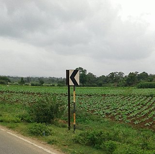
State Highway 91 (SH-91) is a state highway connecting Konanur village of Hassan district and Makutta village of Kodagu, in the South Indian state of Karnataka. It has a total length of 95.50 kilometres (59.34 mi).
