| Bilbrough Falls | |
|---|---|
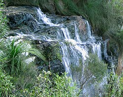 Bilbrough Falls | |
 | |
 | |
| Location | South East Queensland, Australia |
| Coordinates | 28°13′22″S153°17′06″E / 28.22278°S 153.28500°E [1] [2] |
| Type | Cascade |
The Bilbrough Falls, also known as the Goomoolahra Falls, [2] is a cascade waterfall that is located within the Springbrook National Park in the South East region of Queensland, Australia.