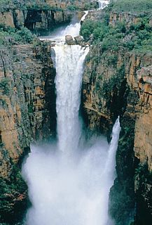
Edith Falls Leliyn | |
---|---|
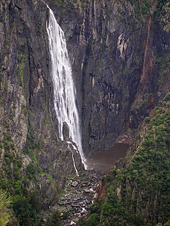
Edith Falls after the wet season. | |
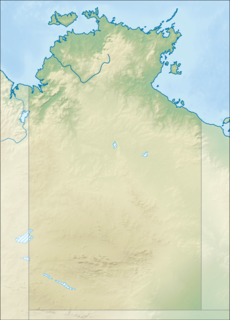
Location | Nitmiluk National Park, Northern Territory, Australia |
Coordinates | 14°10′S132°10′E / 14.167°S 132.167°E Coordinates: 14°10′S132°10′E / 14.167°S 132.167°E [1] |
Type | Cascade |
Elevation | 176 metres (577 ft) AHD |
Total height | 8.7–12 metres (29–39 ft) [2] |
Watercourse | Edith River |
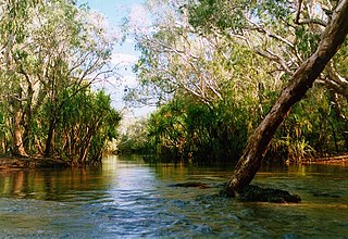
The Edith Falls (Aboriginal Jawoyn language: Leliyn [3] ) is a series of cascading waterfalls and pools on the Edith River in the Nitmiluk National Park, located approximately 60 kilometres (37 mi) north of Katherine, in the Northern Territory of Australia.
Jawoyn, or Kumertuo, is an endangered Gunwinyguan language spoken by elders in Arnhem Land, Australia.
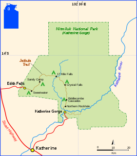
Nitmiluk National Park is in the Northern Territory of Australia, 244 km southeast of Darwin, around a series of gorges on the Katherine River and Edith Falls. Previously named Katherine Gorge National Park, its northern edge borders Kakadu National Park. The gorges and the surrounding landscape have great ceremonial significance to the local Jawoyn people, who are custodians of Nitmiluk National Park. In Jawoyn, Nitmiluk means "place of the cicada dreaming".
Katherine is a town in the Northern Territory of Australia. It is situated on the Katherine River below the "Top End", 320 kilometres (200 mi) southeast of Darwin. It is the fourth largest settlement in the Territory and is known as the place where "The outback meets the tropics". Katherine had an urban population of approximately 6,300 at the 2016 Census. Katherine is also the closest major town to RAAF Base Tindal located 17 km southeast and provides education, health, local government services and employment opportunities for the families of Defence personnel stationed there. In the 2016 census, the base had a residential population of 857, with only around 20% of the workforce engaged in employment outside of defence, the majority commuting to work in Katherine.
The falls descend from an elevation of 176 metres (577 ft) above sea level and range in height between 8.7–12 metres (29–39 ft). [2] There are trails to the top of the escarpment, allowing visitors to view the waterfalls. Edith Falls is connected to Katherine Gorge via the 66-kilometre (41 mi) Jatbula walk. The traditional custodians of the land surrounding the waterfall are the Jawoyn people. [4]
The Australian Height Datum is a vertical datum in Australia. According to Geoscience Australia, "In 1971 the mean sea level for 1966-1968 was assigned the value of 0.000m on the Australian Height Datum at thirty tide gauges around the coast of the Australian continent. The resulting datum surface, with minor modifications in two metropolitan areas, has been termed the Australian Height Datum (AHD) and was adopted by the National Mapping Council as the datum to which all vertical control for mapping is to be referred."
The Wollomombi Falls is a plunge waterfall on the Wollomombi River in the New England region of New South Wales, Australia.
The Twin Falls is a cascade waterfall on the South Alligator River that descends over the Arnhem Land escarpment within the UNESCO World Heritage–listed Kakadu National Park in the Northern Territory of Australia. The Twin Falls area is registered on the Australian National Heritage List.
The Wangi Falls is a segmented waterfall on the Wangi Creek located within the Litchfield National Park in the Northern Territory of Australia.
The Florence Falls is a segmented waterfall on the Florence Creek located within the Litchfield National Park in the Northern Territory of Australia.
The Tjaynera Falls is a waterfall on the Sandy Creek that is located within the Litchfield National Park in the Northern Territory of Australia.
The Tolmer Falls is a plunge waterfall on the Tolmer Creek that is located in the Litchfield National Park in the Northern Territory of Australia.
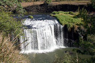
The Millstream Falls, a tiered plunge waterfall on The Millstream, is located in the UNESCO World Heritage–listed Wet Tropics in the Far North region of Queensland, Australia.
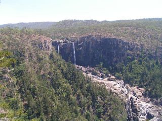
The Blencoe Falls is a segmented waterfall on the Blencoe Creek, located in the Far North region of Queensland, Australia.
The Roper River is a large perennial river located in the Katherine region of the Northern Territory, Australia.
The Jim Jim Falls is a plunge waterfall on the Jim Jim Creek that descends over the Arnhem Land escarpment within the UNESCO World Heritage–listed Kakadu National Park in the Northern Territory of Australia. The Jim Jim Falls area is registered on the Australian National Heritage List.
The Katherine Town Council is a local government area in the Northern Territory, established on 3 March 1978. It is situated 320 kilometres (200 mi) south of Darwin, and covers an area of 7,421 square kilometres (2,865 sq mi).
The Waterfall Creek Falls is a cascading waterfall on the Waterfall Creek located in the Kakadu National Park in the Northern Territory, Australia. The falls are also known as UDP Falls and are perhaps most famous for making an appearance in the movie Crocodile Dundee.
The King George River is a perennial river located in the Kimberley region of Western Australia, in Australia.
The Belmore Falls is a plunge waterfall with three drops on the Barrengarry Creek in the Southern Highlands and Illawarra regions of New South Wales, Australia.
John Leonard Ah Kit is a former Australian politician. He was the Labor member for Arnhem in the Northern Territory Legislative Assembly from 1995 to 2005.
Larisa Antonia Lillian Lee is an Australian politician. She was elected to the Northern Territory Legislative Assembly as the Country Liberal member for Arnhem at the 2012 territory election. She left the CLP on 4 April 2014, sat as independent until 27 April, when she joined the Palmer United Party, resigned from that party on 29 November, and sat as an independent until her defeat at the 2016 election.
The Wickham River is an ephemeral river, located in the Victoria Bonaparte bioregion of the Northern Territory in Australia.
The Goyder River is a river in the Northern Territory, Australia.
The Government of the Northern Territory of Australia, also referred to as the Northern Territory Government, is the Australian territorial democratic administrative authority of the Northern Territory. The Government of Northern Territory was formed in 1978 with the granting of self-government to the Territory. The Northern Territory is a territory of the Commonwealth of Australia, and the Constitution of Australia and Commonwealth law regulates its relationship with the Commonwealth.
This waterfall-related article is a stub. You can help Wikipedia by expanding it. |
This Northern Territory geography article is a stub. You can help Wikipedia by expanding it. |