
New England is a geographical region in the north of the state of New South Wales, Australia, about 60 km inland from the Tasman Sea. The area includes the Northern Tablelands and the North West Slopes regions. As of 2021, New England had a population of 185,560, with over a quarter of the people living in the area of Tamworth Regional Council.

Gwydir River, a major inland perennial river of the Barwon catchment within the Murray–Darling basin, is located in the Northern Tablelands, North West Slopes, and Orana districts of New South Wales, Australia.
Moree is a town in Moree Plains Shire in northern New South Wales, Australia. It is located on the banks of the Mehi River, in the centre of the rich black-soil plains. The town is located at the junction of the Newell Highway and Gwydir Highway and can be reached by daily train and air services from Sydney.
Gwydir Highway is a 568-kilometre (353 mi) state highway in northern New South Wales, Australia. The highway was named after the Gwydir River, which in turn was named after a locale in Wales.

Inverell is a large town in northern New South Wales, Australia, situated on the Macintyre River, close to the Queensland border. It is also the centre of Inverell Shire. Inverell is located on the Gwydir Highway on the western slopes of the Northern Tablelands. It has a temperate climate. In the 2021 census, the population of Inverell was 12,057 and the Inverell Shire population was 17,853.

Gunnedah is a town in north-eastern New South Wales, Australia and is the seat of the Gunnedah Shire local government area. In the 2021 census the town recorded a population of 8,338. Gunnedah is situated within the Liverpool Plains, a fertile agricultural region, with 80% of the surrounding shire area devoted to farming. The Namoi River flows west then north-west through the town providing water beneficial to agricultural operations in the area.

Warialda is a town in the North West Slopes region of New South Wales, Australia, in Gwydir Shire. It is situated on the banks of Warialda Creek. At the 2011 census, Warialda had a population of 1,120.

Copeton Dam is a major clay core and rock fill embankment dam with nine radial gates and a gated concrete chute spillway across the Gwydir River upstream of Bingara in the New England region of New South Wales, Australia. The dam's purpose includes environmental flows, hydro-electric power generation, irrigation, and water supply. The impounded reservoir is called Lake Copeton.

Pallamallawa or "Pally" is a small rural village approximately 30 kilometres east of Moree, in north-western New South Wales, Australia. It is on the banks of the Gwydir River, two kilometres north of the Gwydir Highway between Inverell and Moree. At the 2011 census, Pallamallawa had a population of 253 people.
The North West Slopes region of New South Wales, Australia, refers generally to the area west of the Northern Tablelands, to the north of the Central West region and to the east of the Far West region. Despite its name, the region is in north-central New South Wales, corresponding generally to the Australian Bureau of Meteorology's forecast area of North West Slopes and Plains. The administrative areas of the region include the city of Tamworth, Gunnedah, Moree, Narrabri and Inverell.
The Mungindi railway line is a railway line in northern New South Wales, Australia. It branches from the Main North line at Werris Creek station and heads north-west through the towns of Gunnedah and Narrabri before reaching Moree which for many years was the railhead before the extension to Mungindi was constructed. The line is currently truncated to Weemelah between Moree and Mungindi. Passenger trains still operate to Moree, and goods trains operate to Camurra. As of 1 September 2009, services have been suspended between Camurra and Weemelah. The line between Werris Creek and Moree is also known as the North-West line.
The Boggabilla railway line is a disused railway line in New South Wales, Australia. It branches from the Mungindi railway line at Camurra and ran for 130 kilometres (81 mi) to Boggabilla.

North Star is a small village in the Gwydir Shire, located in northern New South Wales near the Queensland border. At the 2006 census, North Star had a population of 327 people in the surrounding area, with a population of around 50 in the actual village.
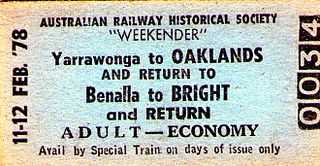
The Oaklands railway line is a freight-only railway line in north-eastern Victoria, Australia. The line branches from the main North East railway at Benalla station and runs across the Victoria-New South Wales border to the town of Oaklands, New South Wales.

The Mehi River is a perennial watercourse that is part of the Barwon catchment within the Murray–Darling basin, located in the Orana district of New South Wales, Australia.

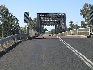
The Inverell railway line is a closed railway line in New South Wales, Australia. The line branches from the Mungindi line at Moree and travels in an easterly direction through the town of Gravesend then Warialda Rail, gradually increasing in elevation through Delungra towards the terminus at Inverell. An initial estimate of its intended length was 96 miles 35 chains (155.2 km). The line opened in February 1900 as far as Gravesend, then more of the line in 1901 before the Gwydir River bridge was finally finished and the line completed in 1902. It was progressively closed between 1987 and 1994. Currently a 5 km (3.1 mi) section at the Moree end remains in use as a siding for the storage of railway wagons. On 8 August 2016, The NSW Government announced that a 2.8km section of the railway would be reinstated to allow grain to be sent by rail, as part of the Fixing Country Rail pilot round. Up to $2 million was allocated for the project.
Mount Russell is a village in Inverell Shire of New South Wales in Australia. In the 2006 census the village and surrounding area had a population of 237. The village is approximately 25 km (16 mi) north-west of Inverell, New South Wales and is approximately 618 km (384 mi) by road from the state capital Sydney.
Croppa Creek is a very small village and railway location in the Gwydir Shire, New South Wales, Australia. It was the site of a railway station on the Boggabilla branch between Moree and North Star from 1932 until 1976 and is still a seasonal loading point for freight trains carrying bulk grain. In the 2016 census, the area surrounding Croppa Creek had a population of 120.

NSW TrainLink is a train and coach operator in Australia, providing services throughout New South Wales and the Australian Capital Territory, along with limited interstate services into Victoria, Queensland and South Australia. Its primary intercity and regional services are spread throughout five major rail lines, operating out of Sydney's Central railway station.

Moree railway station is located on the Mungindi line in New South Wales, Australia. It serves the town of Moree.
