Bird's Point, Missouri

Last updated

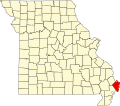
Bird's Point (or Birds Point) is an unincorporated community in Mississippi County, Missouri, United States. [1] It lies on an island or former island in the Mississippi River, near the confluence of the Ohio and Mississippi Rivers and is situated directly across from Cairo, Illinois. This is the point where the U.S. Route 60 bridge connects with Cairo.

Contents

History

Bird's Point was named for Abraham Bird Sr, who was a prominent planter and businessman in Shenandoah County, Virginia. He brought his family briefly to Bourbon, Kentucky and then, in 1796, to what later became Cairo, Illinois, and later, to this location (Bird's Point). It is said that they were the first white people to live in this area. Lewis and Clark encountered the Bird's Point settlement, during their famed expedition, in 1803.; [2] [3] [4]

Bird's Point was a strategic site during the Civil War. The Battle of Charleston was fought in the vicinity on August 19, 1861. Union cavalry under David P. Jenkins guarded the region for the early part of the war, deterring Confederate attempts to regain control of the supply routes. Once secured, Bird's Point was transformed into an important supply and repair site, as well as a training camp and military post, for the Union army and navy. Following the war, many of the military buildings were converted to civilian usage, including the boat yard.

In the 1880s, the area was an important railroad and river terminus for cotton distribution, and a series of ferries facilitated movement of cargo and passengers from the island to the Illinois riverbank. The narrow-gauge Texas and St. Louis Railway built into Bird's Point in 1882. When the remainder of the railroad was completed, it stretched from Bird's Point to Gatesville, Texas. An incline was used to transfer railcars onto car floats for the cross-Mississippi trip from Bird's Point to Cairo, Illinois. The Texas and St. Louis went bankrupt and the new company was the St. Louis, Arkansas and Texas Railway. That railroad rebuilt the line to standard gauge so the railroads shippers would not have to break bulk by transferring to a different gauge railroad. When the St. Louis, Arkansas and Texas Railway went bankrupt it was taken over by the St. Louis Southwestern Railway, nicknamed the Cotton Belt. The railroad ran from Bird's Point through Pine Bluff, Arkansas, Texarkana, Texas and to Gatesville, Texas, offering planters a convenient route to transfer their cotton bales to the Mississippi for water transport to markets in the Midwest. The Cotton Belt moved most of its car ferry operations to a new incline and car float at Gray's Point, Missouri in 1898. In September 1908, the river bank caved in and essentially destroyed the boat yard and surrounding facilities. The railroad incline was destroyed in a flood in April 1909. The Cotton Belt continued to serve Birds Point with rail service for a number of years. The Cotton Belt 5.3 mile rail line between Birds Point and Wyatt was abandoned by ICC order on October 9, 1938. In late 1941, an oil pipeline was laid on the old Cotton Belt right of way between Wyatt and Birds Point to facilitate the transportation of crude oil by barge. A small tank farm was built just south of Birds Point for oil storage. Cotton Belt handled railroad tank cars from Texas and Louisiana to Wyatt for shipment of the oil to Birds Point and trans loading onto barges.

The Cairo Mississippi River Bridge carrying U.S. Routes 60 and 62 over the river between Bird's Point and Cairo was completed in 1929.

The Missouri Pacific Railroad had a rail line into Birds Point from Charleston, Missouri. A rail car ferry to Cairo, Illinois was operated by the Missouri Pacific. The Missouri Pacific rail line to Birds Point was abandoned on March 31, 1942 and the rail line cut back to Alfalfa Center, Missouri.

Bird's Point today is marked by several large grain elevators and storage facilities.

The Birds Point-New Madrid Floodway

The area is part of the New Madrid Floodway Project. Prompted by the Great Flood of 1927 the US Army Corps of Engineers installed an earthen levee to protect the rich farmland of Mississippi County. The section of the Levee at Birds Point was engineered so that when the water reached 61 feet (19 m) on the nearby Cairo flood gauge, the river would over-top the levee and erode it away. This would allow the river to fill the 133,000 acres (54,000 ha) floodway and relieve pressure on the flood control systems in place at nearby Cairo, Illinois and Hickman, Kentucky. This whole area has been engineered to allow for intentional flooding but has only been used twice: in 1937 [5] and 2011. [6]

Two other floodways were built on the Mississippi River downstream: the Bonnet Carré Spillway and the Morganza Spillway, both of which have gates that can be opened for flood control.

Notable person

Jazz pianist Jess Stacy was born in Bird's Point in 1904.

Related Research Articles

<span class="mw-page-title-main">Mississippi River</span> Major river in the United States

The Mississippi River is the primary river, and second-longest river, of the largest drainage basin in the United States. From its traditional source of Lake Itasca in northern Minnesota, it flows generally south for 2,340 miles (3,766 km) to the Mississippi River Delta in the Gulf of Mexico. With its many tributaries, the Mississippi's watershed drains all or parts of 32 U.S. states and two Canadian provinces between the Rocky and Appalachian mountains. The main stem is entirely within the United States; the total drainage basin is 1,151,000 sq mi (2,980,000 km2), of which only about one percent is in Canada. The Mississippi ranks as the thirteenth-largest river by discharge in the world. The river either borders or passes through the states of Minnesota, Wisconsin, Iowa, Illinois, Missouri, Kentucky, Tennessee, Arkansas, Mississippi, and Louisiana.

<span class="mw-page-title-main">Cairo, Illinois</span> City in the United States

Cairo is the southernmost city in Illinois and the county seat of Alexander County. A river city, Cairo has the lowest elevation of any location in Illinois and is the only Illinois city to be surrounded by levees. It is in the river-crossed area of Southern Illinois known as "Little Egypt", for which the city is named, after Egypt's capital on the Nile. The city is coterminous with Cairo Precinct.

<span class="mw-page-title-main">Wyatt, Missouri</span> City in Missouri, United States

Wyatt is a city in Mississippi County, Missouri, United States. The population was 219 at the 2020 census. It is the easternmost city west of the Mississippi River.

<span class="mw-page-title-main">Great Flood of 1993</span> Midwestern United States flooding

The Great Flood of 1993 was a flood that occurred in the Midwestern United States, along the Mississippi and Missouri rivers and their tributaries, from April to October 1993.

<span class="mw-page-title-main">St. Louis Southwestern Railway</span> Defunct American railway

The St. Louis Southwestern Railway Company, known by its nickname of "The Cotton Belt Route" or simply "Cotton Belt", is a former Class I railroad that operated between St. Louis, Missouri, and various points in the U.S. states of Arkansas, Tennessee, Louisiana, and Texas from 1891 to 1980, when the system added the Rock Island's Golden State Route and operations in Kansas, Oklahoma, and New Mexico. The Cotton Belt operated as a Southern Pacific subsidiary from 1932 until 1992, when its operation was assumed by Southern Pacific Transportation Company.

<span class="mw-page-title-main">Levee breach</span> Situation where a levee containing water is breached

A levee breach or levee failure is a situation where a levee fails or is intentionally breached, causing the previously contained water to flood the land behind the levee.

<span class="mw-page-title-main">Mississippi River System</span> Major river system in the United States

The Mississippi River System, also referred to as the Western Rivers, is a mostly riverine network of the United States which includes the Mississippi River and connecting waterways. The Mississippi River is the largest drainage basin in the United States. In the United States, the Mississippi drains about 59% of the country's rivers.

<span class="mw-page-title-main">Terminal Railroad Association of St. Louis</span> Switching and terminal railroad

The Terminal Railroad Association of St. Louis is a Class III switching and terminal railroad that handles traffic in the St. Louis metropolitan area. It is co-owned by five of the six Class I railroads that reach the city: BNSF, Canadian National, CSX, Norfolk Southern and Union Pacific. The railroad also serves Amtrak and Canadian Pacific Kansas City.

<span class="mw-page-title-main">Morganza Spillway</span> Flood-control structure in Louisiana, U.S.

The Morganza Spillway or Morganza Control Structure is a flood-control structure in the U.S. state of Louisiana. It is located along the western bank of the Lower Mississippi River at river mile 280, near Morganza in Pointe Coupee Parish. The spillway stands between the Mississippi and the Morganza Floodway, which leads to the Atchafalaya Basin and the Atchafalaya River in south-central Louisiana. Its purpose is to divert water from the Mississippi River during major flood events by flooding the Atchafalaya Basin, including the Atchafalaya River and the Atchafalaya Swamp. The spillway and adjacent levees also help prevent the Mississippi from changing its present course through the major port cities of Baton Rouge and New Orleans to a new course down the Atchafalaya River to the Gulf of Mexico. The Morganza Spillway, operated by the U.S. Army Corps of Engineers, was opened during the 1973 and 2011 Mississippi River floods.

The Stephenville North & South Texas Railway (SN&ST) was incorporated in Texas on February 4, 1907, by Stephenville and Hamilton business interests. Its original standard gauge 43-mile line was built between Stephenville and Hamilton and completed in late 1907. The first train operated between Stephenville and Hamilton on Christmas Day 1907. Regular service began in January 1908. Four apparently identical wooden depots of a standard design were built at Hamilton, Carlton, Spurlin, and Alexander. The SN&ST shared a Union Station with its original primary railroad connection, the long-established Fort Worth & Rio Grande Railroad at Stephenville.

<span class="mw-page-title-main">2011 Mississippi River floods</span> Major floods in the United States

Major floods along the Mississippi River in April and May 2011 were among the largest and most damaging recorded along the U.S. waterway in the past century, comparable in extent to the Great Mississippi Flood of 1927 and Great Flood of 1993. In April 2011, two large storm systems deposited record levels of rainfall on the Mississippi River drainage basin. When that additional water combined with the springtime snowmelt, the river and many of its tributaries began to swell to record levels by the beginning of May. Flooding occurred in Illinois, Missouri, Kentucky, Tennessee, Arkansas, Mississippi, and Louisiana.

<span class="mw-page-title-main">Birds Point-New Madrid Floodway</span>

The Birds Point-New Madrid Floodway is a flood control component of the Mississippi River and Tributaries Project located on the west bank of the Mississippi River in southeast Missouri just below the confluence of the Ohio and Mississippi Rivers. The construction of the floodway was authorized by the Flood Control Act of 1928 and later modified by the Flood Control Act of 1965. Its purpose is to divert water from the Mississippi River during major flood events and lower the flood stages upstream, notably at Cairo, Illinois.

<span class="mw-page-title-main">St. Louis Southwestern Railway of Texas</span>

The St. Louis Southwestern Railway of Texas, operated the lines of its parent company, the St. Louis Southwestern Railway within the state of Texas. The St. Louis Southwestern, known by its nickname of "The Cotton Belt Route" or simply the Cotton Belt, was organized on January 12, 1891, although it had its origins in a rail line founded in 1871 in Tyler, Texas that eventually connected northeastern Texas to Arkansas and southeastern Missouri. Construction of the original Tyler Tap Railroad began in the summer of 1875, and the first 21 miles out of Tyler to Big Sandy, Texas were constructed by early October of 1887. The line became the Texas and St. Louis Railway, and was completed between Gatesville, Texas and Bird's Point, Missouri by August 12, 1883, creating a continuous 725-mile system. However, that line promptly went into receivership, and was purchased by the St. Louis, Arkansas and Texas Railway in 1886. The assets of that company were acquired out of foreclosure by the St. Louis-Southwestern Railway in 1891. The St. Louis Southwestern of Texas merged with the property of the Tyler Southeastern Railway on October 6, 1899. The property of the Texas and Louisiana Railway was acquired and merged on July 2, 1903.

<span class="mw-page-title-main">Mississippi River and Bonne Terre Railway</span>

The Mississippi River & Bonne Terre Railway was a single-track standard-gauge steam railroad that was located in southeastern Missouri and began service in 1892. It extended from Riverside in a general southwesterly direction to the lead-mining field in St. Francois County. The main stem, from Riverside to Doe Run, was 46.492 miles (74.822 km) long. Eight short branch lines had a total trackage of 17.418 miles (28.032 km). Sidings and spurs aggregated 30.664 miles (49.349 km), and all tracks owned 94.574 miles (152.202 km).

<span class="mw-page-title-main">Climate change in Missouri</span> Climate change in the US state of Missouri

Climate change in Missouri encompasses the effects of climate change, attributed to man-made increases in atmospheric carbon dioxide, in the U.S. state of Missouri.

Originally incorporated as the Tyler Tap Railroad in 1871, the Texas and St. Louis Railway (“T&SL”) constructed a three-foot gauge railroad from Gatesville, Texas through Arkansas to Bird's Point, Missouri starting in 1875 and completing by 1883. One of the two longest narrow-gauge lines in the country, the railroad went into receivership in early 1884, and another railway had acquired its trackage by 1886.

References

Notes

  1. U.S. Geological Survey Geographic Names Information System: Birds Point, Missouri
  2. A History of Shenandoah County, Virginia, Wayland, John Walter, Shenandoah Publ., 1927
  3. History of Southeast Missouri, Goodspeed Publ., 1888.
  4. "Mississippi County Place Names, 1928–1945". The State Historical Society of Missouri. Archived from the original on June 24, 2016. Retrieved November 6, 2016.
  5. Memphis District. "Birds Point-New Madrid Floodway Information Sheet". United States Army Corps of Engineers. Archived from the original on June 1, 2011. Retrieved May 19, 2011.
  6. Eversley, Melanie (May 4, 2011). "Mo. levee blast inundates acres of farmland". USA Today. Retrieved May 23, 2011.

36°57′58″N89°09′25″W / 36.966°N 89.157°W / 36.966; -89.157