
Flamborough is a village and civil parish in the East Riding of Yorkshire, England. It is situated approximately 4 miles (6 km) north-east of Bridlington town centre on the prominent coastal feature of Flamborough Head.

Roos is a village and civil parish in the East Riding of Yorkshire, England. It is situated 12 miles (19 km) east from Kingston upon Hull city centre and 3.5 miles (6 km) north-west from Withernsea, and on the B1242 road.

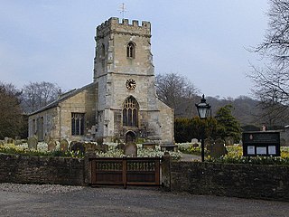
Middleton on the Wolds is a village and civil parish on the Yorkshire Wolds in the East Riding of Yorkshire, England. It is situated on the A614 road midway between Driffield and Market Weighton.

Walkington is a village and civil parish in the East Riding of Yorkshire, England. It is situated approximately 3 miles (4.8 km) to the south-west of the town of Beverley on the B1230 road, and Beverley Grammar School.

Hollym is a small village and civil parish in the East Riding of Yorkshire, England, in an area known as Holderness. It is situated approximately 2 miles (3 km) south of Withernsea and is on the A1033 road.

Rawcliffe is a village and civil parish in the East Riding of Yorkshire, England on the border with North Yorkshire. It is situated approximately 4 miles (6.4 km) west of Goole and 17 miles (27 km) south of York. It lies on the banks of the River Aire just north of the M62 and on the A614 road. Rawcliffe, along with nearby Airmyn, was the location of one of the first reliable reports of the practice of warping in agriculture in the 1730s.

Brayton is a village and civil parish in North Yorkshire, England. The village is situated approximately 1 mile (1.6 km) south from Selby. The parish includes some of south-western Selby, as well as the village of Brayton.

Barton is a village and civil parish in North Yorkshire, England. According to the 2011 census it had a population of 837. It is situated near the border with the ceremonial county of County Durham, and is 6 miles south-west of Darlington.

Wilberfoss is a village and civil parish in the East Riding of Yorkshire, England. It is situated on the north side of the A1079 approximately 8 miles (13 km) east of York city centre and 11 miles (18 km) north-west of Market Weighton. According to the 2011 UK census, Wilberfoss parish had a population of 1,866, an increase on the 2001 UK census figure of 1,855.

Middleton is a small village and civil parish in North Yorkshire, England. It is situated on the A170 road to the west of Pickering.

Warter is a small village and civil parish in the East Riding of Yorkshire, England. It is situated approximately 4 miles (6.4 km) east of Pocklington on the B1246 road and 18 miles (29 km) from the city of York.
Pollington is a village and civil parish in the East Riding of Yorkshire, England. It is situated approximately 2 miles (3.2 km) south-west of the town of Snaith and 1 mile (1.6 km) south of the M62 motorway. It lies on the north bank of the Aire and Calder Navigation.
Settrington is a village and civil parish in North Yorkshire, England, about 3 miles (5 km) east of Malton. It was historically part of the East Riding of Yorkshire until 1974 and part of the Ryedale district from 1974 until 2023.

Waddington is a small village, 2 miles (3 km) north-west of Clitheroe in the Ribble Valley, Lancashire, England. The population of the civil parish at the 2011 census was 1,028. Before the 1974 county boundary changes, Waddington fell just within the Bowland Rural District of the West Riding of Yorkshire. It covers approximately 2000 acres of the Forest of Bowland.

Hook is a village and civil parish in the East Riding of Yorkshire, England. It is situated approximately 1.5 miles (2.4 km) north-east of Goole town centre and lies on the west bank of the River Ouse.

Thorpe Willoughby is a village and civil parish in the Selby District of North Yorkshire, England. The village is situated just off the A1238 and is in close proximity to Selby.

Sherburn is a village and civil parish in North Yorkshire, England. It is situated on the south side of the Vale of Pickering, immediately north of the Yorkshire Wolds. Sherburn lies 4 miles (6.4 km) north of Weaverthorpe, 3 miles (4.8 km) south of Brompton, 2 miles (3.2 km) east of East Heslerton and 2 miles (3.2 km) west of Ganton.

Hambleton is a small village and civil parish near to Selby in North Yorkshire, England. It is a ward of the Selby District and should not be confused with the Hambleton District, another district of North Yorkshire.

Sinnington is a village and civil parish in North Yorkshire, England. It is located on the southern boundary of the North York Moors National Park.

Clapham cum Newby is a civil parish in the Craven district of North Yorkshire, England. It was formerly in the Settle Rural District. It contains the villages of Clapham and Newby. According to the 2001 UK census, Clapham cum Newby parish had a population of 659, falling to 640 at the 2011 Census.

