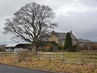
Throckley is a village in the Newcastle upon Tyne district, in the county of Tyne and Wear, England, approximately 7 miles (11 km) west of Newcastle city centre. Hadrian's Wall passed through the village, its course traced by the village's main road, Hexham Road. Throckley lies within the historic county of Northumberland.

Beanley is a village and former civil parish, now in the parish of Hedgeley in the county of Northumberland, England. It is situated to the north-west of Alnwick, near Eglingham. In 1951 the parish had a population of 53.

Belsay is a village and civil parish in Northumberland, England. The village is about 5 miles (10 km) from Ponteland on the A696, which links the village with Newcastle upon Tyne and Jedburgh. The population of the civil parish was 436 at the 2001 census, increasing to 518 at the 2011 Census.

Berwick Hill is a village and former civil parish, now in the parish of Ponteland, in the county of Northumberland, England. It is situated to the north of Newcastle upon Tyne, near Ponteland. In 1951 the parish had a population of 41.

Bolam is a village and former civil parish, now in the parish of Belsay in the county of Northumberland, England. The village is about 20 miles (32 km) north-west of Newcastle upon Tyne, near Bolam West Houses. In 1951 the civil parish had a population of 60. On 1 April 1955 the parish was abolished and merged with Belsay.

Burradon is a village and former civil parish, now in the parish of Netherton, in Northumberland, England. It is about 14 miles (23 km) to the south-west of Alnwick. In 1951 the parish had a population of 53.

Branton is a village and former civil parish, now in the parish of Ingram, in Northumberland, England. It is about 9 miles (14 km) west of Alnwick. In 1951 the parish had a population of 50.
Brunton is a village and former civil parish, now in the parish of Newton-by-the-Sea, in the county of Northumberland, England. It is about 7 miles (11 km) north of Alnwick, a short distance inland from the North Sea coast. In 1951 the parish had a population of 35.

Cambo is a village and former civil parish, now in the parish of Wallington Demesne, in Northumberland, England. It is about 11 miles (18 km) to the west of the county town of Morpeth at the junction of the B6342 and B6343 roads. The village was gifted along with the Wallington Estate to the National Trust by Sir Charles Philips Trevelyan in 1942, the first donation of its kind. It remains a National Trust village. In 1951 the parish had a population of 60.
Clennell is a small village and as Clennel, a former civil parish, now in the parish of Alwinton, in Northumberland, England. It is about 1 mile (1.6 km) north-east of Alwinton. In 1951 the parish had a population of 37.

Sharperton is a small settlement and former civil parish, now in the parish of Harbottle, in Northumberland, England. Sharperton is the site of a deserted medieval village, which was documented as having 14 taxpayers in 1296, and described as having two short rows of dwellings in 1632. There was also a bastle here. In 1951 the parish had a population of 36.

Eshott is a village and former civil parish, now in the parish of Thirston, in Northumberland, England. In 1951 the parish had a population of 114.

Stamfordham is a village and civil parish in Northumberland, England. The population of the civil parish at the 2001 Census was 1,047, rising to 1,185 at the 2011 Census. The place-name Stamfordham is first attested in the Pipe Rolls for 1188, where it appears as Stanfordhamn, which roughly translates as 'village at the stony ford'.

Ouston is a village and former civil parish, now in the parish of Stamfordham, in the county of Northumberland, England. In 1951 the parish had a population of 13.

Kirkheaton is a village and former civil parish, now in the parish of Capheaton, in the county of Northumberland, England. The village lies about 10 miles (16 km) north east of Hexham and about 5 miles (8 km) west of Belsay. In 1951 the parish had a population of 70.

Harlow Hill is a small village and former civil parish, now in the parish of Stamfordham, in Northumberland, England. In 1951 the parish had a population of 61.

Eachwick is a hamlet and former civil parish 11 miles (18 km) from Morpeth, now in the parish of Stamfordham, in the county of Northumberland, England. In 1951 the parish had a population of 69.

Black Callerton is a hamlet and former civil parish about 5 miles from Newcastle upon Tyne, now in the parish of Woolsington, in the Newcastle upon Tyne district, in the county of Tyne and Wear, England. In 1951 the parish had a population of 365.

Ryal or Ryall is a village and former civil parish about 13 miles from Hexham, now in the parish of Matfen, in the county of Northumberland, England. In 1951 the parish had a population of 41. The village now has 2 farms, 6 cottages and a church called All Saints' Church.


