Blue Hill, Kansas | |
|---|---|
 | |
 Blue Hill  Blue Hill | |
| Coordinates: 39°18′25″N98°21′49″W / 39.30694°N 98.36361°W [1] | |
| Country | United States |
| State | Kansas |
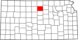
| County | Mitchell |
| Elevation | 1,673 ft (510 m) |
| Population | |
• Total | 0 |
| Time zone | UTC-6 (CST) |
| • Summer (DST) | UTC-5 (CDT) |
| Area code | 785 |
| GNIS ID | 484598 [1] |
Blue Hill is a ghost town in Hayes Township, Mitchell County, Kansas, United States. [1]