Blue Tent, California

Last updated
Blue Tent
Mining community
Ice harvesting near Blue Tent on Rock Creek.jpg
Ice Harvesting on Rock Creek near Blue Tent
CountryUnited States
StateCalifornia
TownshipNevada
Population
 (1860)
  Total300

Blue Tent is a historic 19th century gold mining community located about six miles northeast of Nevada City, California.

Contents

Its approximate location is at the intersection of N. Bloomfield Road and Blue Tent School Road. It was part of Nevada Township.

Early history

The community

Blue Tent lies on a gold-bearing channel of an ancient river bed. The channel runs from the San Juan Ridge through Scotts Flat, California, Hunt's Hill, California, and You Bet, California to Dutch Flat, California and Placer County. [1]

Blue Tent was established in 1850 and named after its first dwelling, a tent made of blue denim. [2] The community thrived, becoming a center for hydraulic mining. Before long, it had its own store, dance hall, blacksmith shop, boarding house and other buildings. [3] A non-denominational Union Church was erected in 1861. [4]

Blue Tent also served as a supply base for the more remote mines in that part of Nevada County. The firm of Lindsay & Dick distributed supplies from Blue Tent by pack train. [5] In 1853, a stagecoach line was started that connected Blue Tent with Nevada City and Downieville, California. [6]

No accurate population figures are readily available. However, in the 1860 United States presidential election, 60 votes were cast in Blue Tent for candidates Abraham Lincoln, 15 for Stephen A. Douglas and 33 for John C. Breckinridge. [7] This suggests a total population at that time in the range of 3-500.

A school was established in 1868. [8] In 1879, the Blue Tent school district had 37 students, of whom 20 were boys, and one female teacher. [9] The schoolhouse was originally close to the N. Bloomfield Road. In 1892, it was moved to its present location on what is now Blue Tent School Road. [10] The school continued to serve the community until 1961, [11] though there were times when the school was closed due to lack of a teacher. [12]

Blue Tent had its own "Chinatown", located near the lime kiln about two miles south of the Yuba River. Over 500 Chinese workers, most of them miner, inhabited the community. [13] However, these workers were eventually fired, due to pressure from white miners and the local community. [14]

In 1878, Blue Tent was connected to the world's first long distance telephone line, established in 1878 to link the mining communities around the San Juan Ridge. [15] A US Post Office branch was established in 1878. David Hughes, Superintendent of the Blue Tent Mining Company, was the first postmaster. The post office closed in 1889. [16]

For recreation, residents of Blue Tent participated in ice skating when the reservoir above the town froze, [17] horse racing, [18] and balls at the St. Louis House. [19] They could also take Hydrotherapy from Mrs. Stone, described as "a lady of rare capability… thoroughly versed" in the art of hydropathy. [20] At the same time, Blue Tent had its share of robberies, [21] and arson. [22]

Other businesses in Blue Tent

Though known as a center for hydraulic mining, there was also drift mining around Blue Tent. [23] In one reported instance, Weston, Holmes and Co set off a blast of 304 kegs of black powder inside a tunnel that ran 65 feet into a hill. [24]

Hydraulic mining required large amounts of water. A ditch bringing water from Rock Creek was built by the South Yuba Canal Company in 1857 and significantly enlarged in 1860 to accommodate the growing mines. [25]

Mining also required lumber. J. N. Turner erected a sawmill in 1857. [26] Other sawmills were built by the Cooper brothers, [27] Roberts and Brewer. [28] In addition, near Brewer's sawmill, was Prosper's charcoal pit, charcoal being often used as a coal substitute. [29]

The ditch, and the reservoir it created, gave rise to another local industry, Ice cutting. In 1867, the Nevada Ice Co. began harvesting blocks of ice and shipping them throughout the California. [30] Ice was harvested as late as 1910. [31] Blue Tent also had its own lime kiln, producing a kind of mortar used in construction. [32]

Hydraulic mining reached its heyday in the 1870s. The principal mine was the Blue Tent Gold Mining Company, which produced $780,00 in gold in 1873 alone. [33] Between 1874 and 1876, the Blue Tent Mining and Water Company spent $160,000 constructing a ditch to bring water from far up the South Yuba River. [34] At the head of the ditch was a four and a half mile flume, below which was a 1000 foot long tunnel. [35] By 1880, the ditch was 30 miles long. [36]

End of hydraulic mining

Like the other communities in the region that depended on hydraulic mining, Blue Tent began to decline following the 1884 Sawyer decision. A farmer near Sacramento had sued the major mining company in state court to stop it from discharging mining debris into the Yuba River. This debris was destroying farmland downstream. [37] By the early 1890s, the Blue Tent mine was closed. [38]

Subsequently, the mine was operated until 1906 as a drift mine. [39] In 1907, the Blue Tent mine, renamed the Channel mine, was reopened to resume hydraulicing. [40] Soon thereafter, the miners went on strike, seeking an eight-hour work day. [41] The mine closed in 1916 and about a year later a fire destroyed its 20 stamp mill. The uninsured loss was estimated at $15,000. [42]

There were other efforts to resume mining. To help, in 1914, the road between Nevada City and Blue Tent was improved, cutting the distance by a mile. [43] In 1909, there was what one newspaper described as an "extremely rich" ore discovery at the Native Son mine. [44] Efforts were also made to resume hydraulic mining, in 1914 by D. A. Campbell, [45] and in 1918 by Eleanor Hoeft, who sought a permit to contain the debris so it would not enter the Yuba River, [46] but these do not appear to have succeeded.

Agriculture

As mining declined in Blue Tent, agriculture started taking over. Two prominent families in the Blue Tent area were the Arbogasts and the Brindejohns. Jacob Arbogast came to Nevada County around 1860 and mined around Blue Tent. He bought 160 acres of land, which he first mined and later farmed. His son John Peter took over the family ranch, expanded to 360 acres, and became a successful farmer. [47] The Brindejohns, natives of Brittany in France, arrived in Blue Tent around 1864. Louis Brindejohn acquired 400 acres of land, which he farmed. His three sons, Louis, Eugene and Paul attended the Blue Tent school and jointly managed the family farm. [48]

Blue Tent today

Today, the Blue Tent district is a rural, largely residential area. The only substantial evidence of the former mining district is the Blue Tent school, which remains at the site to which it was moved in 1892. It has been converted to a private residence..

Blue Tent School Blue Tent School.jpg
Blue Tent School

Related Research Articles

<span class="mw-page-title-main">Gold Country</span> Historic gold-mining region in Northern California

The Gold Country is a historic region in the northern portion of the U.S. state of California, that is primarily on the western slope of the Sierra Nevada. It is famed for the mineral deposits and gold mines that attracted waves of immigrants, known as the 49ers, during the 1849 California Gold Rush.

<span class="mw-page-title-main">French Corral, California</span> Unincorporated community in California, United States

French Corral is an unincorporated community approximately five miles west of California State Highway 49 in Nevada County, California, United States.

<span class="mw-page-title-main">Graniteville, California</span> Unincorporated community in California, United States

Graniteville is a small, unincorporated community and census-designated place (CDP) located in Nevada County, California, United States. The town sits on the San Juan ridge separating the Middle and South Forks of the Yuba River, approximately 26 miles (42 km) northeast of Nevada City. The elevation of Graniteville is 4,977 feet (1,517 m) above sea level. As of the 2010 census, Graniteville had a population of 11.

Lake City is an unincorporated community in Nevada County, California. It lies at an elevation of 3300 ft. about 10 miles northeast of Nevada City as the crow flies, and about three miles southeast of North Columbia, and three miles southwest of North Bloomfield. It is located at the junction of modern day North Bloomfield, Back Bone and Lake City Roads. It was an important mining and transportation center in the second half of the 19th century.

Moore's Flat was a historic mining town located on the San Juan Ridge about 19 miles northeast of Nevada City, California and about 5 miles northeast of North Bloomfield, California. The town was about 1 mile south of the Middle Yuba at an elevation of about 4200 ft. On either side of it, lay the mining towns of Orleans Flat and Woolsey's Flat, each about I mile apart. All three were settled around 1851 and their histories frequently intertwine. Collectively, they are sometimes referred to as "The Flats." All three were part of Eureka Township.

Orleans Flat was a historic mining town located on the San Juan Ridge about 20 miles northeast of Nevada City, California and about 5 miles northeast of North Bloomfield, California. The town was about 1 mile south of the Middle Yuba River at an elevation of about 4200 ft. To the west lay the mining towns of Moore's Flat and Woolsey's Flat, each about I mile apart. All three were settled around 1851 and their histories frequently intertwine. Collectively, they are sometimes referred to as "The Flats." All three were part of Eureka Township.

Woolsey Flat or Woolsey's Flat was a historic mining town located on the San Juan Ridge, located about 17 miles northeast of Nevada City and about 3 miles northeast of North Bloomfield. The town was about 1 mile south of the Middle Yuba at an elevation of about 4200 ft. To the east lay the mining towns of Moore's Flat and Orleans Flat, each about I mile apart. All three were settled in 1851 and their histories frequently intertwine. Collectively, they are sometimes referred to as "The Flats. All three were part of Eureka Township.

Snow Point was a historic mining town in Nevada County, California on the San Juan Ridge about 2 miles east of Moore's Flat and about 6 miles west of Graniteville. It was located at an elevation of 4321 ft just off present day German Bar Road about midway between that road's intersections with present day Moore's Flat Road and Hagerty Road.

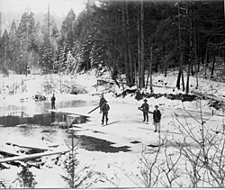
Snow Tent was a historic settlement in Nevada County, California. The name derives from a tent set up by the first resident in 1850. Snow Tent grew into a gold mining and lumbering center, then vanished sometime after 1880.

Maybert was a mining town in Nevada County, California. It was located on the south side of the South Yuba River, about 6 miles east of the town of Washington, at an elevation of 3,245 ft (989 m). Fall Creek empties into the South Yuba slightly to the northwest of the town site.

Alpha was a gold mining town in Nevada County, located about 2 miles southeast of the town of Washington, California and about 15 miles northeast of Nevada City, California. It lay at an elevation of 4120 feet, about 2 miles below the South Yuba River and just west of Scotchman Creek.

Birchville is a historic mining and agricultural community in Nevada County, California. Birchville is located about 10 miles northwest of Nevada City and about 2 miles northeast of French Corral. It is situated at an elevation of 1,765 ft (538 m) above sea level.

Cherokee is a former gold mining community in Nevada County, California. As explained below, it has also been known as Patterson, Melrose and Tyler. It is located on the San Juan Ridge about 4 miles east of North San Juan. Its elevation is 2,516 ft (767 m) above sea level.

Little York is the name of one of the first gold mining towns established in Nevada County, California as well as the name of the township in which it was situated. The town was located on the Lowell Ridge between Steephollow Creek and the Bear River, about 13 miles east of Nevada City, California and about 1 mile southwest of Dutch Flat, California at an elevation of about 2800 feet.

<span class="mw-page-title-main">Meadow Lake, Nevada County, California</span> Former settlement in California, United States

Meadow Lake was a historic mining town in Nevada County, California. It was located on the southwest shore of Meadow Lake, about 18 miles northwest of Truckee as the crow flies. Situated at an elevation of 7,290 ft (2,220 m) above sea level, the reservoir of the same name is one of the highest lakes in elevation within the Tahoe National Forest.

Gaston is the site of a former mining community in Nevada County, California. Gaston lies at an elevation of 5062 feet on the Gaston Ridge. The Gaston Ridge historically, was often referred to as God's Country, because of its wild and somewhat inaccessible beauty. Gaston is located 3.25 miles (5.2 km) south of Graniteville and about 4 miles northeast of the town of Washington. It is near the intersection of what are now Gaston and Hoosier Roads, in the Tahoe National Forest.

Mooney Flat was an important mining and transportation hub in western Nevada County, California, just east of the Yuba County line. It was situated on modern Mooney Flat Road, about 1 mile north of modern Highway 20, at an elevation of about 800 ft.

Chalk Bluff is the name of the ridge which lies between Greenhorn and Steephollow Creeks in Nevada County, California. It runs in a northeasterly direction for about 10 miles, and sits atop a "lead" of auriferous gravel, which intersects the fabled "Blue Lead" which runs from the San Juan Ridge through Red Dog and You Bet towards Placer County. It was also briefly the name for the mining camp that grew into the important town of Red Dog, then the name for a mining camp east of Red Dog. It received its name from the prominent chalk bluffs on the Ridge.

Remington Hill is a historic mining camp in Nevada County, California which prospered in the second half of the 19th century. It was named for Caleb Remington, a prominent local miner who lived mostly in neighboring Little York, where he died in 1865. It lay at an elevation of 4052 feet. It was situated around present Chalk Bluff Road about one mile south of Highway 20 and about 5.5 miles southeast of the town of Washington and 6 miles northeast of Dutch Flat, as the crow flies.

Sebastopol was a historic mining community located on the San Juan Ridge, about 13 miles north of Nevada City. It lay midway between Sweetland and North San Juan, around the intersection of modern Sweetland and School Roads, at an elevation of about 2000 feet.

References

  1. Thompson, Thomas H. and West, Albert A. (1970 ed.) History of Nevada County -1880, p. 179.
  2. Carlson, Walter A., Gold Nuggets of Nevada County (1951) (hereinafter Nuggets) p.13.
  3. Id.
  4. Nevada Democrat, August 1, 1861; Sacramento Daily Union, August 3, 1861.
  5. Bean, Edwin F., History and Directory of Nevada County (1867) p.86.
  6. Young America, September 28, 1853.
  7. Morning Transcript, November 7, 1860. Thompson & West, ibid, p.137.
  8. Nuggets, ibid, p.13.
  9. Id, p.13.
  10. Id, p.13.
  11. Undated newspaper article found in the Blue Tent folder in the Doris Foley Library in Nevada City.
  12. See e.g. Sacramento Union, January 28, 1921.
  13. Nuggets, ibid, quoting long-time resident Peter Arbogast, p. 18.
  14. The Morning Transcript on May 3, 1882 editorialized: "There will be trouble if the Blue Tent mining company does not cease giving employment to the small army of Chinamen working in its gold mines. We ask that company, how it can expect sympathy and financial aid from our people when it daily insults them by employing rice eaters in the place of white men? " Quoted in Greenland, ibid, pp. 244-5.
  15. Welselsky, Audrey, Another First for Nevada County, Nevada County Historical Society Bulletin, Vol. 2, No.7, (Dec.1949) p. 3.
  16. Janicot, ibid, p.10.
  17. Nevada Democrat, January 24, 1861.
  18. Id, February 21, 1861.
  19. Id, February 15, 1862.
  20. Morning Transcript, June 20, 1861.
  21. Nevada Democrat, February 7, 1861; Marysville Daily Appeal, June 23, 1875.
  22. Morning Transcript, August 1, 1861; Sacramento Daily Union, November 17, 1869.
  23. Hydraulic mining uses water directed at great pressure against gold bearing hillsides to dislodge the gold. Drift mining, which is much more expensive than hydraulicking, requires tunneling into hillsides and blasting to dislodge the gold. See generally Greenland, Powell, Hydraulic Mining in California (2001) pp. 242, 297-9. See also Lindgren, Waldemar (1911) The Tertiary Gravels of the Sierra Nevada of California, p. 24.
  24. Sacramento Daily Union, March 31, 1869.
  25. Sacramento Daily Union, October 1, 1857; Nevada Democrat, October 25, 1860; Marysville Daily Appeal, October 27, 1860.
  26. Nevada Journal, March 13, 1857.
  27. Thompson & West, ibid, p. 167.
  28. Nuggets, ibid, pp. 14, 23.
  29. Id. p. 14.
  30. Thompson & West, ibid, p. 166; Nuggets, ibid, pp. 21-2; Sacramento Daily Union, February 15, 1867.
  31. Sacramento Union, November 24, 1910.
  32. Nuggets, ibid, p. 18.
  33. Janicot, Michel, A History of Nevada County Post Offices (1994) p. 10.
  34. Its construction was difficult. To build the six miles which ran along the face of a cliff, workmen were suspended by ropes 1000 feet above the bottom of the gorge. Greenland, ibid, pp. 85-6.
  35. Thompson and West, ibid, p. 173.
  36. Lardner, W.B. and Brock, M.J. (1924) History of Placer and Nevada Counties California, p.324.
  37. The Sawyer decision is reported as Woodruff v. North Bloomfield Gravel Mining Co., 18 F. 753 (CCD Cal. 1884).
  38. Janicot, ibid, p.10.
  39. Sacramento Union, January 30, 1907.
  40. Sacramento Union, January 30, 1907; Id, March 2, 1907.
  41. Sacramento Union, August 28, 1907.
  42. Sacramento Union, August 29, 1917.
  43. Sacramento Union, March 16, 1914.
  44. San Francisco Call, April 7, 1909; Los Angeles Herald, April 12, 1909.
  45. Sacramento Union, November 23, 1914.
  46. Sacramento Union, January 7, 1918.
  47. Lardner and Brock, ibid, p. 594.
  48. Id, p. 768.