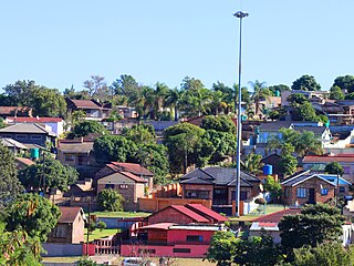
Soweto is a township of the City of Johannesburg Metropolitan Municipality in Gauteng, South Africa, bordering the city's mining belt in the south. Its name is an English syllabic abbreviation for South Western Townships. Formerly a separate municipality, it is now incorporated in the City of Johannesburg Metropolitan Municipality, and one of the suburbs of Johannesburg.

Mount Pleasant is a city in the U.S. state of Michigan. The city is the county seat of Isabella County, which is part of Central Michigan. The population of Mount Pleasant was 21,688 as of the 2020 census. The city is surrounded by Union Charter Township, but is politically independent.

Larimore is a city in Grand Forks County, North Dakota, United States. It is located three miles south of the junction of U.S. Route 2 and North Dakota Highway 18. Larimore is part of the "Grand Forks, ND-MN Metropolitan Statistical Area" or "Greater Grand Forks". The population was 1,260 at the 2020 census.

Middletown Township is a township in Bucks County, Pennsylvania, United States. The population was 46,040 at the 2020 census. Many sections of Levittown are located in the southern end of the township. The municipality surrounds the boroughs of Langhorne, Langhorne Manor, Penndel and Hulmeville; much of the township beyond Levittown uses Langhorne as its mailing address. The township is located within the Delaware Valley, also known as the Philadelphia metropolitan area.

South Strabane Township is a township in Washington County, Pennsylvania, United States. The population was 9,616 at the 2020 census. The township is named after the town of Strabane in County Tyrone, Northern Ireland.

North West is a province of South Africa. Its capital is Mahikeng. The province is located to the west of the major population centre of Gauteng and south of Botswana.

Washington-on-the-Brazos is an unincorporated community along the Brazos River in Washington County, Texas, United States. The town is best known for being the site of the Convention of 1836 and the signing of the Texas Declaration of Independence.

Marabastad is a business area to the west of the city centre of Pretoria, South Africa. The original Maraba Village, situated just to the south of the present Marabastad, was founded and ruled by the Ndebele Chief Maraba. The name Marabastad is the Afrikaans word meaning Maraba's Town.

Brits is a town in the North West Province of South Africa. It is situated in a fertile citrus, vegetable and grain-producing area that is irrigated by the waters of the Hartbeespoort Dam. It is close to the City of Tshwane Metropolitan Municipality in Gauteng, which includes Pretoria, and it has the same dialling code as Pretoria. In addition to being a centre for agriculture, the city is home to several heavy industries. A factory of the Italian car manufacturer Alfa Romeo produced cars for the domestic market and export to Asia from 1974 to 1985. The city also plays an important role in the South African mining industry: 94% of South Africa's platinum comes from the Rustenburg and Brits districts, which together produce more platinum than any other single area in the world. In addition, there is a large vanadium mine in the district.

Orange Farm ("Farma") is a township located approximately 45 km (28 mi) from Johannesburg in the Gauteng Province of South Africa. It is the southernmost township of the City of Johannesburg Metropolitan Municipality. Its name, a misnomer given that oranges are grown in orchards instead of farms, has Dutch origins. It is one of the youngest townships in South Africa, with the original inhabitants, laid-off farm workers, taking up residency in 1988. Support for the population came slowly mostly from people who were tenants at the larger township of Soweto.
Ennerdale is a town in the City of Johannesburg Metropolitan Municipality in Gauteng, South Africa. Ennerdale was declared as a coloured group area under the apartheid regime.

The suburbs of Johannesburg are officially demarcated areas within the City of Johannesburg Metropolitan Municipality, South Africa. As in other Commonwealth countries, the term suburb refers to a "neighbourhood", although in South Africa most "suburbs" have legally recognised borders and often separate postal codes. The municipal functions for the area, such as municipal policing and social services, are still managed by the city government.
Sebokeng locally called Zweni by residents, is a middle-class township in the Emfuleni Local Municipality in southern Gauteng, South Africa near the industrial cities of Vanderbijlpark and Vereeniging. Other neighboring townships include Evaton to the north and Sharpville to the south.

Botshabelo, meaning "a place of refuge", is a large township set up in 1979 by the then apartheid government. It is located east of Bloemfontein in the present-day Free State province of South Africa. Botshabelo is now the largest township in Free State.

Bloemhof is an agricultural town of about 2,000 inhabitants situated on the banks of the Vaal River in North West Province of South Africa.

Zeerust is a commercial town situated in the Ngaka Modiri Molema district of North West Province, South Africa. It lies in the Marico valley, approximately 240 kilometres northwest of Johannesburg. It lies on the N4, the main road link between South Africa and Botswana. There are large cattle ranches in the area, as well as wheat, maize, tobacco and citrus fruit farms. There are also fluorite and chromite mines in the vicinity. Tourism is also a developing industry.

Langa is a township in Cape Town, South Africa. Its name in Xhosa means "sun". The township was initially built in phases before being formally opened in 1927. It was developed as a result of South Africa's 1923 Urban Areas Act, which was designed to force Africans to move from their homes into segregated locations. Similar to Nyanga, Langa is one of the many areas in South Africa that were designated for Black Africans before the apartheid era. It is the oldest of such suburbs in Cape Town and was the location of much resistance to apartheid.
Makinen is an unincorporated community in St. Louis County, Minnesota, United States.
Eersterust or "First Rest", often incorrectly spelled "Eersterus", is a formal South African township within the City of Tshwane Metropolitan Municipality and is located just about 15 km east of the Pretoria city centre. It is also referred to by locals as "Poort". Eersterust is situated west of Mamelodi.

Matsulu is a township in the Mbombela Local Municipality under the Ehlanzeni District Municipality in the Mpumalanga province of South Africa. It lies between Kruger National Park and the N4 national road 41 km east of Nelspruit (Mbombela) CBD, 3 km before the Kaapmuiden train station. It is also surrounded by the Nsikazi River & Crocodile River.


