Bom Jesus do Araguaia

Last updated
Bom Jesus do Araguaia
Municipality
Monumento Bem Vindo (Bom Jesus do Araguaia) 03.jpg
MatoGrosso Municip BomJesusdoAraguaia.svg
Location of Bom Jesus do Araguaia in Mato Grosso
Brazil location map.svg
Red pog.svg
Bom Jesus do Araguaia
Location of Bom Jesus do Araguaia in Brazil
Coordinates: 12°10′40″S51°30′21″W / 12.17778°S 51.50583°W / -12.17778; -51.50583
CountryFlag of Brazil.svg  Brazil
Region Center-West
State Mato Grosso
MesoregionNordeste Mato-Grossense
Population
 (2020 [1] )
  Total6,706
Time zone UTC−3 (BRT)

Bom Jesus do Araguaia is a municipality in the state of Mato Grosso in the Central-West Region of Brazil. [2] [3] [4] [5] [6]

Contents

History

The municipality of Bom Jesus do Araguaia was created through law nº 7,174, of September 29, 1999, authored by deputy Humberto Bosaipo from territory separated from the municipalities of Ribeirão Cascalheira and Alto Boa Vista. [7] [8]

Divisions

Campinas do Araguaia Sub Prefeitura Campinas do Araguaia (Bom Jesus do Araguaia) 13.jpg
Campinas do Araguaia

In addition to the headquarters, the municipality of Bom Jesus do Araguaia has the districts of Planalto do Araguaia and Vila Campinas do Araguaia, all on the edge of the BR-158 highway. Until the year 2024, both did not have paving on their streets. [9]

In 2024, a partnership was signed between the State Government and the city hall for asphalt paving of the streets of Vila Campinas do Araguaia, which exceeds the value of 7 million. [10]

Planalto do Araguaia was officially created by law Nº230-2010 on 06/08/2010. [11]

See also

Related Research Articles

<span class="mw-page-title-main">Santarém Novo</span> Municipality in Northern, Brazil

Santarém Novo is a municipality in the state of Pará in the Northern region of Brazil.

<span class="mw-page-title-main">Nova Xavantina</span> Municipality in Center-West, Brazil

Nova Xavantina is a municipality in the state of Mato Grosso in the Central-West Region of Brazil.

<span class="mw-page-title-main">Confresa</span> Municipality in Center-West, Brazil

Confresa is a municipality in the state of Mato Grosso in the Central-West Region of Brazil.

<span class="mw-page-title-main">Ribeirão Cascalheira</span> Municipality in Center-West, Brazil

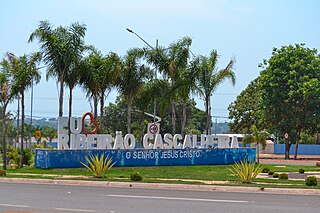
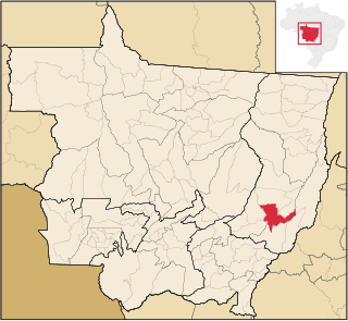
Ribeirão Cascalheira is a municipality in the state of Mato Grosso in the Central-West Region of Brazil.

<span class="mw-page-title-main">Santa Cruz do Xingu</span> Municipality in Center-West, Brazil

Santa Cruz do Xingu is a municipality in the state of Mato Grosso in the Central-West Region of Brazil.

<span class="mw-page-title-main">São Félix do Araguaia</span> Municipality in Center-West, Brazil

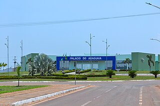
São Félix do Araguaia is a municipality in the state of Mato Grosso in the Central-West Region of Brazil.

<span class="mw-page-title-main">Vila Rica, Mato Grosso</span> Municipality in Center-West, Brazil

Vila Rica is a municipality in the state of Mato Grosso in the Central-West Region of Brazil.

<span class="mw-page-title-main">Nova Bandeirantes</span> Municipality in Center-West, Brazil

Nova Bandeirantes is a municipality in the state of Mato Grosso in the Central-West Region of Brazil.

<span class="mw-page-title-main">Nova Maringá</span> Municipality in Center-West, Brazil

Nova Maringá is a municipality in the state of Mato Grosso in the Central-West Region of Brazil. Nova Maringá is the municipality where the highest temperature ever measured in Brazil was recorded: 44.8 °C on the 4th and 5th of November 2020.

<span class="mw-page-title-main">Porto dos Gaúchos</span> Municipality in Center-West, Brazil

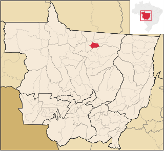
Porto dos Gaúchos is a municipality in the state of Mato Grosso in the Central-West Region of Brazil. The environmental conditions in Porto dos Gaúchos resemble those in other municipalities within the central-north region of the state. This area is experiencing rapid expansion driven primarily by unregulated cattle ranching, agriculture, and logging activities. Consequently, the municipality faces significant ecological challenges, including the degradation of permanent preservation areas, widespread burn-offs, and illegal deforestation. In early 2008, Porto dos Gaúchos was designated by the Ministry of the Environment as a priority municipality for initiatives aimed at preventing and combating deforestation in the Legal Amazon.

<span class="mw-page-title-main">São José do Rio Claro</span> Municipality in Center-West, Brazil

São José do Rio Claro is a municipality in the state of Mato Grosso in the Central-West Region of Brazil.

<span class="mw-page-title-main">Terra Nova do Norte</span> Municipality in Center-West, Brazil

Terra Nova do Norte is a municipality in the state of Mato Grosso in the Central-West Region of Brazil.

<span class="mw-page-title-main">Planalto da Serra</span> Municipality in Center-West, Brazil

Planalto da Serra is a municipality in the state of Mato Grosso in the Central-West Region of Brazil.

<span class="mw-page-title-main">União do Sul</span> Municipality in Center-West, Brazil

União do Sul is a municipality in the state of Mato Grosso in the Central-West Region of Brazil.

<span class="mw-page-title-main">Campo Verde</span> Municipality in Center-West, Brazil

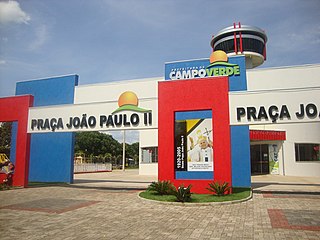
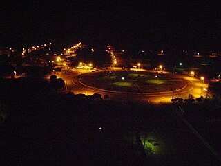
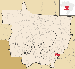
Campo Verde is a municipality in the state of Mato Grosso in the Central-West Region of Brazil.

<span class="mw-page-title-main">Pontal do Araguaia</span> Municipality in Center-West, Brazil

Pontal do Araguaia is a municipality in the state of Mato Grosso in the Central-West Region of Brazil.

<span class="mw-page-title-main">Ribeirãozinho</span> Municipality in Center-West, Brazil

Ribeirãozinho is a municipality in the state of Mato Grosso in the Central-West Region of Brazil.

<span class="mw-page-title-main">Nova Lacerda</span> Municipality in Center-West, Brazil

Nova Lacerda is a municipality in the state of Mato Grosso in the Central-West Region of Brazil.

<span class="mw-page-title-main">Vale de São Domingos</span> Municipality in Center-West, Brazil

Vale de São Domingos is a municipality in the state of Mato Grosso in the Central-West Region of Brazil.

Planalto, Paraná is a municipality in the state of Paraná in the Southern Region of Brazil.

References

  1. IBGE 2020
  2. "Divisão Territorial do Brasil" (in Portuguese). Divisão Territorial do Brasil e Limites Territoriais, Instituto Brasileiro de Geografia e Estatística (IBGE). July 1, 2008. Retrieved December 17, 2009.
  3. "Estimativas da população para 1º de julho de 2009" (PDF) (in Portuguese). Estimativas de População, Instituto Brasileiro de Geografia e Estatística (IBGE). August 14, 2009. Retrieved December 17, 2009.
  4. "Ranking decrescente do IDH-M dos municípios do Brasil" (in Portuguese). Atlas do Desenvolvimento Humano, Programa das Nações Unidas para o Desenvolvimento (PNUD). 2000. Archived from the original on October 3, 2009. Retrieved December 17, 2009.
  5. "Produto Interno Bruto dos Municípios 2002-2005" (PDF) (in Portuguese). Instituto Brasileiro de Geografia e Estatística (IBGE). December 19, 2007. Archived from the original (PDF) on October 2, 2008. Retrieved December 17, 2009.
  6. Redação, Da (2024-06-24). "BOM JESUS DO ARAGUAIA- Parceria entre Estado e Prefeitura garante mais asfalto para a cidade e Distrito de Vila Campinas". NOTÍCIA DOS MUNICÍPIOS (in Brazilian Portuguese). Retrieved 2024-06-30.
  7. cidades.ibge.gov.br https://cidades.ibge.gov.br/brasil/mt/bom-jesus-do-araguaia/historico . Retrieved 2024-06-30.{{cite web}}: Missing or empty |title= (help)
  8. "Município". bomjesusdoaraguaia.mt.gov.br (in Brazilian Portuguese). Retrieved 2024-06-30.
  9. "Lei Ordinária 7789 2002 de Mato Grosso MT". leisestaduais.com.br (in Brazilian Portuguese). Retrieved 2024-06-30.
  10. Redação, Da (2024-06-24). "BOM JESUS DO ARAGUAIA- Parceria entre Estado e Prefeitura garante mais asfalto para a cidade e Distrito de Vila Campinas". NOTÍCIA DOS MUNICÍPIOS (in Brazilian Portuguese). Retrieved 2024-06-30.
  11. "LEI Nº 230-2010 - CRIA O LOTEAMENTO PLANALTO DO ARAGUAIA NO MUNICIPIO DE BOM JESUS DO ARAGUAIA". www.CamaraBomJesusdoAraguaia.mt.gov.br (in Brazilian Portuguese). 2020-02-28. Retrieved 2024-06-30.

12°10′40″S51°30′21″W / 12.1778°S 51.5058°W / -12.1778; -51.5058