Santa Rita do Trivelato

Last updated
Santa Rita do Trivelato
Municipality
RR DRONES.jpg
The Municipali of Santa Rita do Trivelato
Bandeira do Municipio de Santa Rita do Trivelato.jpg
Coat of arms of Santa Rita do Trivelato MT.png
MatoGrosso Municip SantaRitadoTrivelato.svg
CountryFlag of Brazil.svg  Brazil
Region Center-West
State Mato Grosso
MesoregionNorte Mato-Grossense
Population
 (2020 [1] )
  Total3,506
Time zone UTC−3 (BRT)

Santa Rita do Trivelato is a municipality in the state of Mato Grosso in the Central-West Region of Brazil. [2] [3] [4] [5]

See also

Related Research Articles

Curvelândia Municipality in Center-West, Brazil

Curvelândia is a municipality in the state of Mato Grosso in the Central-West Region of Brazil.

Campinápolis Municipality in Center-West, Brazil

Campinápolis is a municipality in the state of Mato Grosso in the Central-West Region of Brazil.

Nova Xavantina Municipality in Center-West, Brazil

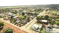
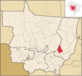
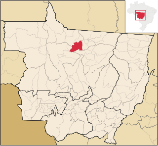
Nova Xavantina is a municipality in the state of Mato Grosso in the Central-West Region of Brazil.

São Félix do Araguaia Municipality in Center-West, Brazil

São Félix do Araguaia is a municipality in the state of Mato Grosso in the Central-West Region of Brazil.

Carlinda Municipality in Center-West, Brazil

Carlinda is a municipality in the state of Mato Grosso in the Central-West Region of Brazil.

Nova Monte Verde Municipality in Center-West, Brazil

Nova Monte Verde is a municipality in the state of Mato Grosso in the Central-West Region of Brazil.

Colíder Municipality in Center-West, Brazil

Colíder is a municipality in the state of Mato Grosso in the Central-West Region of Brazil. The Colíder Dam is being constructed about 40 km (25 mi) southeast of it on the Teles Pires River.

Matupá Municipality in Center-West, Brazil

Matupá is a municipality in the state of Mato Grosso in the Central-West Region of Brazil.

Nova Canaã do Norte Municipality in Center-West, Brazil

Nova Canaã do Norte is a municipality in the state of Mato Grosso in the Central-West Region of Brazil.

Nova Guarita Municipality in Center-West, Brazil

Nova Guarita is a municipality in the state of Mato Grosso in the Central-West Region of Brazil.

Terra Nova do Norte Municipality in Center-West, Brazil

Terra Nova do Norte is a municipality in the state of Mato Grosso in the Central-West Region of Brazil.

Paranatinga Municipality in Center-West, Brazil

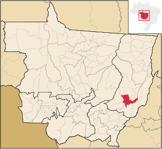
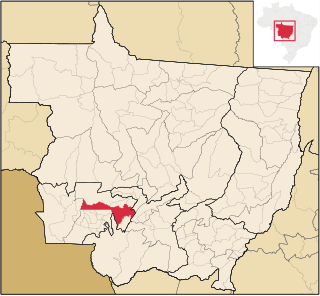
Paranatinga is a municipality in the state of Mato Grosso in the Central-West Region of Brazil.

Sapezal Municipality in Center-West, Brazil

Sapezal is a municipality in the state of Mato Grosso in the Central-West Region of Brazil.

Feliz Natal Municipality in Center-West, Brazil

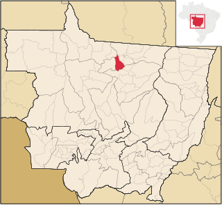
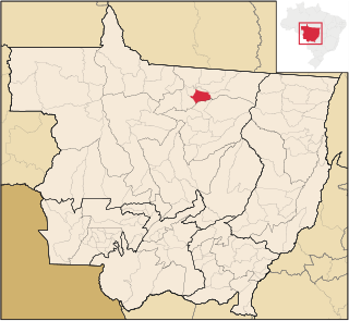
Feliz Natal is a municipality in the state of Mato Grosso in the Central-West Region of Brazil.

Itaúba Municipality in Center-West, Brazil

Itaúba is a municipality in the state of Mato Grosso in the Central-West Region of Brazil.

Santa Carmem Municipality in Center-West, Brazil

Santa Carmem is a municipality in the state of Mato Grosso in the Central-West Region of Brazil.

Vera, Mato Grosso Municipality in Center-West, Brazil

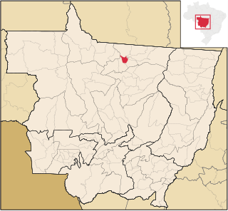
Vera is a municipality in the state of Mato Grosso in the Central-West Region of Brazil.

Dom Aquino Municipality in Center-West, Brazil

Dom Aquino is a municipality in the state of Mato Grosso in the Central-West Region of Brazil.

Vale de São Domingos Municipality in Center-West, Brazil

Vale de São Domingos is a municipality in the state of Mato Grosso in the Central-West Region of Brazil.

Barra do Bugres Municipality in Central-West, Brazil

Barra do Bugres is a municipality in the state of Mato Grosso in the Central-West Region of Brazil.

References

  1. IBGE 2020
  2. "Divisão Territorial do Brasil" (in Portuguese). Divisão Territorial do Brasil e Limites Territoriais, Instituto Brasileiro de Geografia e Estatística (IBGE). July 1, 2008. Retrieved December 17, 2009.
  3. "Estimativas da população para 1º de julho de 2009" (PDF) (in Portuguese). Estimativas de População, Instituto Brasileiro de Geografia e Estatística (IBGE). August 14, 2009. Retrieved December 17, 2009.
  4. "Ranking decrescente do IDH-M dos municípios do Brasil" (in Portuguese). Atlas do Desenvolvimento Humano, Programa das Nações Unidas para o Desenvolvimento (PNUD). 2000. Retrieved December 17, 2009.
  5. "Produto Interno Bruto dos Municípios 2002-2005" (PDF) (in Portuguese). Instituto Brasileiro de Geografia e Estatística (IBGE). December 19, 2007. Retrieved December 17, 2009.

Coordinates: 13°48′43″S55°16′01″W / 13.8119°S 55.2669°W / -13.8119; -55.2669