Novo Mundo

Last updated
Novo Mundo
Municipality
Bandeira Novo Mundo MT.png
Brasao Novo Mundo MT.png
MatoGrosso Municip NovoMundo.svg
CountryFlag of Brazil.svg  Brazil
Region Center-West
State Mato Grosso
MesoregionNorte Mato-Grossense
Population
 (2020 [1] )
  Total9,363
Time zone UTC−3 (BRT)

Novo Mundo is a municipality in the state of Mato Grosso in the Central-West Region of Brazil. [2] [3] [4] [5]

The municipality contains most of the 184,900 hectares (457,000 acres) Cristalino State Park, created in 2001. [6] The municipality contains the 118,000 hectares (290,000 acres) Cristalino II State Park, created in 2001. [7]

See also

Related Research Articles

Santarém Novo Municipality in Northern, Brazil

Santarém Novo is a municipality in the state of Pará in the Northern region of Brazil.

Curvelândia Municipality in Center-West, Brazil

Curvelândia is a municipality in the state of Mato Grosso in the Central-West Region of Brazil.

Rosário Oeste Municipality in Center-West, Brazil

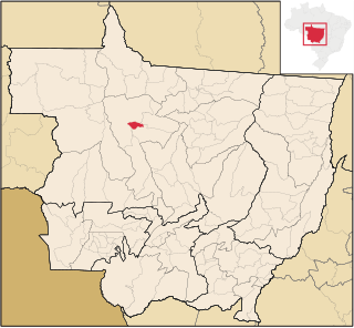
Rosário Oeste is a municipality in the state of Mato Grosso in the Central-West Region of Brazil.

Campinápolis Municipality in Center-West, Brazil

Campinápolis is a municipality in the state of Mato Grosso in the Central-West Region of Brazil.

Nova Xavantina Municipality in Center-West, Brazil

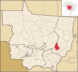
Nova Xavantina is a municipality in the state of Mato Grosso in the Central-West Region of Brazil.

Porto Alegre do Norte Municipality in Center-West, Brazil

Porto Alegre do Norte is a municipality in the state of Mato Grosso in the Central-West Region of Brazil.

Carlinda Municipality in Center-West, Brazil

Carlinda is a municipality in the state of Mato Grosso in the Central-West Region of Brazil.

Santa Rita do Trivelato Municipality in Center-West, Brazil

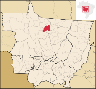
Santa Rita do Trivelato is a municipality in the state of Mato Grosso in the Central-West Region of Brazil.

Tapurah Municipality in Center-West, Brazil

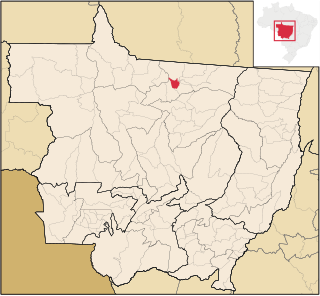
Tapurah is a municipality in the state of Mato Grosso in the Central-West Region of Brazil.

Novo Horizonte do Norte Municipality in Center-West, Brazil

Novo Horizonte do Norte is a municipality in the state of Mato Grosso in the Central-West Region of Brazil.

Colíder Municipality in Center-West, Brazil

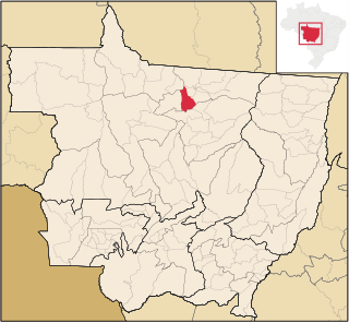
Colíder is a municipality in the state of Mato Grosso in the Central-West Region of Brazil. The Colíder Dam is being constructed about 40 km (25 mi) southeast of it on the Teles Pires River.

Nova Canaã do Norte Municipality in Center-West, Brazil

Nova Canaã do Norte is a municipality in the state of Mato Grosso in the Central-West Region of Brazil.

Nova Guarita Municipality in Center-West, Brazil

Nova Guarita is a municipality in the state of Mato Grosso in the Central-West Region of Brazil.

Terra Nova do Norte Municipality in Center-West, Brazil

Terra Nova do Norte is a municipality in the state of Mato Grosso in the Central-West Region of Brazil.

Paranatinga Municipality in Center-West, Brazil

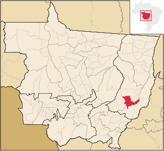
Paranatinga is a municipality in the state of Mato Grosso in the Central-West Region of Brazil.

Itaúba Municipality in Center-West, Brazil

Itaúba is a municipality in the state of Mato Grosso in the Central-West Region of Brazil.

Vera, Mato Grosso Municipality in Center-West, Brazil

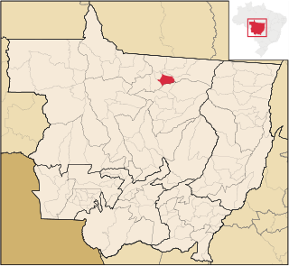
Vera is a municipality in the state of Mato Grosso in the Central-West Region of Brazil.

Campo Verde Municipality in Center-West, Brazil

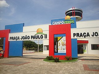
Campo Verde is a municipality in the state of Mato Grosso in the Central-West Region of Brazil.

Dom Aquino Municipality in Center-West, Brazil

Dom Aquino is a municipality in the state of Mato Grosso in the Central-West Region of Brazil.

Vale de São Domingos Municipality in Center-West, Brazil

Vale de São Domingos is a municipality in the state of Mato Grosso in the Central-West Region of Brazil.

References

  1. IBGE 2020
  2. "Divisão Territorial do Brasil" (in Portuguese). Divisão Territorial do Brasil e Limites Territoriais, Instituto Brasileiro de Geografia e Estatística (IBGE). July 1, 2008. Retrieved December 17, 2009.
  3. "Estimativas da população para 1º de julho de 2009" (PDF) (in Portuguese). Estimativas de População, Instituto Brasileiro de Geografia e Estatística (IBGE). August 14, 2009. Retrieved December 17, 2009.
  4. "Ranking decrescente do IDH-M dos municípios do Brasil" (in Portuguese). Atlas do Desenvolvimento Humano, Programa das Nações Unidas para o Desenvolvimento (PNUD). 2000. Archived from the original on October 3, 2009. Retrieved December 17, 2009.
  5. "Produto Interno Bruto dos Municípios 2002-2005" (PDF) (in Portuguese). Instituto Brasileiro de Geografia e Estatística (IBGE). December 19, 2007. Retrieved December 17, 2009.
  6. Infraestrutura do Módulo do Parque Estadual do Cristalino (in Portuguese), PPBio, retrieved 2016-11-01
  7. PES Cristalino II (in Portuguese), ISA: Instituto Socioambiental, retrieved 2016-12-17

Coordinates: 9°57′00″S55°11′52″W / 9.95000°S 55.19778°W / -9.95000; -55.19778