Comodoro

Last updated
The municipality of Comodoro
Municipality
Comodoro centro.jpg
Bandeiracomodoromt.png
Brasaocomodoromt.jpg
Nickname(s): 
"New West"
MatoGrosso Municip Comodoro.svg
Location of Comodoro
CountryFlag of Brazil.svg  Brazil
Region Center-West
State Mato Grosso
MesoregionNorte Mato-Grossense
Founded1986
Area
  Total8,407.07 sq mi (21,774.22 km2)
Elevation
2,000 ft (600 m)
Population
 (2020 [1] )
  Total21,008
  Density2.1/sq mi (0.82/km2)
Demonym(s) Comodorense
Time zone UTC−3 (BRT)
Postal Code (CEP)
78310-000
Area code(s) +55 65
Website Comodoro, Mato Grosso

Comodoro is a municipality in the state of Mato Grosso in the Central-West Region of Brazil. [2] [3] [4] [5]

See also

Related Research Articles

Nortelândia Municipality in Center-West, Brazil

Nortelândia is a municipality in the state of Mato Grosso in the Central-West Region of Brazil.

Campinápolis Municipality in Center-West, Brazil

Campinápolis is a municipality in the state of Mato Grosso in the Central-West Region of Brazil.

Nova Nazaré Municipality in Center-West, Brazil

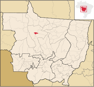
Nova Nazaré is a municipality in the state of Mato Grosso in the Central-West Region of Brazil.

Nova Xavantina Municipality in Center-West, Brazil

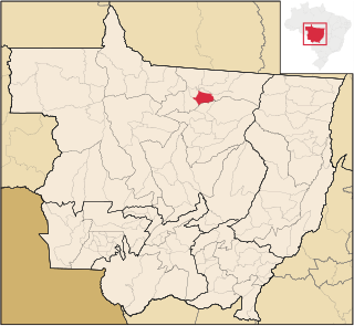
Nova Xavantina is a municipality in the state of Mato Grosso in the Central-West Region of Brazil.

São Félix do Araguaia Municipality in Center-West, Brazil

São Félix do Araguaia is a municipality in the state of Mato Grosso in the Central-West Region of Brazil.

Nova Monte Verde Municipality in Center-West, Brazil

Nova Monte Verde is a municipality in the state of Mato Grosso in the Central-West Region of Brazil.

Novo Horizonte do Norte Municipality in Center-West, Brazil

Novo Horizonte do Norte is a municipality in the state of Mato Grosso in the Central-West Region of Brazil.

Brasnorte Municipality in Center-West, Brazil

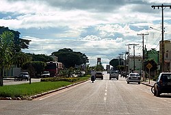
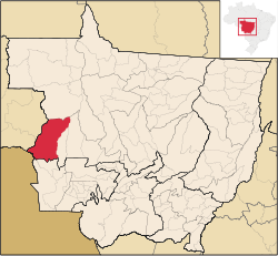
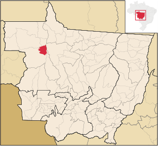
Brasnorte is a municipality in the state of Mato Grosso in the Central-West Region of Brazil.

Castanheira, Mato Grosso Municipality in Center-West, Brazil

Castanheira, Mato Grosso is a municipality in the state of Mato Grosso in the Central-West Region of Brazil.

Terra Nova do Norte Municipality in Center-West, Brazil

Terra Nova do Norte is a municipality in the state of Mato Grosso in the Central-West Region of Brazil.

Campos de Júlio Municipality in Center-West, Brazil

Campos de Júlio is a municipality in the state of Mato Grosso in the Central-West Region of Brazil.

Sapezal Municipality in Center-West, Brazil

Sapezal is a municipality in the state of Mato Grosso in the Central-West Region of Brazil.

Nova Santa Helena Municipality in Center-West, Brazil

Nova Santa Helena is a municipality in the state of Mato Grosso in the Central-West Region of Brazil.

Santa Carmem Municipality in Center-West, Brazil

Santa Carmem is a municipality in the state of Mato Grosso in the Central-West Region of Brazil.

Jaciara Municipality in Center-West, Brazil

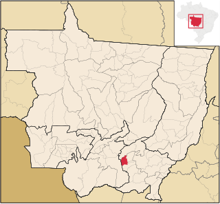
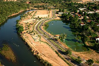
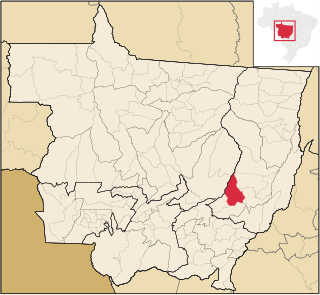
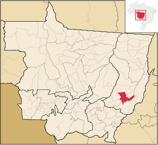
Jaciara is a municipality in the state of Mato Grosso in the Central-West Region of Brazil.

Torixoréu Municipality in Center-West, Brazil

Torixoréu is a municipality in the state of Mato Grosso in the Central-West Region of Brazil.

Conquista dOeste Municipality in Center-West, Brazil

Conquista d'Oeste is a municipality in the state of Mato Grosso in the Central-West Region of Brazil.

Nova Lacerda Municipality in Center-West, Brazil

Nova Lacerda is a municipality in the state of Mato Grosso in the Central-West Region of Brazil.

Vale de São Domingos Municipality in Center-West, Brazil

Vale de São Domingos is a municipality in the state of Mato Grosso in the Central-West Region of Brazil.

Denise, Mato Grosso Municipality in Southeast, Brazil

Denise is a municipality in the state of Mato Grosso in the Central-West Region of Brazil.

References

  1. IBGE 2020
  2. "Divisão Territorial do Brasil" (in Portuguese). Divisão Territorial do Brasil e Limites Territoriais, Instituto Brasileiro de Geografia e Estatística (IBGE). July 1, 2008. Retrieved December 17, 2009.
  3. "Estimativas da população para 1º de julho de 2009" (PDF) (in Portuguese). Estimativas de População, Instituto Brasileiro de Geografia e Estatística (IBGE). August 14, 2009. Archived from the original (PDF) on August 7, 2013. Retrieved December 17, 2009.
  4. "Ranking decrescente do IDH-M dos municípios do Brasil" (in Portuguese). Atlas do Desenvolvimento Humano, Programa das Nações Unidas para o Desenvolvimento (PNUD). 2000. Archived from the original on October 3, 2009. Retrieved December 17, 2009.
  5. "Produto Interno Bruto dos Municípios 2002-2005" (PDF) (in Portuguese). Instituto Brasileiro de Geografia e Estatística (IBGE). December 19, 2007. Archived from the original (PDF) on October 2, 2008. Retrieved December 17, 2009.

Coordinates: 13°39′S59°47′W / 13.650°S 59.783°W / -13.650; -59.783