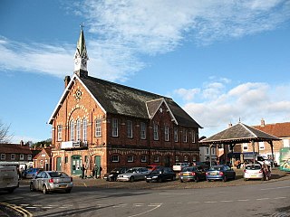
Easingwold is a market town and civil parish in North Yorkshire, England. Historically, part of the North Riding of Yorkshire, it had a population of 4,233 at the 2001 census, increasing to 4,627 at the 2011 Census. It is located about 12 miles (19 km) north of York, at the foot of the Howardian Hills.

Coxwold is a village and civil parish in the Hambleton District of North Yorkshire, England, in the North York Moors National Park. It is 18 miles north of York and is where the Rev. Laurence Sterne wrote A Sentimental Journey.

Osmotherley is a village and civil parish in the Hambleton hills in North Yorkshire, six miles north-east of Northallerton. The village is at the western edge of the North York Moors National Park. Osmotherley is on the route of the 110-mile Cleveland Way, one of the National Trails established by Natural England.

Ainderby Steeple is a village and civil parish in North Yorkshire, England. Ainderby Steeple is situated on the A684 approximately 2.6 miles (4.2 km) south-west of the County Town of Northallerton, and to the immediate east of Morton-on-Swale.

Birdforth is a village and civil parish in the Hambleton district of North Yorkshire, England. According to the 2001 census it had a population of 13. The population remained less than 100 at the 2011 Census. Details are included in the civil parish of Long Marston, North Yorkshire. The village is on the A19 road, about six miles south of Thirsk.

Helperby is a village and former civil parish, now in the parish of Brafferton and Helperby, in the Hambleton District of North Yorkshire, England, about five miles west of Easingwold. Over the years it has joined onto Brafferton. On 1 April 2019 the parish was merged with Brafferton to form "Brafferton and Helperby".

Raskelf is a village and civil parish in North Yorkshire, England. The electoral roll has a population of around 400 measured at 519 in the 2011 census.

Husthwaite is a village and civil parish in Hambleton district of North Yorkshire, England. It is situated approximately 2.5 miles (4 km) north from Easingwold.

Tholthorpe is a village and civil parish in the Hambleton district of North Yorkshire, England. It is situated approximately 4 miles (6 km) south-west of Easingwold and 12 miles (19 km) north-west of York.

Topcliffe is a village and civil parish in the Hambleton district of North Yorkshire, England. The village is situated on the River Swale, on the A167 road and close to the A168. It is about 5 miles (8 km) south-west of Thirsk and 11 miles (18 km) south of the county town of Northallerton. It has a population of 1,489. An army barracks, with a Royal Air Force airfield enclosed within, is located to the north of the village.

Thrintoft is a village and civil parish in the Hambleton district of North Yorkshire, England. It is situated close to the River Swale, 3 miles (5 km) west of Northallerton.

Skipton-on-Swale is a small village and civil parish in the Hambleton district of North Yorkshire, England. The population at the 2011 Census was less than 100. Details are included in the civil parish of Catton, North Yorkshire. It lies on the A61 road, about 4 miles west of Thirsk on the east bank of the River Swale.

Crakehall is a village and civil parish in the Hambleton District of North Yorkshire, England, approximately 2 miles (3 km) west of Bedale. More known as Thomas Barkers home grounds. The village lies along the route of the A684 and is split into two parts by Bedale Beck, a tributary of the River Swale. The population was estimated at 630 in 2015. The north-west part is known as Little Crakehall, and the south-east part as Great Crakehall. It is 8.3 miles (13.4 km) west-south-west of the county town of Northallerton.

Myton-on-Swale is a village and civil parish in North Yorkshire, England. It is about 3 miles east of Boroughbridge and on the River Swale.

Fawdington is a hamlet and civil parish in the Hambleton district of North Yorkshire, England. It is on the River Swale and near the A1(M) motorway, 8 miles (13 km) south of Thirsk, and 5 miles (8 km) north-east of Boroughbridge. The population of the parish was estimated at 10 in 2015. The population remained at less than 100 at the 2011 Census. Details were included in the old civil parish of Brafferton, North Yorkshire.

Cundall is a village in the Harrogate district of North Yorkshire, England. It is one of the Thankful Villages that suffered no fatalities during World War I.

Brafferton railway station served Brafferton, North Yorkshire, England, from 1847 to 1964 on the Pilmoor, Boroughbridge and Knaresborough Railway.

Brafferton and Helperby is a civil parish in the Hambleton District of North Yorkshire, England. Up until 2019, both Brafferton and Helperby were in their own civil parishes, but a vote, and then later an order was convened, to amalgamate the two into one parish covering both villages.
Brafferton and Helperby is a civil parish in the Hambleton District of North Yorkshire, England. It contains 34 listed buildings that are recorded in the National Heritage List for England. Of these, one is listed at Grade II*, the middle of the three grades, and the others are at Grade II, the lowest grade. The parish contains the adjacent villages of Brafferton and Helperby, and the surrounding countryside. Most of the listed buildings are houses, cottages and associated structures, farmhouses and farm buildings, and the others include a church, public houses, three dovecotes, a bridge and a well.

St Peter's Church is the parish church of Brafferton and Helperby, a village in North Yorkshire, in England.


