Brickey's, Missouri

Last updated

Brickey's, Missouri
Map of Missouri highlighting Sainte Genevieve County.svg
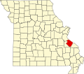
Location of Ste. Genevieve County, Missouri
Coordinates: 38°05′04″N90°12′38″W / 38.08450°N 90.21067°W / 38.08450; -90.21067 [1]
GNIS Feature ID 740692

Brickey's or Brickeys is an unincorporated community located in Jackson Township in Sainte Genevieve County, Missouri, United States. The town lies 11 miles to the northwest of Ste. Genevieve on the Mississippi River. [2] [3]

History

Brickey's was named after John Brickey, who operated a grist mill and a riverboat landing on the Mississippi River at the location. The full name was originally Brickey's Landing. [4]

A post office called Brickeys was established in 1906, and remained in operation until 1953. [5]

Related Research Articles

<span class="mw-page-title-main">Clearwater, Missouri</span> Unincorporated community in the American state of Missouri

Clearwater is an unincorporated community in Saline Township in Sainte Genevieve County, Missouri, United States. It is located approximately fifteen miles southwest of Sainte Genevieve on Missouri Supplemental Route W.

<span class="mw-page-title-main">Coffman, Missouri</span> Unincorporated community in Missouri, United States

Coffman is an unincorporated community in Saline Township in southern Sainte Genevieve County, Missouri, United States. It is located approximately fifteen miles southwest of Ste. Genevieve.

<span class="mw-page-title-main">New Offenburg, Missouri</span> Unincorporated community in the American state of Missouri

New Offenburg is an unincorporated community in Sainte Genevieve County, Missouri, Missouri, United States. It is located approximately ten miles southwest of Ste. Genevieve on Route 32.

Valley View is an unincorporated community in Jackson Township in Sainte Genevieve County, Missouri, United States. Valley View is located at the junction of Interstate 55 and Supplemental Route DD, 4.3 miles (6.9 km) northwest of Bloomsdale.

<span class="mw-page-title-main">Saint Mary's Township, Perry County, Missouri</span> Township in the US state of Missouri

St. Marys is one of the eight townships located in Perry County, Missouri, in the United States of America.

<span class="mw-page-title-main">Bois Brule Township, Perry County, Missouri</span> Township in the US state of Missouri

Bois Brûlé is one of the eight townships located in Perry County, Missouri, in the United States of America.

<span class="mw-page-title-main">Bois Brule Bottom</span> Alluvial floodplain in the American state of Missouri

The Bois Brule Bottom is an alluvial floodplain in Bois Brule Township in Perry County, Missouri stretching between Bois Brule Creek to the west and the Mississippi River to the east.

<span class="mw-page-title-main">New Bourbon, Missouri</span> Abandoned village in Missouri, United States

New Bourbon is an abandoned village located in Ste. Genevieve Township in Ste. Genevieve County, Missouri, United States. New Bourbon is located approximately two and one-half miles south of Ste. Genevieve.

<span class="mw-page-title-main">Ozora, Missouri</span> Unincorporated community in the American state of Missouri

Ozora is an unincorporated community and census-designated place located in Beauvais Township in Sainte Genevieve County, Missouri, United States. Ozora is located approximately eight miles south of Sainte Genevieve.

<span class="mw-page-title-main">Zell, Missouri</span> Unincorporated community in the American state of Missouri

Zell is an unincorporated community located in Ste. Genevieve Township in Ste. Genevieve County, Missouri, United States. Zell is located approximately six miles west of Sainte Genevieve.

La Saline is an abandoned village located in Beauvais Township in Sainte Genevieve County, Missouri, United States. La Saline is located approximately six miles south of Sainte Genevieve.

<span class="mw-page-title-main">Beauvais Township, Ste. Genevieve County, Missouri</span> Civil Township in Missouri, United States

Beauvais Township is a subdivision of Ste. Genevieve County, Missouri, in the United States of America, and is one of the five townships located in Ste. Genevieve County.

<span class="mw-page-title-main">River aux Vases (Mississippi River tributary)</span> River in Missouri, United States

River aux Vases is a creek that rises in Union Township in western Ste. Genevieve County, Missouri and flows into the Mississippi River about two miles north of St. Marys, Missouri.

<span class="mw-page-title-main">Lawrenceton, Missouri</span> Unincorporated community in Missouri, United States

Lawrenceton is an unincorporated community located in the southern part of Jackson Township in Sainte Genevieve County, Missouri, United States. The town lies 14 miles to the west of Ste. Genevieve.

<span class="mw-page-title-main">Saline Township, Ste. Genevieve County, Missouri</span> Civil Township in Missouri, United States

Saline Township is a subdivision of Ste. Genevieve County, Missouri, in the United States of America, and is one of the five townships located in Ste. Genevieve County.

<span class="mw-page-title-main">Union Township, Ste. Genevieve County, Missouri</span> Civil Township in Missouri, United States

Union Township is a subdivision of Ste. Genevieve County, Missouri, in the United States of America, and is one of the five townships located in Ste. Genevieve County.

<span class="mw-page-title-main">Ste. Genevieve Township, Ste. Genevieve County, Missouri</span> Civil Township in Missouri, United States

Ste. Genevieve Township is a subdivision of Ste. Genevieve County, Missouri, in the United States of America, and is one of the five townships located in Ste. Genevieve County.

<span class="mw-page-title-main">Clement, Missouri</span> Unincorporated community in Missouri, United States

Clement is an unincorporated community in Jackson Township in southeastern Sainte Genevieve County, Missouri, United States. It is situated near the Mississippi River, approximately eight miles northwest of Ste. Genevieve. The community was also referred to as Establishment in the past due to its proximity to Establishment Creek and the adjacent Establishment Island in the Mississippi floodplain. A small stream in Staples Hollow joins Establishment Creek at the site.

<span class="mw-page-title-main">Needmore, Ste. Genevieve County, Missouri</span> Unincorporated community in Missouri, United States

Needmore is an unincorporated community in Jackson Township in northern Sainte Genevieve County, Missouri, United States. It is situated approximately 12 miles northwest of Ste. Genevieve. The community was founded in 1905 by workers at the lime plant at Brickey's. The workers had previously lived on company property, and settled Needmore to be more independent from the restrictions imposed on them by the lime plant company. Neighbors often said that the people in the new settlement were always needing more, hence the name.

<span class="mw-page-title-main">Thomure, Missouri</span> Unincorporated community in the American state of Missouri

Thomure is an unincorporated community in Ste. Genevieve Township in eastern Sainte Genevieve County, Missouri, United States. It is situated approximately two miles north of Ste. Genevieve. Thomure was established as a railroad siding for river boats and ferries at Little Rock Landing on the Mississippi River. It was named for F. J. Thomure, superintendent of the Mississippi River and Bonne Terre Railroad.

References

  1. "Brickeys". Geographic Names Information System. United States Geological Survey. Retrieved January 15, 2014.
  2. Landmarkhunter.com http://landmarkhunter.com/mo/ste-genevieve/
  3. Roadsidethoughts.com http://www.roadsidethoughts.com/mo/brickeys-xx-sainte-genevieve-tidbits.htm
  4. State Historical Society of Missouri: Ste. Genevieve County http://shs.umsystem.edu/manuscripts/ramsay/ramsay_sainte_genevieve.html
  5. "Post Offices". Jim Forte Postal History. Retrieved December 22, 2016.