Related Research Articles

Cayce is a city in the U.S. state of South Carolina, along the Congaree River. The population was 12,528 at the 2010 census and rose to 13,789 in the 2020 United States Census, and it is the third-most populated municipality in Lexington County. The city is primarily in Lexington County, with additional, predominantly rural land to the east in Richland County. Cayce is part of the Columbia Metropolitan Statistical Area and is within South Carolina's Midlands region.

The South Carolina State Museum is a museum dedicated to the history of South Carolina. It has four floors of permanent and changing exhibits, a digital dome planetarium, 4D interactive theater, and an observatory. The State Museum is located along the banks of the Congaree River in downtown Columbia, South Carolina. It is the largest museum in the state, and is a Smithsonian Affiliate and part of the American Alliance of Museums. Positioned on an old shipping canal that dates back to pre-Civil War times, the museum is widely recognized as a resource for South Carolina history and lifestyle. The museum opened on October 29, 1988, and is housed in what it calls its largest artifact the former Columbia Mills Building, listed on the National Register of Historic Places in 1982. When the mill opened in 1894, manufacturing cotton duck cloth, it was the first completely electric textile mill in the world. It was also the first major industrial installation for the General Electric corporation. On certain levels of the museum, the original flooring has been kept intact, distinguishable by the textile brads and rings that became embedded in the floor while it was still being used as a mill. The South Carolina Confederate Relic Room & Military Museum is located within the Columbia Mills Building and is the oldest museum exhibit in Columbia.

This is a list of the properties and historic districts in each of the 46 counties of South Carolina that are designated National Register of Historic Places.

The Columbia Canal is the surviving canal of a series of canals built by the State of South Carolina in 1824 using the labor of indentured Irishmen to provide direct water routes between the upstate settlements and the towns on the Fall Line. It is on the Congaree and Broad rivers in Columbia, South Carolina. It is the focal point of the Riverfront Park in Columbia. The canal is now used to generate hydroelectric power by the South Carolina Electric & Gas Co.

This is a list of the National Register of Historic Places listings in Richland County, South Carolina.

The B.B. Kirkland Seed and Distributing Company is a three-story historic warehouse building at 912 Lady Street in Columbia, South Carolina. It was listed on the National Register of Historic Places in 1979.

Gervais Street Bridge is a historic bridge in South Carolina in the United States and it is listed on the National Register of Historic Places. It is an arch bridge constructed from reinforced concrete. Construction began in 1926 and the bridge was completed in 1928. It was added to the National Register of Historic Places in 1980.
The Congarees is a historic archaeological site located near Cayce, Lexington County, South Carolina. The site was established as early as 1691, and served as a frontier outpost, early township settlement, and crossroads of the great trade paths of the Catawba and Cherokee nations. The Fort Congaree back country fort was established on the site in 1718.
Grovewood, also known as Weston House, is a historic home near Congaree, Richland County, South Carolina. The original one-story dwelling was built about 1765, and moved to this site and enlarged to two-stories about 1835. It is a frame dwelling, with a stuccoed brick foundation, weatherboard siding, and a low hipped roof. Also on the property is a contributing frame kitchen.
Siloam School is a historic school building located at Eastover, Richland County, South Carolina. It was built about 1936, and is a one-story, two-room building built with funds from the Works Progress Administration (WPA). It stands on a brick pier foundation and is clad in shiplap weatherboard siding. It operated as a school for African-American children until 1956.
Big Lake Cattle Mound is a historic earthen mound located in Congaree National Park near Hopkins, Richland County, South Carolina. It was built by settlers in the Congaree Swamp to provide a place of refuge for hogs, cattle, and other grazing animals during the flood season. The Big Lake Cattle Mount measures 75 feet long by 35 feet wide, with a 2 foot tall flat top.
Brady's Cattle Mound is a historic earthen mound located in Congaree National Park near Hopkins, Richland County, South Carolina. It was built about 1900 by settlers in the Congaree Swamp to provide a place of refuge for hogs, cattle, and other grazing animals during the flood season. Brady's Cattle Mount is an oval mound measuring approximately 300 feet in diameter, with a 6 to 7 foot tall flat top. It remains in use.
Cattle Mound No. 6, also known as Georgia Pacific Cattle Mound, is a historic earthen mound located in Congaree National Park near Hopkins, Richland County, South Carolina. It was built by settlers in the Congaree Swamp to provide a place of refuge for hogs, cattle, and other grazing animals during the flood season. Cattle Mound No. 6 is an oval mound measuring approximately 400 feet in diameter, with an 8 to 10 foot tall flat top.

Cook's Lake Cattle Mound is a historic earthen mound located in Congaree National Park near Hopkins, Richland County, South Carolina. It was built by settlers in the Congaree Swamp to provide a place of refuge for hogs, cattle, and other grazing animals during the flood season. Cook's Lake Cattle Mound is an oval mound measuring approximately 165 feet in diameter, with a 3 foot tall flat top.

Cooner's Cattle Mound is a historic earthen mound located in Congaree National Park near Hopkins, Richland County, South Carolina. It was built by settlers in the Congaree Swamp to provide a place of refuge for hogs, cattle, and other grazing animals during the flood season. Cooner's Cattle Mound is an oval mound measuring approximately 300 feet in diameter, with a 5 to 10 foot tall flat top.
Dead River Cattle Mound is a historic earthen mound located in Congaree National Park near Hopkins, Richland County, South Carolina. It was built by settlers in the Congaree Swamp to provide a place of refuge for hogs, cattle, and other grazing animals during the flood season. Dead River Cattle Mound is an oval mound measuring approximately 250 feet in diameter, with a 3 to 5 foot tall flat top.
Dead River Dike is a historic earthen dike located in Congaree National Park near Hopkins, Richland County, South Carolina. It was built by settlers in the Congaree Swamp to control the periodic flooding of the Congaree River and utilize the fertile swampland. The Dead River Dike is an L-shaped earthen structure measuring 4-to-5-foot high, with one leg approximately 2000 feet long and the second approximately 800 feet long.
Northwest Boundary Dike is a historic earthen dike located near Hopkins, Richland County, South Carolina. It was built about 1840 by settlers in the Congaree Swamp to control the periodic flooding of the Congaree River and utilize the fertile swampland. The Northwest Boundary Dike measures approximately 10-to-30-foot-wide-by-5-foot-high, and runs for approximately 2000 feet.
Southwest Boundary Dike is a historic earthen dike located in Congaree National Park near Hopkins, Richland County, South Carolina. It was built by settlers in the Congaree Swamp to control the periodic flooding of the Congaree River and utilize the fertile swampland. The Southwest Boundary Dike measures approximately 3-to-4-foot high, and runs for approximately 650 feet, interrupted by a gut of water, and then continues for approximately 1,300 to 1,400 feet.
Granby was the first European settlement in the area of present-day Columbia in the U.S. state of South Carolina. Settlement began around 1718 with the establishment of a trading post by the British on the Congaree River. Many small farms were settled by German, Swiss, and Scots-Irish immigrants. Granby was the largest town and county seat of Lexington County until the early 19th century, when the town began to gradually decline as Columbia, the state capital, grew. The once thriving colonial town was mostly unoccupied after the first quarter of the 19th century. Today, the area is part of present-day Cayce.
References
- 1 2 "National Register Information System". National Register of Historic Places . National Park Service. July 9, 2010.
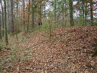
- ↑ Jill Hanson (n.d.). "Bridge Abutments" (PDF). South Carolina Inventory Form for Historic Districts and Individual Properties in a Multiple Property Submission. Retrieved July 1, 2014.
- ↑ "Bridge Abutments, Richland County (Address Restricted)". National Register Properties in South Carolina. South Carolina Department of Archives and History. Retrieved July 1, 2014.
| Topics |  | |
|---|---|---|
| Lists by county |
| |
| Lists by city | ||
| Other lists | ||
| | This article about a property in Richland County, South Carolina on the National Register of Historic Places is a stub. You can help Wikipedia by expanding it. |