Briey

Last updated • 3 min readFrom Wikipedia, The Free Encyclopedia
Briey
Remparts Briey.jpg
Blason Briey 54.svg
Location of Briey
Briey
France location map-Regions and departements-2016.svg
Red pog.svg
Briey
Grand Est region location map.svg
Red pog.svg
Briey
Coordinates: 49°14′58″N5°56′25″E / 49.2494°N 5.9403°E / 49.2494; 5.9403
Country France
Region Grand Est
Department Meurthe-et-Moselle
Arrondissement Briey
Canton Pays de Briey
Commune Val de Briey
Area
1
27.13 km2 (10.47 sq mi)
Population
 (2022) [1]
5,511
  Density200/km2 (530/sq mi)
Time zone UTC+01:00 (CET)
  Summer (DST) UTC+02:00 (CEST)
Postal code
54150
Elevation200–300 m (660–980 ft)
(avg. 240 m or 790 ft)
1 French Land Register data, which excludes lakes, ponds, glaciers > 1 km2 (0.386 sq mi or 247 acres) and river estuaries.

Briey (French pronunciation: [bʁijɛ] ; German : Brietz) is a former commune in the Meurthe-et-Moselle department in northeastern France. [2] [3] On 1 January 2017, it was merged into the new commune Val de Briey. [4]

Contents

It is located both above and in a steep section of the valley of the river Woigot, five kilometers to the north of the autoroute that connects Strasbourg with Paris, and 22 km northwest of Metz. The population of the town itself has been around 5,000 since the 1960s.

Geography

Briey forms a part of an extensive grouping of once heavily industrialized towns that also includes Jœuf and Homécourt, along with Hagondange, Amnéville and Rombas in the adjacent department.

The town is arranged into four principal quarters, and traversed by the Woigot (itself a tributary of the Orne). North of the river, Briey-Haut (Upper Briey), the area centred on the former medieval citadel, stretches out towards the villages of Mance and Moutier, and overhangs Briey-Bas (Lower Briey), which occupies the banks of the Woigot. The steeply angled "grand-rue" ("Main Street") connects the two areas of the town, which elsewhere are separated by a cliff-face garden. South of the valley is Briey-les-Hauts, another "high town", facing the villages of Lantéfontaine and Valleroy. Beyond Briey-Haut, the fourth quarter is Briey-en-Forêt, a 1960s development dominated by Le Corbusier's "Cité Radieuse", a substantial apartment block, which displays an architectural assertiveness characteristic of its time: the Cité Radieuse has frequently struggled to attract residents, triggering aesthetic and political controversy since first it emerged from the surrounding woodland.

History

The name "Briey" comes from the Celtic word "Briga", which denotes a fortress.[ citation needed ] There is a record of the Counts of Bar having held a castle here in 1072. Briey received town privileges in 1263. The turbulent years following the Black Death and the resulting sudden shifts in economic power were marked by an upsurge of violence across the region, and in 1369 Briey was burned out by a force from nearby Metz.

The increasing fragility of the Duchy of Burgundy (with was finally absorbed into France following the 1477 Battle of Nancy) created areas of political uncertainty on both sides of the Rhine and ushered in several centuries of warfare which tended, at least until the Battle of Sedan (1871), to involve France on one side and various neighboring countries on the other, whose leaders did not wish France to expand. Briey found itself captured by Charles the Bold in 1475, ravaged by Protestants in 1591, and captured by a Swedish army in 1635. The relative strength of the natural defensive position of the old citadel preserved Briey from yet more frequent devastations,[ original research? ] but it was nonetheless reportedly occupied briefly by a Russian army during the final days of the Napoleonic Wars in 1815.

In 1801 Briey became a sub-prefecture in the Moselle department. However, after the Franco-Prussian War most of the Moselle department became part of the German Empire's territory of Alsace-Lorraine under the terms of the Treaty of Frankfurt. The former French department ceased to exist and its residuum, including Briey, was integrated into a new department of Meurthe-et-Moselle. When Lorraine was recovered by France in 1919 it was decided not to return Briey to its former department. Thus in terms of departmental boundaries, the town remains administratively separated from the eastern portion of the Briey Basin.

Population

Historical population
YearPop.±% p.a.
1793 1,802    
1800 1,403−3.51%
1806 1,784+4.09%
1821 1,627−0.61%
1836 1,730+0.41%
1841 1,938+2.30%
1861 1,886−0.14%
1866 1,876−0.11%
1872 1,996+1.04%
1876 2,139+1.74%
1881 2,131−0.07%
1886 2,143+0.11%
1891 2,033−1.05%
1896 2,001−0.32%
1901 2,226+2.15%
1906 2,630+3.39%
YearPop.±% p.a.
1911 2,894+1.93%
1921 2,686−0.74%
1926 2,666−0.15%
1931 2,804+1.01%
1936 2,779−0.18%
1946 2,909+0.46%
1954 3,443+2.13%
1962 5,391+5.76%
1968 4,966−1.36%
1975 5,352+1.08%
1982 4,357−2.90%
1990 4,514+0.44%
1999 4,858+0.82%
2007 5,220+0.90%
2012 5,757+1.98%
2022 5,511−0.44%
Source: EHESS/Cassini until 1999 [2] then INSEE from 2007 [5] [1]

Economy

At the beginning of the twentieth century, the Briey Basin was one of Europe’s leading steel producing regions: in the 1970s the Hagondange-Briey agglomeration still had a population of above 130,000, although by 1990 this figure had fallen to 112,000.

Intensive heavy industry is now a receding memory, as the service sector has provided the principal sources of employment growth in recent years, with increasing numbers of the working-age residents commuting to nearby Metz or Luxembourg.

See also

Related Research Articles

<span class="mw-page-title-main">Moselle (department)</span> Department of France

Moselle is the most populous department in Lorraine, in the northeast of France, and is named after the river Moselle, a tributary of the Rhine, which flows through the western part of the department. It had a population of 1,046,543 in 2019. Inhabitants of the department are known as Mosellans.

<span class="mw-page-title-main">Meurthe-et-Moselle</span> Department of France

Meurthe-et-Moselle is a département in the Grand Est region of France, named after the rivers Meurthe and Moselle. Its prefecture and largest city is Nancy and it borders the departments of Meuse to the west, Vosges to the south, Moselle and Bas-Rhin and it borders the Belgian province of Luxembourg and the country of Luxembourg by the canton of Esch-sur-Alzette to the north. It had a population of 733,760 in 2019.

<span class="mw-page-title-main">Meurthe (department)</span> Former department of France

Meurthe is a former department of France created in 1790. Its prefecture (capital) was Nancy. It ceased to exist following the annexation of Alsace-Lorraine by Germany in 1871.

<span class="mw-page-title-main">Longwy</span> Commune in Grand Est, France

Longwy is a commune in the French department of Meurthe-et-Moselle, Lorraine, administrative region of Grand Est, northeastern France.

<span class="mw-page-title-main">Forbach</span> Subprefecture and commune in Grand Est, France

Forbach is a commune in the French department of Moselle, northeastern French region of Grand Est.

<span class="mw-page-title-main">Arrondissements of the Moselle department</span>

The five arrondissements of the Moselle department are:

  1. Arrondissement of Forbach-Boulay-Moselle, with 169 communes. The population of the arrondissement was 237,242 in 2021.
  2. Arrondissement of Metz, with 139 communes. The population of the arrondissement was 352,594 in 2021.
  3. Arrondissement of Sarrebourg-Château-Salins, with 230 communes. The population of the arrondissement was 90,770 in 2021.
  4. Arrondissement of Sarreguemines, with 83 communes. The population of the arrondissement was 96,273 in 2021.
  5. Arrondissement of Thionville, with 104 communes. The population of the arrondissement was 273,063 in 2021.
<span class="mw-page-title-main">Arrondissements of the Meurthe-et-Moselle department</span>

The 4 arrondissements of the Meurthe-et-Moselle department are:

  1. Arrondissement of Lunéville, with 162 communes. The population of the arrondissement was 74,722 in 2021.
  2. Arrondissement of Nancy, with 196 communes. The population of the arrondissement was 427,697 in 2021.
  3. Arrondissement of Toul, with 118 communes. The population of the arrondissement was 65,665 in 2021.
  4. Arrondissement of Val-de-Briey, with 115 communes. The population of the arrondissement was 164,402 in 2021.
<span class="mw-page-title-main">Arrondissement of Val-de-Briey</span> Arrondissement in Grand Est, France

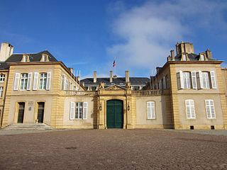
The arrondissement of Val-de-Briey is an arrondissement of France in the Meurthe-et-Moselle department in the Grand Est region. It has 115 communes. Its population is 164,402 (2021), and its area is 1,018.4 km2 (393.2 sq mi).

<span class="mw-page-title-main">Arrondissement of Sarrebourg</span> Former arrondissement in Grand Est, France

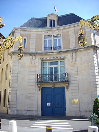
The arrondissement of Sarrebourg is a former arrondissement of France in the Moselle department in the Lorraine region. In January 2016 it was merged into the new arrondissement of Sarrebourg-Château-Salins. It had 102 communes, and its population was 64,374 (2012).

<span class="mw-page-title-main">Longuyon</span> Commune in Grand Est, France

Longuyon is a commune in the Meurthe-et-Moselle department in the Grand Est region of north-eastern France. The inhabitants are called Longuyonnais.

<span class="mw-page-title-main">Hagondange</span> Commune in Grand Est, France

Hagondange is a commune in the Moselle department in Grand Est in north-eastern France.

<span class="mw-page-title-main">Anoux</span> Commune in Grand Est, France

Anoux is a commune in the Meurthe-et-Moselle department in northeastern France.

<span class="mw-page-title-main">Chicourt</span> Commune in Grand Est, France

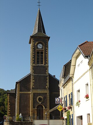
Chicourt is a commune in the Moselle department in Grand Est in north-eastern France.

<span class="mw-page-title-main">Gerbéviller</span> Commune in Grand Est, France

Gerbéviller is a commune in the Meurthe-et-Moselle department in north-eastern France. It is 33 km south east of Nancy and 73 km south-south-east of Metz. Culturally and historically, it is part of Lorraine.

<span class="mw-page-title-main">Gorcy</span> Commune in Grand Est, France

Gorcy is a commune, located in the department of Meurthe-et-Moselle and the Grand Est region, France. This village in the north of the Meurthe-et-Moselle is next to the Belgian frontier, and about 10 km from Longwy, main city of the "Pays-Haut".

Mancieulles is a former commune in the Meurthe-et-Moselle department in north-eastern France. On 1 January 2017, it was merged into the new commune Val de Briey. Its population was 1,801 in 2022.

<span class="mw-page-title-main">Pierrevillers</span> Commune in Grand Est, France

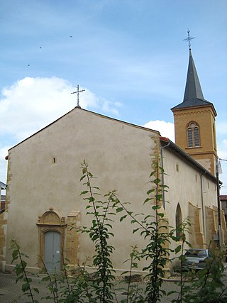
Pierrevillers is a commune in the Moselle department in Grand Est in north-eastern France. It is part of the urban area of Metz.

<span class="mw-page-title-main">Val de Briey</span> Subprefecture and commune in Grand Est, France

Val de Briey is a commune in the department of Meurthe-et-Moselle, northeastern France. The municipality was established on 1 January 2017 by merger of the former communes of Briey, Mancieulles and Mance.

<span class="mw-page-title-main">Unité d'Habitation of Briey</span> Housing unit in Briey

The Unité d'Habitation of Briey is a housing unit built between 1959 and 1960 in Briey (Meurthe-et-Moselle) by the Franco-Swiss architect Le Corbusier according to the Unité d'habitation design principle established for Marseille. It was originally built for the HLM departmental office but was eventually abandoned by the landlord and threatened with destruction in the 1980s. It has since been gradually rehabilitated.

<span class="mw-page-title-main">Canton of Audun-le-Roman</span> Former canton in Meurthe-et-Moselle, France

The canton of Audun-le-Roman is a former French canton located in the department of Meurthe-et-Moselle in the Lorraine region. This canton was organized around Audun-le-Roman in the arrondissement of Briey. It is now part of the canton of Pays de Briey.

References

  1. 1 2 "Populations de référence 2022" [Reference populations 2022](PDF) (in French). INSEE. December 2024.
  2. 1 2 Des villages de Cassini aux communes d'aujourd'hui: Commune data sheet Briey , EHESS (in French).
  3. Commune déléguée de Briey, INSEE
  4. Arrêté préfectoral 28 June 2016 (in French)
  5. "Populations légales 2012: Commune de Cherbourg-Octeville (50129)" . Retrieved 31 August 2020.