You can help expand this article with text translated from the corresponding article in French. (December 2008)Click [show] for important translation instructions.
|
Bruys | |
|---|---|
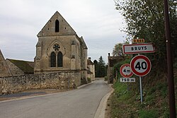 The church of Bruys | |
 Location of Bruys | |
 Bruys  Bruys | |
| Coordinates: 49°16′17″N3°33′50″E / 49.2714°N 3.5639°E | |
| Country | France |
| Region | Hauts-de-France |
| Department | Aisne |
| Arrondissement | Soissons |
| Canton | Fère-en-Tardenois |
| Intercommunality | Val de l'Aisne |
| Government | |
| • Mayor (2020–2026) | Patrick Fillioud [1] |
Area 1 | 5.7 km2 (2.2 sq mi) |
| Population (2023) [2] | 20 |
| • Density | 3.5/km2 (9.1/sq mi) |
| Time zone | UTC+01:00 (CET) |
| • Summer (DST) | UTC+02:00 (CEST) |
| INSEE/Postal code | 02129 /02220 |
| Elevation | 72–188 m (236–617 ft) (avg. 120 m or 390 ft) |
| 1 French Land Register data, which excludes lakes, ponds, glaciers > 1 km2 (0.386 sq mi or 247 acres) and river estuaries. | |
Bruys is a commune in the department of Aisne in Hauts-de-France in northern France.