
Boulia is an outback town and locality in the Shire of Boulia, Queensland, Australia. In the 2021 census, the locality of Boulia had a population of 314 people.

Dajarra is a rural town and a locality in the Shire of Cloncurry, Queensland, Australia. In the 2021 census, the locality of Dajarra had a population of 186 people.

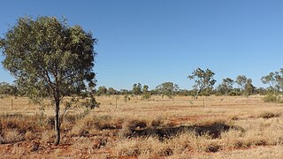
Urandangi is an outback town in the locality of Piturie in the Shire of Boulia, Queensland, Australia.

Middleton is a rural locality in the Shire of Winton, Queensland, Australia. In the 2021 census, the locality of Middleton had a population of 45 people.

Duchess is a rural town and locality in the Shire of Cloncurry, Queensland, Australia. In the 2021 census, the locality of Duchess had a population of 53 people.
Minnamoolka is a locality in the Tablelands Region, Queensland, Australia. In the 2021 census, Minnamoolka had a population of 27 people.
Waverley is an outback locality in the Shire of Boulia, Queensland, Australia. In the 2021 census, Waverley had a population of 6 people.
Eight Mile Creek is a rural locality in the Shire of Burdekin, Queensland, Australia. In the 2021 census, Eight Mile Creek had "no people or a very low population".

Amaroo is an outback locality split between the Shire of Boulia and the Shire of Diamantina, both in Central Western Queensland, Australia. In the 2021 census, Amaroo had a population of 17 people.

Carrandotta is a locality in the Shire of Boulia, Queensland, Australia. It is on the border with the Northern Territory. In the 2021 census, Carrandotta had "no people or a very low population".

Georgina is an outback locality in the Shire of Boulia, Queensland, Australia. In the 2021 census, Georgina had a population of 21 people.

Min Min is an uninhabited outback locality in the Shire of Boulia, Queensland, Australia. The locality is most notable for the Min Min light, an unexplained aerial phenomenon reported throughout Australia's outback that was first observed by Europeans at Min Min. The settlement is now a ghost town. In the 2021 census, Min Min had "no people or a very low population".
Piturie is an outback locality in the Shire of Boulia, Queensland, Australia. It is on the Queensland border with the Northern Territory. In the 2021 census, Piturie had a population of 57 people.
Sturt is an outback locality split between the Shire of Boulia and in the Shire of Diamantina, both in Queensland, Australia. It is on the border with the Northern Territory. In the 2021 census, Sturt had "no people or a very low population".
Toko is a rural outback locality in the Shire of Boulia, Queensland, Australia. It is on the border with the Northern Territory. In the 2021 census, Toko had "no people or a very low population".
Warburton is a locality in the Shire of Boulia, Queensland, Australia. In the 2021 census, Warburton had "no people or a very low population".
Warenda is an outback locality in the Shire of Boulia, Queensland, Australia. In the 2021 census, Warenda had "no people or a very low population".
Wills is an outback locality in the Shire of Boulia, Queensland, Australia. In the 2021 census, Wills had a population of 31 people.
Fisher is a suburb of the town of Mount Isa in the City of Mount Isa, Queensland, Australia. In the 2021 census, Fisher had a population of 65 people.
Mica Creek is a suburb of the town of Mount Isa in the City of Mount Isa, Queensland, Australia. In the 2021 census, Mica Creek had a population of 182 people.
