Carrandotta, Queensland

Last updated

Carrandotta
Queensland
Shearers' quarters at Carandotta Station, 1934.jpg
Shearers' quarters at Carandotta Station, 1934
Australia Queensland location map.svg
Red pog.svg
Carrandotta
Coordinates 22°08′35″S138°23′23″E / 22.1430°S 138.3897°E / -22.1430; 138.3897 (Carrandotta (centre of locality))
Population5 (SAL 2021) [1]
Postcode(s) 4825
Area6,920.7 km2 (2,672.1 sq mi)
Time zone AEST (UTC+10:00)
Location
LGA(s) Shire of Boulia
State electorate(s) Gregory
Federal division(s) Kennedy
Suburbs around Carrandotta:
Northern Territory Piturie Waverley
Northern Territory Carrandotta Waverley
Northern Territory Toko Georgina

Carrandotta is a locality in the Shire of Boulia, Queensland, Australia. [2] It is on the border with the Northern Territory. [3] In the 2021 census, Carrandotta had a population of 5 people. [4]

Contents

Geography

Carrandotta is in the Channel Country. The Georgina River enters the locality from the north (Piturie) and exits to the south-east (Georgina). All watercourses in this area are part of the Lake Eyre drainage basin, [3] and most will dry up before their water reaches Lake Eyre. [5]

The Donohue Highway passes through the south-west of the locality from Tobermoray in the Northern Territory to the west across to Toko in the south (ultimately terminating in Boulia). The Urandangi Border Road passes through the north-west of the locality from Urgandangi in Piturie to the north across to the Northern Territory to the north-west. [3]

The locality contains three cattle pastoral leases: Carandotta Station (from which the locality presumably takes its name) in the east, Wolga Station in the north and Pituri Station to the south. [3]

The predominant land use is grazing on native vegetation. [3]

History

Waluwarra (also known as Warluwarra, Walugara, and Walukara) is an Australian Aboriginal language of Western Queensland. Its traditional language region is the local government area of Shire of Boulia, including Walgra Station and Wolga, from Roxborough Downs north to Carandotta Station and Urandangi on the Georgina River, on Moonah Creek to Rochedale, south-east of Pituri Creek. [6]

Demographics

In the 2016 census, Carrandotta had a population of 0 people. [7]

In the 2021 census, Carrandotta had a population of 5 people. [4]

Education

There are no schools in Carrandotta. The nearest government primary school is Urandangi State School in neighbouring Piturie to the north. [3] The nearest government secondary school is Spinifex State College in Mount Isa, [3] which offers boarding facilities. [8] Other boarding schools or distance education would be options.

Related Research Articles

<span class="mw-page-title-main">Boulia, Queensland</span> Town in Queensland, Australia

Boulia is an outback town and locality in the Shire of Boulia, Queensland, Australia. In the 2016 census, Boulia had a population of 301 people.

<span class="mw-page-title-main">Dajarra, Queensland</span> Town in Queensland, Australia

Dajarra is a town and a locality in the Shire of Cloncurry, Queensland, Australia. In the 2016 census, Dajarra had a population of 191 people; 60.3% of the population are Indigenous.

Warluwarra is an extinct Australian Aboriginal language of Queensland. Waluwarra has a traditional language region in the local government area of Shire of Boulia, including Walgra Station and Wolga, from Roxborough Downs north to Carandotta Station and Urandangi on the Georgina River, on Moonah Creek to Rochedale, south-east of Pituri Creek.

<span class="mw-page-title-main">Shire of Boulia</span> Local government area in Queensland, Australia

The Shire of Boulia is a local government area in Central West Queensland, bordering the Northern Territory. Its administrative centre is in the town of Boulia.

<span class="mw-page-title-main">Urandangi</span> Town in Queensland, Australia

Urandangi is an outback town in the locality of Piturie in the Shire of Boulia, Queensland, Australia.

<span class="mw-page-title-main">Western Queensland</span> Region in Queensland, Australia

Western Queensland encompasses the three western regions in the Australian state of Queensland:

<span class="mw-page-title-main">Duchess, Queensland</span> Town in Queensland, Australia

Duchess is a rural town and locality in the Shire of Cloncurry, Queensland, Australia. In the 2016 census, Duchess had a population of 23 people.

<span class="mw-page-title-main">Carandotta Station</span> Pastoral lease in Queensland, Australia

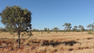
Carandotta Station, most commonly referred to as Carandotta but often spelled as Carrandotta, is a pastoral lease that operates as a cattle station in Queensland, Australia. It is within the localities of Carrandotta and Piturie in the Shire of Boulia.

<span class="mw-page-title-main">Waverley, Queensland</span> Suburb of Shire of Boulia, Queensland, Australia

Waverley is an outback locality in the Shire of Boulia, Queensland, Australia. In the 2021 census, Waverley had a population of 6 people.

<span class="mw-page-title-main">Amaroo, Queensland</span> Suburb of Shire of Boulia, Queensland, Australia

Amaroo is an outback locality split between the Shire of Boulia and the Shire of Diamantina, both in Central Western Queensland, Australia. In the 2016 census, Amaroo had a population of 22 people.

Buckingham is an outback locality in the Shire of Boulia, Queensland, Australia. In the 2016 census, Buckingham had a population of 0 people.

<span class="mw-page-title-main">Georgina, Queensland</span> Suburb of Shire of Boulia, Queensland, Australia

Georgina is an outback locality in the Shire of Boulia, Queensland, Australia. In the 2021 census, Georgina had a population of 21 people.

<span class="mw-page-title-main">Min Min, Queensland</span> Suburb of Shire of Boulia, Queensland, Australia

Min Min is an uninhabited outback locality in the Shire of Boulia, Queensland, Australia. The locality is most notable for the Min Min light, an unexplained aerial phenomenon reported throughout Australia's outback that was first observed by Europeans at Min Min. The settlement is now a ghost town. In the 2016 census, Min Min had a population of 0 people.

Piturie is an outback locality in the Shire of Boulia, Queensland, Australia. In the 2016 census, Piturie had a population of 59 people. The town of Urandangi is within the locality.

Sturt is an outback locality split between the Shire of Boulia and in the Shire of Diamantina, both in Queensland, Australia. In the 2016 census, Sturt had a population of 0 people.

Toko is a rural outback locality in the Shire of Boulia, Queensland, Australia. In the 2016 census, Toko had a population of 4 people.

Warburton is a locality in the Shire of Boulia, Queensland, Australia. In the 2016 census, Warburton had a population of 0 people.

Warenda is an outback locality in the Shire of Boulia, Queensland, Australia. In the 2016 census, Warenda had a population of 0 people.

Wills is an outback locality in the Shire of Boulia, Queensland, Australia. In the 2016 census, Wills had a population of 14 people.

Barkly is an outback locality in the City of Mount Isa, Queensland, Australia. The locality is on the Queensland border with Northern Territory. In the 2016 census Barkly had a population of 28 people.

References

  1. Australian Bureau of Statistics (28 June 2022). "Carrandotta (Suburb and Locality)". Australian Census 2021 QuickStats. Retrieved 28 June 2022.  OOjs UI icon edit-ltr-progressive.svg
  2. "Carrandotta – locality in Shire of Boulia (entry 42341)". Queensland Place Names. Queensland Government . Retrieved 10 June 2019.
  3. 1 2 3 4 5 6 7 "Queensland Globe". State of Queensland . Retrieved 30 August 2023.
  4. 1 2 Australian Bureau of Statistics (28 June 2022). "Carrandotta (SAL)". 2021 Census QuickStats. Retrieved 28 February 2023. OOjs UI icon edit-ltr-progressive.svg
  5. FitzSimons, Trish (2010). "Channel Country". Queensland Historical Atlas. University of Queensland. Archived from the original on 15 August 2019. Retrieved 15 August 2019.
  6. CC BY icon-80x15.png This Wikipedia article incorporates CC-BY-4.0 licensed text from: "Waluwarra". Queensland Aboriginal and Torres Strait Islander languages map. State Library of Queensland . Retrieved 30 January 2020.
  7. Australian Bureau of Statistics (27 June 2017). "Carrandotta (SSC)". 2016 Census QuickStats. Retrieved 20 October 2018. OOjs UI icon edit-ltr-progressive.svg
  8. "Residential Campus" (PDF). Spinifex State College . 2015. Archived (PDF) from the original on 15 August 2019. Retrieved 15 August 2019.