Buffalo, Marquette County, Wisconsin

Last updated

Buffalo, Wisconsin
Motto: 
"The Boyhood Home of John Muir"
WIMap-doton-Buffalo b.png
Location of Buffalo, Marquette County, Wisconsin
Coordinates: 43°41′10″N89°19′45″W / 43.68611°N 89.32917°W / 43.68611; -89.32917
Country Flag of the United States.svg  United States
State Flag of Wisconsin.svg  Wisconsin
County Marquette
Area
  Total49.3 sq mi (127.6 km2)
  Land48.5 sq mi (125.7 km2)
  Water0.8 sq mi (1.9 km2)
Elevation
[1]
846 ft (258 m)
Population
 (2000)
  Total1,085
  Density22.4/sq mi (8.6/km2)
Time zone UTC-6 (Central (CST))
  Summer (DST) UTC-5 (CDT)
FIPS code 55-11050 [2]
GNIS feature ID1582886 [1]
Website Town of Buffalo, Marquette County, Wisconsin
Town Hall TownOfBuffaloWisconsinTownhall.jpg
Town Hall

Buffalo is a town in Marquette County, Wisconsin, in the United States. As of the 2000 census, the town population was 1,085.

Contents

Geography

According to the United States Census Bureau, the town has a total area of 49.3 square miles (127.6 km2), of which, 48.5 square miles (125.7 km2) of it is land and 0.8 square miles (1.9 km2) of it (1.52%) is water.

Demographics

As of the census [2] of 2000, there were 1,085 people, 412 households, and 306 families residing in the town. The population density was 22.4 people per square mile (8.6/km2). There were 461 housing units at an average density of 9.5 per square mile (3.7/km2). The racial makeup of the town was 97.24% White, 0.09% African American, 0.28% Native American, 0.18% Asian, 0.74% from other races, and 1.47% from two or more races. Hispanic or Latino of any race were 1.84% of the population.

There were 412 households, out of which 32.3% had children under the age of 18 living with them, 61.2% were married couples living together, 6.8% had a female householder with no husband present, and 25.5% were non-families. 17.5% of all households were made up of individuals, and 6.8% had someone living alone who was 65 years of age or older. The average household size was 2.63 and the average family size was 2.99.

In the town, the population was spread out, with 25.4% under the age of 18, 6.5% from 18 to 24, 29.8% from 25 to 44, 24.4% from 45 to 64, and 13.8% who were 65 years of age or older. The median age was 38 years. For every 100 females, there were 105.9 males. For every 100 females age 18 and over, there were 105.3 males.

The median income for a household in the town was $38,594, and the median income for a family was $44,044. Males had a median income of $30,761 versus $22,500 for females. The per capita income for the town was $17,009. About 6.3% of families and 9.4% of the population were below the poverty line, including 13.2% of those under age 18 and 7.4% of those age 65 or over.

Related Research Articles

<span class="mw-page-title-main">Buffalo, Iowa</span> Town in Iowa, United States

Buffalo is a town in Scott County, Iowa, United States. The population was 1,176 at the 2020 census. Buffalo is located on the Mississippi River. The town is a part of the Quad Cities Metropolitan Area.

High Forest Township is a township in Olmsted County, Minnesota, United States. The population was 1,085 at the 2000 census.

<span class="mw-page-title-main">Sennett, New York</span> Town in New York, United States

Sennett is a town in Cayuga County, New York, United States. The population was 3,595 at the 2010 census. The town is named after a public official and early settler, Daniel Sennett. The town is on the eastern county line of Cayuga County and borders Auburn.

<span class="mw-page-title-main">Chesterville, Ohio</span> Village in Ohio, United States

Chesterville is a village in Morrow County, Ohio, United States, along the Kokosing River. The population was 191 at the 2020 census. Chesterville is southeast of Mount Gilead, the county seat.

<span class="mw-page-title-main">Fairview Township, Mercer County, Pennsylvania</span> Township in Pennsylvania, United States

Fairview Township is a township in Mercer County, Pennsylvania, United States. The population was 950 at the 2020 census, a decline from the figure of 1,085 in 2010.

<span class="mw-page-title-main">Buffalo Gap, South Dakota</span> Town in South Dakota, United States

Buffalo Gap is a town in Custer County, South Dakota, United States. The population was 131 at the 2020 census.

<span class="mw-page-title-main">Man, West Virginia</span> Town in West Virginia, United States

Man is a town in Logan County, West Virginia, United States. The population was 772 at the 2020 census. The town is located along the Guyandotte River at the mouth of Buffalo Creek, which was the site of the 1972 Buffalo Creek Flood following a dam collapse. The name of the town reportedly derives from the last syllable of the surname of Ulysses Hinchman, who was a member of the House of Delegates from Logan County between 1866 and 1869.

<span class="mw-page-title-main">Buffalo, West Virginia</span> Town in West Virginia, United States

Buffalo is a town in Putnam County, West Virginia, United States, located along the Kanawha River. The population was 1,211 at the time of the 2020 census It is part of the Huntington–Ashland metropolitan area.

<span class="mw-page-title-main">Belvidere, Wisconsin</span> Town in Wisconsin, United States

Belvidere is a town in Buffalo County in the U.S. state of Wisconsin. The population was 396 at the 2010 census. The unincorporated community of Herold is located in the town.

<span class="mw-page-title-main">Buffalo City, Wisconsin</span> City in Wisconsin, United States

Buffalo City is a city in Buffalo County in the U.S. state of Wisconsin. The population was 1,023 at the 2010 census.

<span class="mw-page-title-main">Dover, Buffalo County, Wisconsin</span> Town in Wisconsin, United States

Dover is a town in Buffalo County in the U.S. state of Wisconsin. The population was 486 at the 2010 census. The unincorporated community of Lookout is located in the town.

<span class="mw-page-title-main">Lincoln, Buffalo County, Wisconsin</span> Town in Wisconsin, United States

Lincoln is a town in Buffalo County in the U.S. state of Wisconsin. The population was 162 at the 2010 census. The unincorporated communities of Cream and Praag are located in the town.
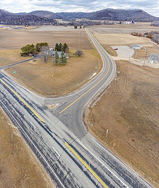
<span class="mw-page-title-main">Milton, Buffalo County, Wisconsin</span> Town in Wisconsin, United States

Milton is a town in Buffalo County in the U.S. state of Wisconsin. The population was 534 at the 2010 census. The unincorporated community of Czechville is located in the town.

<span class="mw-page-title-main">Naples, Wisconsin</span> Town in Wisconsin, United States

Naples is a town in Buffalo County in the U.S. state of Wisconsin. The population was 697 at the 2020 census.

<span class="mw-page-title-main">Day, Wisconsin</span> Town in Wisconsin, United States

Day is a town in southwest Marathon County, Wisconsin, United States. It is part of the Wausau, Wisconsin Metropolitan Statistical Area. The population was 1,085 at the 2010 census. The unincorporated community of Rozellville is located in the town. The unincorporated community of Rangeline is also located partially in the town.
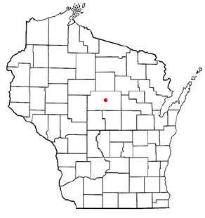
<span class="mw-page-title-main">Marathon, Wisconsin</span> Town in Wisconsin, United States

Marathon is a town in Marathon County, Wisconsin, United States. It is part of the Wausau, Wisconsin Metropolitan Statistical Area. The population was 1,048 at the 2010 census. The village of Marathon City was incorporated from a part of the town's original area.
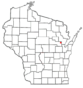
<span class="mw-page-title-main">Green Valley, Shawano County, Wisconsin</span> Town in Wisconsin, United States

Green Valley is a town in Shawano County, Wisconsin, United States. The population was 1,024 at the 2000 census. The census-designated place of Green Valley and unincorporated communities of Advance and Pulcifer are located in the town.

Alma is a town in Buffalo County in the U.S. state of Wisconsin. The population was 297 at the 2010 census. The city of Alma is located along the western town line. The unincorporated community of Tell is located in the town.

<span class="mw-page-title-main">Gillett (town), Wisconsin</span> Town in Wisconsin, United States

Gillett is a town in Oconto County, Wisconsin, United States. The population was 1,085 at the 2000 census. The City of Gillett is located within the town. The unincorporated community of Mosling is located partially in the town.

Ironton is a town in Sauk County, Wisconsin, United States. The population was 650 at the 2000 census. The town was named from deposits of iron ore in the area. The Village of Ironton is located within the town.

References

  1. 1 2 "US Board on Geographic Names". United States Geological Survey. October 25, 2007. Retrieved January 31, 2008.
  2. 1 2 "U.S. Census website". United States Census Bureau . Retrieved January 31, 2008.