
Frederick Law Olmsted was an American landscape architect, journalist, social critic, and public administrator. He is popularly considered to be the father of American landscape architecture. Olmsted was famous for co-designing many well-known urban parks with his senior partner Calvert Vaux, including Central Park in New York City, Prospect Park in Brooklyn, New York and Cadwalader Park in Trenton. He headed the pre-eminent landscape architecture and planning consultancy of late nineteenth-century America, which was carried on and expanded by his sons, Frederick Jr and John C, under the name Olmsted Brothers.

A parkway is a landscaped thoroughfare. The term is particularly used for a roadway in a park or connecting to a park from which trucks and other heavy vehicles are excluded.
A National Parkway is a designation for a protected area in the United States. The designation is given to a scenic roadway and a protected corridor of surrounding parkland. National Parkways often connect cultural or historic sites. The U.S. National Park Service manages the parkways.

New York State Route 198 (NY 198) is a state highway located entirely within the city of Buffalo, New York, in the United States. It is named the Scajaquada Expressway for Scajaquada Creek, which it parallels as it heads across northern Buffalo. NY 198 connects the Niagara Thruway in the Black Rock neighborhood to the Kensington Expressway (NY 33) on Buffalo's east side. On average, the highway carries up to 70,000 cars per day per the New York State Department of Transportation informational meeting of September 2015.
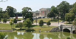
Delaware Park–Front Park System is a historic park system and national historic district located in the northern and western sections of Buffalo in Erie County, New York. The park system was designed by Frederick Law Olmsted and Calvert Vaux and developed between 1868 and 1876.

The Richardson Olmsted Campus in Buffalo, New York, United States was designated a National Historic Landmark in 1986. The site was designed by the American architect, Henry Hobson Richardson, in concert with the famed landscape team of Frederick Law Olmsted and Calvert Vaux in the late 1800s, incorporating a system of enlightened treatment for people with mental illness developed by Dr. Thomas Story Kirkbride. Over the years, as mental health treatment changed and resources were diverted, the buildings and grounds began a slow deterioration. In 2006, the Richardson Center Corporation was formed to restore the buildings.

The Allentown district is a neighborhood in Buffalo, New York. The neighborhood is home to the Allentown Historic District.
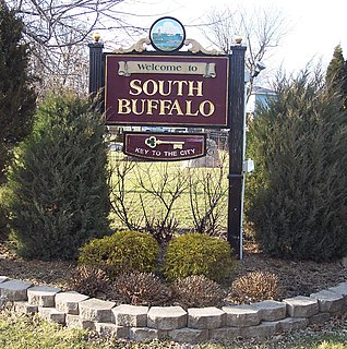
South Buffalo is a neighborhood that makes up the southern third of the City of Buffalo, New York. Traditionally known for its large Irish-American community, this community also has a strong presence of various other nationalities. The once-heavily industrialized district was home to many steel mills, automotive parts manufacturers, petroleum refineries, foundries, and machine shops. However, due to increasing deindustrialization and rising unemployment, the area has experienced growing problems with poverty and population decline.

James Addison Johnson was an American architect known for his design of various architectural landmarks in Buffalo, New York, and his use of decorative work that many consider a foreshadowing of art deco design.

Riverside Park is a historic park located in Buffalo in Erie County, New York. Located in northwest Buffalo, it is an individual park designed by the Olmsted Architectural Firm in 1898 after Frederick Law Olmsted's retirement. It is on a 22-acre (8.9 ha) site on a bluff overlooking the Niagara River. Riverside Park was designed for active recreation and periodic alterations have occurred as the community's recreation needs have changed. Despite the changes, the park retains numerous original design elements and remains as the final element completed as a part of the Olmsted plan for Buffalo's park system.
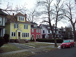
Parkside East Historic District is a national historic district located at Buffalo in Erie County, New York. The district is architecturally and historically significant for its association with the 1876 Parks and Parkways Plan for the city of Buffalo developed by Frederick Law Olmsted. It consists of 1,769 contributing structures developed from 1876 to 1936, as a middle class residential neighborhood. The district largely contains single-family dwellings, built in a variety of popular architectural styles, and located along the irregular and curvilinear street pattern developed by Olmsted. The district is located to the east of Buffalo's Delaware Park and includes the Walter V. Davidson House and the separately listed Darwin D. Martin House, both designed by Frank Lloyd Wright.

Parkside West Historic District is a national historic district located at Buffalo in Erie County, New York. The district is architecturally and historically significant for its association with the 1876 Parks and Parkways Plan for the city of Buffalo developed by Frederick Law Olmsted in 1876. It consists of 137 contributing structures developed primarily from 1923 to 1940, as a middle class residential neighborhood. The district largely contains single-family dwellings, built in a variety of popular architectural styles, and located along the irregular and curvilinear street pattern developed by Olmsted. They include homes along Nottingham Terrace and Middlesex Road, and segments of Meadow Road, Lincoln Parkway, Delaware Avenue, and Amherst Street. The district is located to the north of Buffalo's Delaware Park.

Martin Luther King Jr. Park, originally The Parade and after 1896, Humboldt Park, is a historic park located in Buffalo in Erie County, New York. The park is located in east Buffalo and bisected by Fillmore Avenue.

Cazenovia Park–South Park System is a historic park system located in the South Buffalo neighborhood at Buffalo in Erie County, New York. The interconnected set of parkways and parks was designed by Frederick Law Olmsted as part of his parks plan for the city of Buffalo.

The Old Harbor Reservation Parkways are three historic roads in the Old Harbor area of Boston. They are part of the Boston parkway system designed by Frederick Law Olmsted. They include

Park Drive is a mostly one-way, two-lane parkway in the Fenway-Kenmore neighborhood of Boston that runs along the northern and western edges of the Back Bay Fens before ending at Mountfort Street. As part of the Emerald Necklace park system mainly designed by Frederick Law Olmsted in the late 19th century, Park Drive, along with the Back Bay Fens and the Fenway, connects the Commonwealth Avenue Mall and Boylston Street to Beacon Street and the Riverway. For a portion of its length, the parkway runs along the Muddy River and is part of the Metropolitan Park System of Greater Boston's Muddy River Reservation. Like others in the park system, it is maintained by the Massachusetts Department of Conservation and Recreation.

The Architecture of Buffalo, New York, particularly the buildings constructed between the American Civil War and the Great Depression, is said to have created a new, distinctly American form of architecture and to have influenced design throughout the world.
The Lower West Side is a neighborhood in Buffalo, New York.
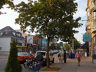
Elmwood Village is a neighborhood in Buffalo, New York.

The historic Chicago park and boulevard system is a ring of parks connected by wide, planted-median boulevards that winds through the north, west, and south sides of the City of Chicago. The neighborhoods along this historic stretch include, Logan Square, Humboldt Park, Englewood, Back of the Yards, Lawndale, and Bronzeville. It reaches as far west as Garfield Park and turns south east to Douglas Park. In the south, it reaches Washington Park and Jackson Park, including the Midway Plaisance, used for the 1893 World's Fair.


