

Burnt Oak Brook is a one-mile-long stream between Mill Hill and Burnt Oak in the London Borough of Barnet. It is a tributary of the Silk Stream, which is a tributary of the River Brent, which is a tributary of the River Thames.
Burnt Oak Brook is a one-mile-long stream between Mill Hill and Burnt Oak in the London Borough of Barnet. It is a tributary of the Silk Stream, which is a tributary of the River Brent, which is a tributary of the River Thames.
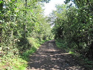
A minor spring in The Mill Field in Mill Hill is probably a source of a tributary of Burnt Oak Brook, but the brook itself is first visible in Simmonds Mead Open Space, a small green open space at the junction of Watford Way and Lawrence Street. [1] The stream then again passes through an underground pipe to re-emerge in the north-west corner of Lyndhurst Park. It goes along The Meads and under Deansbrook Road to pass through Abbots Road Allotments into Watling Park. On exiting from the park it goes underground to join the Silk Stream near Silkstream Park.
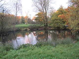
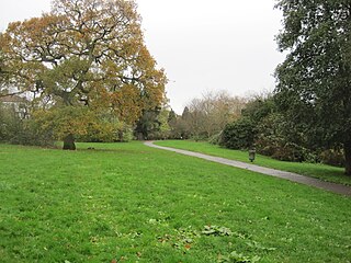
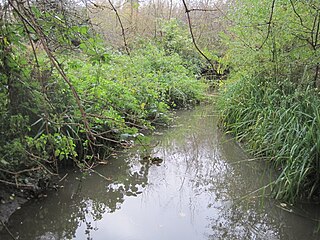
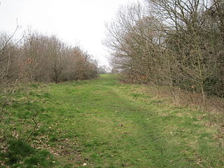
The section of the brook between Lyndhurst Park and Watling Park is part of the Silk Stream and Burnt Oak Brook Site of Borough Importance for Nature Conservation, Grade II. [2] [3] Downstream of Lyndhurst Park, it passes through a narrow belt of mown grass which is left wild close to the brook, with scattered trees and common wild flowers on the banks. In Watling Park the stream mainly follows a natural course and crack-willows, hawthorn and alder form a woodland corridor for wildlife. Grey wagtails often forage among the pebbles of the brook. [4]

Dollis Brook is a waterway which runs through Barnet in north London. It is a tributary of the River Brent, which is itself a tributary of the River Thames.

Folly Brook is a 2+1⁄4-mile (3.6 km) long brook in the London Borough of Barnet. It is a tributary of Dollis Brook, which is a tributary of the River Brent, which is a tributary of the River Thames. Folly Brook is lined for most of its length by narrow strips of woodland and scrub, with a good variety of trees and shrubs. It is one of the best streams in Barnet for small aquatic invertebrates, including several species of caddis fly and a stonefly, which are only found in unpolluted waters.

Edgwarebury Park is a 22-hectare park in Edgware in the London Borough of Barnet. It was once part of the manor of Earlsbury, which was first mentioned in 1216. In the later Middle Ages it was owned by All Souls College, Oxford, and there is still evidence of the older landscape of fields and woodland. Hendon Rural District and Middlesex County Council bought the land in two parts in 1929 and 1932, and the park opened in the latter year. It is now owned and managed by Barnet Council.

The Silk Stream is a brook just over 4 kilometres (2.5 mi) long in the London Borough of Barnet. It is one of the major components of the Blue Ribbon Network.
Burtonhole Lane and Pasture is a 6.5-hectare (16-acre) Site of Borough Importance for Nature Conservation, Grade II, between Mill Hill and Totteridge in the London Borough of Barnet. It consists of Burtonhole Lane between Partingdale Lane and Burtonhole Close, a footpath east from Burtonhole Lane towards Folly Brook, two fields south of the footpath, and a narrow belt of privately owned woodland north of the footpath. Burtonhole Brook, a tributary of Folly Brook, crosses Burtonhole Lane and the fields.

King George's Fields is a 28-hectare (69-acre) Site of Borough Importance for Nature Conservation, Grade II, in Monken Hadley in the London Borough of Barnet.

Scratchwood is an extensive, mainly wooded, country park in Mill Hill in the London Borough of Barnet. The 57-hectare site is a Site of Metropolitan Importance for Nature Conservation and together with the neighbouring Moat Mount Open Space. It is a Local Nature Reserve.

Oak Hill Wood is a 10-hectare Local Nature Reserve (LNR) and a Site of Borough Importance for Nature Conservation Grade I, in East Barnet, London. It is owned by the London Borough of Barnet, and part of it is a 5.5-hectare nature reserve managed by the London Wildlife Trust.

Copthall Railway Walk and Copthall Old Common is a 9-hectare (22-acre) Site of Borough Importance for Nature Conservation, Grade II, in Mill Hill in the London Borough of Barnet.
Totteridge Green is a five hectare Site of Borough Importance for Nature Conservation, Grade II, in Totteridge in the London Borough of Barnet. It is also registered common land.
Stoneyfields Park is a three-hectare public park in The Hale in the London Borough of Barnet.
Deans Brook is a two-kilometre-long stream which runs between Mill Hill and Edgware in the London Borough of Barnet. It is a tributary of the Silk Stream, which is a tributary of the River Brent, which is a tributary of the River Thames.

Mill Hill Old Railway Nature Reserve is a 2.3-hectare (5.7-acre) Site of Borough Importance for Nature Conservation, Grade II, in Mill Hill in the London Borough of Barnet.

Mutton Brook is a stream which runs between East Finchley and Hendon in the London Borough of Barnet. It is a tributary of the River Brent, which is itself a tributary of the River Thames.

Friary Park is a 9-hectare (22-acre) formal Edwardian park in Friern Barnet in the London Borough of Barnet. The park opened to the public in 1910, and the facilities include a cafe, playground and skatepark. It is a Site of Local Importance for Nature Conservation, and contains three redwood trees and a small stream. It is next to North Middlesex Golf Course, which contains the North Middlesex Golf Course Ponds nature reserve; this is not open to the public.

Copthall South Fields is a six hectare Site of Local Importance for Nature Conservation, next to Fiveways Corner on the A1, in Mill Hill in the London Borough of Barnet.
The Mill Field is a 3.4-hectare (8.4-acre) Site of Borough Importance for Nature Conservation, Grade II, in Mill Hill in the London Borough of Barnet. It is a public open space which slopes steeply down from the road called The Ridgeway. It may be the site of the windmill which gave the area its name. This was documented as early as 1321 and had disappeared by 1754.
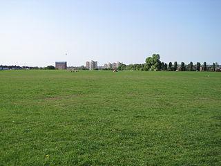
Clitterhouse Recreation Ground or Clitterhouse Playing Fields is a park and Site of Local Importance for Nature Conservation in Brent Cross in the London Borough of Barnet. It is a large area of mown grass with a children's playground, bordered by thick hedges. Clitterhouse Stream, a tributary of the River Brent, runs along its eastern border.
Watling Park is a public park in Burnt Oak in the London Borough of Barnet. It is one of Barnet's sixteen premier parks.