List of nature reserves in the London Borough of Barnet

Last updated

Beech Hill Lake in Monken Hadley Common Beech Hill Lake.jpg
Beech Hill Lake in Monken Hadley Common

The London Borough of Barnet, on the northern outskirts of London, is mainly residential, but it has large areas of green space and farmland. The spread of suburban development into the countryside was halted by the designation of a statutory Green Belt around London after the Second World War, and almost one third of Barnet's area of 8,663 hectares (21,410 acres) is Green Belt. Without this control, Barnet would be very different today, and this list of nature reserves would be much shorter. [1]

Contents

Most of Barnet lies over London Clay, which is poor for agriculture, and open land is mainly used for activities such as horse grazing, playing fields, parks and golf courses. Features of the traditional agricultural landscape have survived, such as old hedgerows, ancient trees and areas of herb-rich grassland. Some hay meadows have a large diversity of wild flowers, and the London Ecology Unit (LEU) [lower-alpha 1] described them as one of Barnet's most important ecological assets. [4]

Barnet has large areas with designations intended to protect them from "inappropriate development", and to "provide the strongest protection for the preservation of Barnet's green and natural open spaces". As well as 2,466 hectares (6,090 acres) of Green Belt, Barnet has another 690 hectares (1,700 acres) of Metropolitan Open Land, which receive a similar level of protection. Watling Chase Community Forest [lower-alpha 2] covers 72 square miles (190 km2), extending north and west from Totteridge into south Hertfordshire. [6]

In 1992 Barnet Council commissioned the LEU to carry out a survey of wildlife habitats in the borough, which looked at green sites covering 4,055 hectares (10,020 acres), 45% of the borough. In 1997 the LEU published Nature Conservation in Barnet, which described 67 Sites of Importance for Nature Conservation (SINCs). [7] [8] This formed the basis of Barnet's nature conservation policies in its 2006 Unitary Development Plan, designated as "a material planning consideration" to be used as "non-statutory guidance". [9] The table below lists SINCs described in Nature Conservation in Barnet. [10] [lower-alpha 3] SINCs do not have statutory protection, but some sites are also wholly or partly designated as Sites of Special Scientific Interest [lower-alpha 4] or local nature reserves, [lower-alpha 5] which do have statutory protection. [18] According to a report of the Department for Environment, Food and Rural Affairs, 39% of Barnet's SINCs were "in positive conservation management" in 2009–10. Barnet Council did not supply figures for 2010–11, 2011–12 or 2012–13. [19]

Nature reserves

Key

Map all coordinates using: OpenStreetMap

Sites

SitePhotographHectares [lower-alpha 6] Location [lower-alpha 7] AccessTypeDescription
Arkley Lane and Pastures Arkley Lane.JPG 52 Arkley
51°39′18″N0°13′48″W / 51.655°N 0.230°W / 51.655; -0.230 (Arkley Lane and Pastures)
TQ 225 965
PPB2The site covers Arkley Lane, a neighbouring woodland and fields on either side. The lane, now a quiet country path, is thought to be an old drovers' road. The hedges have massive gnarled oak trees, lofty ash and mature field maples, while the hedge bottoms have a diverse range of plants. The woodland is probably ancient, and supports a variety of nesting birds. [25]
Arkley South Fields Arkley South Field.JPG 38 Arkley
51°38′28″N0°13′55″W / 51.641°N 0.232°W / 51.641; -0.232 (Arkley South Fields)
TQ 224 951
VB2This is an extensive area of open grassland crossed by ditches and with mature hedgerows. Its importance lies in its breeding grassland birds, including skylarks and meadow pipits, and it is the main site in the borough for these species. Skylarks have declined in recent years, and they are a priority species in the UK Biodiversity Action Plan. [26] [27]
Arrandene Open Space and Featherstone Hill Arrandene Open Space.JPG 25 Mill Hill
51°36′47″N0°13′48″W / 51.613°N 0.230°W / 51.613; -0.230 (Arrandene Open Space and Featherstone Hill)
TQ 226 920
PMThis site's fields, which are divided by ancient hedgerows, were rated by the LEU as one of the best examples of old hay meadows in London. Wild flowers are abundant in the summer, with each field having its own specialities. The woods and scrub are important habitats for birds. [28] [29]
Ashley Lane Ashley Lane.JPG 1 Hendon
51°36′04″N0°13′01″W / 51.601°N 0.217°W / 51.601; -0.217 (Ashley Lane)
TQ 236 906
PB2This ancient trackway is over 400 years old. It has retained its ancient hedgerows along much of its length. Old oak and ash trees line the lane, and there are also some wild service-trees. The hedgerows have diverse shrub species. [30]
Avenue House Grounds Avenue House Grounds pond.JPG 3.5 Church End
51°35′51″N0°11′37″W / 51.5975°N 0.1937°W / 51.5975; -0.1937 (Avenue House Grounds)
TQ 251 902
PLThis small public park is the garden of Avenue House. It has a terrace with ornamental plants and a rockery. There is a pond which has hornwort, yellow iris and water-lilies, together with common frogs and koi carp. There are large areas of shrubbery. [31]
Barfield Allotments Nature Park Barfield Allotments Nature Park.JPG 0.9 Whetstone
51°37′37″N0°09′29″W / 51.627°N 0.158°W / 51.627; -0.158 (Barfield Allotments Nature Park)
TQ 276 935
VLThis small wildlife site is adjacent to a playground. Its scrub and grassland provide a haven for common lizards and slowworms, both legally protected species. [32]
Barnet Countryside Centre Barnet Countryside Centre from Byng Road.JPG 2.8 High Barnet
51°39′29″N0°12′58″W / 51.658°N 0.216°W / 51.658; -0.216 (Countryside Centre)
TQ 234 969
VLThe centre was established in the 1970s to provide schoolchildren with contact with farm animals and wildlife. After a period of closure the now renamed Barnet Environment Centre operates a full programme of environmental education visits for school children from Nursery to A level. Its woodland has a wide range of birds. Ponds support aquatic life and more open areas have a wide variety of insects. [33] [34]
Bell's Hill Burial Ground Bells Hill Burial Ground 2.JPG 2.8 High Barnet
51°38′56″N0°12′54″W / 51.649°N 0.215°W / 51.649; -0.215 (Bell's Hill Burial Ground)
TQ 235 959
PLThis small cemetery has mown grass in the western part, but in the east it is less managed, and has a wide variety of wild flowers. The LEU described it as a fine site for butterflies, including gatekeeper, small skipper and meadow brown. [35] [36]
Belmont Open Space, Cockfosters Belmont Open Space Cockfosters.JPG 1.0 Cockfosters
51°38′49″N0°09′25″W / 51.647°N 0.157°W / 51.647; -0.157 (Belmont Open Space)
TQ 275 958
PLThis site is a secluded small park, which has a fair number of wild flowers and mature trees, together with an old hedgerow. The local Royal Society for the Protection of Birds has recorded a wide range of birds for a small suburban park. [37]
Big Wood and Little Wood Big Wood, N2.JPG 8.6 Hampstead Garden Suburb
51°34′59″N0°11′24″W / 51.583°N 0.190°W / 51.583; -0.190 (Big Wood)
TQ 255 887
51°35′10″N0°11′35″W / 51.586°N 0.193°W / 51.586; -0.193 (Little Wood)
TQ 253 890
PB1 LNRThese woods are remnants of an ancient large forest. Big Wood has a wide variety of trees and shrubs, with pedunculate oak the dominant species. There are several old wild service-trees. All the common woodland species of birds are present in the woods, and Little Wood has a small theatre. [38]
Brent Reservoir (Welsh Harp) Brent Res view.JPG 46 [lower-alpha 8] Hendon
51°34′16″N0°14′42″W / 51.571°N 0.245°W / 51.571; -0.245 (Brent Reservoir)
TQ 215 871
PM LNR SSSIBrent Reservoir is Barnet's only Site of Special Scientific Interest. It is an important breeding site for waterfowl and other birds, including one of Britain's largest breeding populations of great crested grebe. It has many uncommon wetland plants and insects, including over forty rare species of invertebrates. It is also one of the few London sites with water shrews. [39]
Bruno's Field Bruno's Field.JPG 6.6 Mill Hill
51°37′34″N0°14′46″W / 51.626°N 0.246°W / 51.626; -0.246 (Bruno's Field)
TQ 215 934
NOB2This steeply sloping site has a varied topography. On higher ground there are dry areas, while lower down there are areas of bog crossed by several small streams. The field has typical pasture herbs, a scattering of mature trees and a wide variety of birds. [40]
Burtonhole Lane and Pasture Burtonhole Lane.JPG 8.5 Mill Hill
51°37′12″N0°12′25″W / 51.620°N 0.207°W / 51.620; -0.207 (Burtonhole Lane and Pasture)
TQ 242 927
PPB2Burtonhole Lane is an old green lane which is now a bridleway and footpath. Its hedgerow has several species of trees, such as wild service-tree and black bryony, which suggest that it is ancient, and its verge is rich in wild flowers. The pasture area is dominated by Yorkshire Fog. It is crossed by Burtonhole Brook, which supports a number of uncommon plant species. [41]
Cherry Tree Wood Cherry Tree Wood 2.JPG 4.7 East Finchley
51°35′10″N0°09′36″W / 51.586°N 0.160°W / 51.586; -0.160 (Cherry Tree Wood)
TQ 275 890
PLThis local park was once part of the Bishop of London's Great Hornsey Park. it has an inner area of lawn with a playground and tennis courts, which is surrounded by the surviving ancient woodland. Its tree canopy is mainly oak and hornbeam, and its sparse undergrowth has a number of species associated with ancient woodland, such as wild garlic and wood-sedge. [42]
Clarefield Park Clarefield Park.JPG 3.2 Brent Cross
51°34′19″N0°13′16″W / 51.572°N 0.221°W / 51.572; -0.221 (Clarefield Park)
TQ 232 874
PLThis small park has mown grass, a children's playground, scented shrubs and a small wildlife pond. [43] In October 2010 Barnet Council gave planning consent for the Brent Cross Cricklewood Planning Application, which includes closure of the Clarefield Park and development of the area. [44] [45]
Clay Lane Clay Lane.JPG 1.8 Edgware
51°37′48″N0°16′23″W / 51.630°N 0.273°W / 51.630; -0.273 (Clay Lane)
TQ 194 939
PLThis is an ancient green lane which leads from Edgwarebury into the Hertfordshire countryside. An old hedge bank and herbaceous plants associated with ancient woodland suggest that it is of considerable antiquity. Its canopy has fine old oaks above an understorey of midland hawthorn, blackthorn and hazel. [46]
Clitterhouse Recreation Ground Clitterhouse Recreation Ground.JPG 16 Brent Cross
51°34′08″N0°12′54″W / 51.569°N 0.215°W / 51.569; -0.215 (Clitterhouse Recreation Ground)
TQ 238 871
PLThis large recreation ground is managed as a sports field, and its main wildlife interest is in the unmanaged perimeter which has species such as crab apple which are typical of ancient hedgerows. [47] The Brent Cross Cricklewood scheme includes improvements to the Recreation Ground. [48]
College Farm College Farm2009.JPG 4.5 Finchley
51°35′35″N0°12′07″W / 51.593°N 0.202°W / 51.593; -0.202 (College Farm)
TQ 246 897
PPLCollege Farm in central Finchley was a working farm open to the public from 1980 until the foot and mouth epidemic in 2001. A charitable trust purchased the site in 2006, but as of March 2013 efforts to re-open the farm have failed, and the farm buildings are an equestrian shop. The site has trees and scrub which provide a habitat for birds, and pipistrelle bats have been recorded. [49]
Coppetts Wood and Scrublands Local Nature Reserve Coppett's Wood.JPG 12 Colney Hatch
51°36′32″N0°09′25″W / 51.609°N 0.157°W / 51.609; -0.157 (Coppett's Wood and Scrublands)
TQ 277 915
PB1 LNRThese sites provide a range of wildlife habitats. Coppetts Wood has a population of juneberry, and a pond which has yellow iris and breeding common frogs and smooth newts. Scrublands is on the site of a former sewage works. It has a number of rare plant and insect species. [50]
Copthall Railway Walk and Copthall Old Common Copthall Railway Walk.JPG 11 Mill Hill
51°36′25″N0°13′23″W / 51.607°N 0.223°W / 51.607; -0.223 (Copthall Railway Walk and Copthall Old Common)
TQ 231 912
PB2This is a green path along an old railway line, with Copthall Old Common at one side. The grassland on the walk is mostly false oat-grass, with a wide diversity of wild flowers. The hedges have some fine old oaks and areas of bluebells. A pond on the common has yellow iris and water-starwort. The site also has a range of birds and invertebrates, including glow-worms, a scarce and declining species. [51]
Copthall South Fields Copthall South Fields hedgrerow.JPG 6 Mill Hill
51°36′07″N0°13′59″W / 51.602°N 0.233°W / 51.602; -0.233 (Copthall South Fields)
TQ 225 908
PLThe fields have what the LEU described as "a surprisingly rural quality", even though they lie alongside the A1 road. The hedgerow trees are oak, ash and field maple, and the fields contain flowers typical of clay grassland, such as meadow vetchling, meadow buttercup and common sorrel. [52]
Deans Brook and Stoneyfields Park Deans Brook.JPG 3.3 Edgware
51°37′30″N0°15′47″W / 51.625°N 0.263°W / 51.625; -0.263 (Deans Brook and Stoneyfields Park)
TQ 203 929
PPB2 Kingfishers and grey wagtails are often seen along the two kilometre Deans Brook, which largely follows a natural course. In Stoneyfields Park it has been widened into an ornamental lake, which has a wide fringe of tall water plants such as great and lesser reedmace, and breeding birds such as coots, moorhens and mallards. The woodland in the park is oak and hazel, and the hedgerows have plants which show that it is ancient, such as wood-sedge and ramsons. [53]
Drivers Hill Drivers Hill field.JPG 10 Mill Hill
51°36′58″N0°13′16″W / 51.616°N 0.221°W / 51.616; -0.221 (Drivers Hill)
TQ 231 920
VB2This site consists of several fields and two small woods. The pasture areas have a variety of grasses and wild flowers, including some typical of old pasture, such as crested dog's-tail and oval sedge. Wetter areas have plants such as tufted hair-grass and greater bird's-foot-trefoil, while the woods are mainly oak, ash and sycamore. [54]
East Finchley Cemetery East Finchley cemetery.jpg 16 East Finchley
51°35′31″N0°11′02″W / 51.592°N 0.184°W / 51.592; -0.184 (East Finchley Cemetery)
TQ 258 896
PLMost of this cemetery is formally managed, but it has some old oaks which have survived from its rural past, and evergreen trees such as cedar of Lebanon and Wellingtonia provide a habitat for goldcrest and coal tit. In less managed areas there are wild flowers such as burnet saxifrage, and around the edges of the site ash and sycamore are evolving into woodland. [55]
Edgware Way Rough Edgware Way Grassland.JPG 5.5 Edgware
51°37′30″N0°17′17″W / 51.625°N 0.288°W / 51.625; -0.288 (Edgware Way Rough)
TQ 185 932
FMThis site is London Clay pasture which has not been cultivated for many years. In areas of damp grassland it has London's largest population of the herb great burnet, and other rare plants characteristic of old meadows include sneezewort and devil's-bit scabious. Breeding birds include the yellowhammer and spotted flycatcher, both of which are declining species. [56]
Edgwarebury Brook Edgwarebury Brook in Edgwarebury Park.JPG 5 Edgware
51°37′26″N0°17′02″W / 51.624°N 0.284°W / 51.624; -0.284 (Edgwarebury Brook)
TQ 188 935
VB2This stream rises among fields and flows through Edgware Way Rough on to suburban Edgware, where it join Deans Brook. The most important section ecologically is the upper part, which was rated by the LEU as one of the best areas of wetland vegetation in Barnet. There is a mass of floating sweet-grass with clumps of brooklime and water pepper. The banks have clumps of great willowherb and trifid bur-marigold. [57]
Edgwarebury Park Edgwarebury Park.JPG 15 Edgware
51°37′30″N0°16′59″W / 51.625°N 0.283°W / 51.625; -0.283 (Edgwarebury Park)
TQ 190 934
PLThe hedgerows in this large park have fine oak and ash trees, and the presence of wild service-trees is considered an indicator that the hedges are ancient. It has a variety of wild flowers in damp areas and nesting birds include song thrush, mistle thrush, great spotted woodpecker and common whitethroat. [58]
Folly Brook and Darland's Lake Nature Reserve Darlands Lake 2.JPG 11 Arkley/Woodside Park
51°37′30″N0°12′18″W / 51.625°N 0.205°W / 51.625; -0.205 (Folly Brook and Darland's Lake Nature Reserve)
TQ 240 934
PB1Darland's Lake, which is now a nature reserve, was originally an ornamental feature created by damming Folly Brook. The water quality is good, and Darland's Lake has extensive reed beds. On its margin there is a boggy wood of willows and alder, a scarce habitat in London. The site has a number of tree species typical of ancient woodland, and a diverse bird and invertebrate population, while eighteen species of mammal have been recorded. [59]
Friary Park Friary Park formal garden.JPG 8.8 Friern Barnet
51°37′05″N0°09′43″W / 51.618°N 0.162°W / 51.618; -0.162 (Friary Park)
TQ 273 926
PLOld oak trees date from before the foundation of the park, and they support woodland birds such as nuthatch and treecreeper. Near a small stream, a tributary of Pymme's Brook, there are wildflowers such as cow parsley, lesser celandine, dog violet and garlic mustard. [60]
Glebe Lane Pastures Glebe Lane Pastures.JPG 11 Arkley
51°38′42″N0°14′02″W / 51.645°N 0.234°W / 51.645; -0.234 (Glebe Lane Pastures)
TQ 223 954
VB1This is an area of five fields which was once part of a communal pasture called Barnet Common. The grassland is unimproved clay grassland, a relic of the old common. It has many species of wild flowers, and the most important aspect of the site is its diverse old meadow plants. Some of the rarities have been found in temporary pools, such as bog stitchwort and pond and ivy-leaved crowfoot. [61]
Glebelands Local Nature Reserve Glebelands.JPG 7.5 Colney Hatch
51°36′14″N0°10′08″W / 51.604°N 0.169°W / 51.604; -0.169 (Glebelands Local Nature Reserve)
TQ 270 911
PB1 LNRThis is a fragment of the old Finchley Common. It has tall scrub and woodland, together with numerous streams and seasonal ponds. The pools have a number of rare species, and it is the only known London site for lesser water-plantain. Other rarities are thread-leaved water-crowfoot ( Ranunculus trichophyllus ) and marsh speedwell, and the site has diverse breeding birds. [62]
Greenhill Gardens Greenhill Gardens lake.JPG 1.5 High Barnet
51°38′41″N0°10′57″W / 51.6446°N 0.1824°W / 51.6446; -0.1824 (Greenhill Gardens)
TQ 258 955
PLThe principal feature of this small park is its large lake, with a wooded island. Water birds include mallard, mute swan, coot and moorhen, and pipistrelle and noctule bats have been seen foraging. [63]
Hadley Green Hadley Green.JPG 10 Monken Hadley
51°39′40″N0°11′56″W / 51.661°N 0.199°W / 51.661; -0.199 (Hadley Green)
TQ 246 973
PMHadley Green was the site of one of the major battles of the Wars of the Roses, the Battle of Barnet in 1471. It is mainly acid grassland with some wetter areas and several ponds. It has a number of rare species of plant, such as mat-grass and oval sedge in the grassland, lesser spearwort and marsh ragwort in the ditches, and tufted forget-me-not and fiddle dock in the ponds. There are also eleven species of dragonflies and damselflies. [64]
Hampstead Heath Extension and Golders Hill Park Golders Hill Park in 2006.jpg 46 [lower-alpha 9] Golders Green
51°34′30″N0°11′10″W / 51.575°N 0.186°W / 51.575; -0.186 (Hampstead Heath Extension and Golders Hill Park)
TQ 258 878
PMThe LEU described the hedges of Hampstead Heath Extension as some of the best on the Heath. It also has a chain of seven ponds which have a wide variety of aquatic and pond margin plant species. Golders Hill Park has areas of formal and less managed parkland. Swan Pond is a large ornamental lake which has a variety of exotic and native wildfowl. [65]
Hendon Park and Northern Line Railway Cutting Hendon Park.JPG 14 Hendon
51°34′55″N0°13′19″W / 51.582°N 0.222°W / 51.582; -0.222 (Hendon Park and Northern Line Railway Cutting)
TQ 233 884
PLThe site is mainly informal parkland, with mown grass and mature trees. A variety of small birds forage among the tall hedgerows at the northern end. The railway cutting has rough grassland and patches of woodland, which provide a habitat for birds such as the great spotted woodpecker and goldcrest. [66]
King George's Fields King George's Fields.JPG 27 Monken Hadley
51°39′22″N0°11′42″W / 51.656°N 0.195°W / 51.656; -0.195 (King George's Fields)
TQ 250 969
PB2This site is mainly covered with coarse grasses, but it also has herb-rich fields dominated by creeping bent and red fescue, together with wild flowers commonly found on unimproved grassland. Oak trees grow in old hedges, and breeding birds include sparrowhawk and stock dove. [67]
Lakeside Nature Reserve Lakeside Nature Reserve.JPG 0.6 Church End
51°35′58″N0°11′06″W / 51.5994°N 0.1850°W / 51.5994; -0.1850 (Lakeside Nature Reserve)
TQ 257 904
VLThis site is a lake with a small island behind an office block, surrounded by a belt of trees. The island provides a safe breeding ground for wildfowl, away from mammalian predators. The lake also has fish, frogs, toads and terrapins. [68]
Lower Dollis Brook, Brent Park and River Brent Dollis brook windsor open space.JPG 28 Woodside Park/Hendon
51°34′19″N0°14′10″W / 51.572°N 0.236°W / 51.572; -0.236 (Lower Dollis Brook)
TQ 243 906
PB2This site covers Dollis Brook between Woodside Park and its end in Temple Fortune, where it becomes the River Brent, the Brent as far as the A1, and Brent Park. At the Woodside Park end there is a wild area with old ivy-clad oaks and alder. Brent Park has a lake which may have been created by the abbots of Westminster almost a thousand years ago. It has a wooded island which provides a refuge for birds. [69]
Mill Hill Golf Course Mill Hill Golf Course 2.JPG 60 Mill Hill
51°38′02″N0°15′32″W / 51.634°N 0.259°W / 51.634; -0.259 (Mill Hill Golf Course)
TQ 206 942
NOB1The golf course has several small streams which meet in Stoneyfields Lake, which was formed by damming Deans Brook. On the edges of the fairways there is a variety of wild flowers, some of them relics of old farm meadows. The most important area ecologically is acid grassland which contains the rare plant dyer's greenweed. [70]
Mill Hill Old Railway Nature Reserve Mill Hill Old Railway.JPG 9 Mill Hill
51°36′43″N0°15′25″W / 51.612°N 0.257°W / 51.612; -0.257 (Mill Hill Old Railway Nature Reserve)
TQ 203 917
PLB2This linear nature reserve on the site of an old railway line is managed by the London Wildlife Trust. Trees in the woodland canopy include oak and sycamore, and there is a scrub layer of hawthorn, blackthorn and grey willow. The grassland has a range of wild flowers, and the site has a large population of slow-worms. [71]
Mill Hill Substation Pastures Mill Hill Substation Pastures 2.JPG 15 Mill Hill
51°37′00″N0°12′38″W / 51.6168°N 0.2106°W / 51.6168; -0.2106 (Mill Hill Substation Pastures)
TQ 240 925
VMThe LEU described this site as a "remarkable example of unimproved herb-rich pasture on damp clay soil, with substantial populations of attractive and locally uncommon wild flowers". Burtonhole Brook crosses the site, providing a corridor of damp habitat, and old hedgerows and small areas of woodland provide a refuge for birds. [72]
Moat Mount Open Space and Barnet Gate Wood Leg of Mutton Pond.JPG 110 Mill Hill
51°38′02″N0°15′11″W / 51.634°N 0.253°W / 51.634; -0.253 (Moat Mount Open Space and Barnet Gate Wood)
TQ 215 943
PB2 LNRMoat Mount is a large hilly area, which slopes down to valleys, which have open fields crossed by old hedgerows. Towards the top of the hill woodland opens out to Leg of Mutton Pond, which has clumps of water-lilies and Nuttall's waterweed. The site also includes the neighbouring Barnet Gate Wood, which is probably a remnant of an ancient forest. [73]
Monken Hadley Common Monken Hadley Common 1.JPG 72 Monken Hadley
51°39′36″N0°10′37″W / 51.660°N 0.177°W / 51.660; -0.177 (Monken Hadley Common)
TQ 263 972
PB1 CLThis large common is mostly wooded, with small areas of grassland. Daubenton's bats forage over an artificial lake called Jack's Lake. The principal trees are oak, hornbeam and beech, and the ground flora includes several plants which are normally only present in ancient woodland. Breeding birds include sparrowhawk, tawny owl and cuckoo. [74]
Mutton Brook Mutton Brook in Brookside Walk.JPG 13 Hampstead Garden Suburb
51°35′13″N0°12′36″W / 51.587°N 0.210°W / 51.587; -0.210 (Mutton Brook)
TQ 251 892
PLThe brook is a tributary of the River Brent. Oak, ash and willow trees fringe the bank, providing a habitat for birds, and grey wagtails forage at the water's edge. Woodland wild flowers include dog's mercury and winter heliotrope. [75] [76]
New Southgate Cemetery Brunswick Park Cemetery, London N11 - geograph.org.uk - 759207.jpg 20 Brunswick Park
51°37′26″N0°08′38″W / 51.624°N 0.144°W / 51.624; -0.144 (New Southgate Cemetery)
TQ 286 933
PB2The cemetery is closely managed in the vicinity of recent burials, but woodland has developed in other areas, where young oak, ash, birch and sycamore are growing between mature oak and yew trees. There is a range of breeding birds such as green and great spotted woodpeckers, coal tit and nuthatch, and the cemetery is the most northerly known site for the dusky cockroach, a native species. [77]
North Middlesex Golf Course Ponds North Middlesex Golf Club ponds 2.JPG 0.8 Whetstone
51°37′16″N0°10′05″W / 51.621°N 0.168°W / 51.621; -0.168 (North Middlesex Golf Course Ponds)
TQ 269 930
NOB2These ponds have one of few known populations of palmate newts in Barnet, and there is also a colony of the more common smooth newt. The pond edges have some Michaelmas daisies and water mint. A ditch leads to a small area of woodland, and this is probably an important corridor for amphibia. [78]
Northern Line Embankment, High Barnet Northern Line Embankment, High Barnet.JPG 6.5 Totteridge/High Barnet
51°38′28″N0°11′06″W / 51.641°N 0.185°W / 51.641; -0.185 (Northern Line Embankment, High Barnet)
TQ 256 951
VB2The vegetation varies between low bramble scrub and light woodland, and it provides a habitat for small birds such as tits and finches. The main ecological significance of the site lies in one of Barnet's few known colonies of the common lizard, which are protected by the absence of pesticides, and freedom from dogs, cats and people. [79]
Oak Hill Wood Oak Hill Wood.JPG 10 East Barnet
51°38′27″N0°09′08″W / 51.6409°N 0.1521°W / 51.6409; -0.1521 (Oak Hill Wood)
TQ 280 951
PB1 LNRThis wood is managed by the London Wildlife Trust. The canopy is oak, hornbeam and ash, with some horse chestnut trees. Ground plants include bluebell and wood speedwell. A small stream flows through the wood, and a meadow has common wild flowers and butterflies. The site also has several bat species. [80]
Oakleigh Park Rail Cutting Oakleigh Park Rail Cutting looking south.jpg 8.0 Oakleigh Park
51°37′59″N0°09′43″W / 51.633°N 0.162°W / 51.633; -0.162 (Oakleigh Park Rail Cutting)
TQ 272 944
VLThis site has a diverse habitat. The eastern bank has an open expanse of bramble scrub with clumps of blackthorn, hawthorn and dog-rose. The western bank has a mature woodland of oak, ash and sycamore, with goat willow in wetter areas. Tall herbs are useful to seed eating birds such goldfinch, wrens and dunnocks. [81]
Princes Park Princes Park tree.JPG 1.2 Temple Fortune
51°34′55″N0°12′22″W / 51.5820°N 0.2061°W / 51.5820; -0.2061 (Princes Park)
TQ 243 885
PLThis small park is highly managed, with mown lawns and flowerbeds, but some of the old trees pre-date the surrounding houses. In the south-east corner a small woodland appears to be a fragment of an old farm wood. Mature hawthorns around the perimeter may be relics of old farm hedgerows. [82]
Pymme's Brook Pymme's Brook in Oak Hill Park 2.JPG 13 Monken Hadley/New Southgate
51°37′55″N0°08′46″W / 51.6320°N 0.1462°W / 51.6320; -0.1462 (Pymme's Brook)
TQ 284 942
PB2Two separate sections of Pymme's Brook are included in this site. The northern section, which runs 500 metres from Monken Hadley, goes through rough grassland and scattered scrub, with a narrow strip of oak woodland. The three kilometre southern stretch to the boundary with Enfield is largely wooded. One part is ancient, with an understorey which includes wild service-trees, midland hawthorn, field maple and crab apple. [83]
Rowley Green Common Rowley Green Common.JPG 4.9 Arkley
51°39′01″N0°14′36″W / 51.6502°N 0.2433°W / 51.6502; -0.2433 (Rowley Green Common)
TQ 217 960
PM LNR CLThis site has a mosaic of habitats with different conditions and many rare species. Most of it is woodland with fairly young trees, and the most important area ecologically is a sphagnum bog, described by the LEU as an extremely rare habitat in south-east England. The site also has an area of acid grassland and a pond which supports diverse wetland plants. [84]
Rowley Lodge Field Rowley Lodge Field 1.JPG 4.4 Arkley
51°38′44″N0°14′28″W / 51.6456°N 0.2410°W / 51.6456; -0.2410 (Rowley Lodge Field)
TQ 218 955
FB2This is an old hay meadow with a few oak trees and small patches of scrub. It has diverse wild flowers, including great burnet and pignut. Areas of acid grassland are dominated by red fescue, together with sheep's sorrel and tormentil. [85]
Scratchwood Scratchwood.JPG 57 Mill Hill
51°38′24″N0°15′50″W / 51.640°N 0.264°W / 51.640; -0.264 (Scratchwood)
TQ 201 948
PM LNRPart of Scratchwood is ancient woodland, possibly dating back to the end of the last ice age, which has small streams, tall sessile oaks and old hornbeams. Other areas include Bluebell Wood, which is more open and has extensive carpets of wild flowers, and Scratchwood Pond which has marshy areas nearby described by the LEU as botanically very rich. [86]
Silk Stream and Burnt Oak Brook Silk Stream in Silkstream Park.jpg 8 Edgware
51°35′56″N0°15′32″W / 51.599°N 0.259°W / 51.599; -0.259 (Silk Stream and Burnt Oak Brook)
TQ 207 903
PPB2These streams were described by the LEU as valuable wildlife corridors through suburban housing. Mallards and grey wagtails are often seen along the banks, and fish include three-spined stickleback. The streams are best seen when they go through parks, such as Silkstream Park, Montrose Recreation Ground and Rushgrove Park. [87]
St Pancras and Islington Cemetery Islington St Pancras Cemetery.JPG 74 East Finchley
51°36′00″N0°09′54″W / 51.600°N 0.165°W / 51.600; -0.165 (St Pancras and Islington Cemetery)
TQ 272 907
PB2Parts of this cemetery which are no longer used for burials are managed for nature conservation. These areas have woodland and open grassland, while Strawberry Vale Brook which flows through the north-east corner. The LEU considered the understorey of the wood as surprisingly rich, including pignut, goldilocks buttercup, cuckooflower, primrose, wild and barren strawberries. [88]
Sulloniacis Pastures Sulloniacis plaque 2.jpg 4.2 Edgware
51°37′55″N0°18′07″W / 51.632°N 0.302°W / 51.632; -0.302 (Sulloniacis Pastures)
TQ 176 940
VB2Most of this site is herb-rich grassland on London Clay, and it has many flowers typical of clay pasture such as greater bird's-foot-trefoil, burnet saxifrage, agrimony and devil's-bit scabious. There are also small plots of woodland and scrub. [57]
Sunny Hill Park and Hendon Churchyard SNV30109.jpg 22 Hendon
51°35′49″N0°13′48″W / 51.597°N 0.230°W / 51.597; -0.230 (Sunny Hill Park and Hendon Churchyard)
TQ 227 901
PLMost of this site is formal parkland, but at the southern end there is a wild flower meadow with black knapweed, common sorrel, lesser stitchwort and three species of buttercup. An area at the northern end is managed to preserve slow-worms. [89]
The Mill Field The Mill Field.JPG 3.4 Mill Hill
51°37′19″N0°14′10″W / 51.622°N 0.236°W / 51.622; -0.236 (The Mill Field)
TQ 221 929
PB2The grassland in the more natural part of this site has scattered oak and willow scrub, and mature trees and hedgerows on the periphery. There is a variety of wild flowers, and the small copper butterfly has been recorded. A small pond has rich aquatic flora including nodding bur-marigold and branched bur-reed. [90]
Totteridge Common Totteridge Common pond.JPG 3 Totteridge
51°37′53″N0°13′22″W / 51.6315°N 0.2227°W / 51.6315; -0.2227 (Totteridge Common)
TQ 230 939
PB2 CLThe trees on this site are mostly sycamore and elm, but it also has two black poplars, which are considered England's most threatened native tree. [91] The most important feature ecologically is a chain of old ponds, which are valuable for dragonflies, other insects and amphibians. Plants in deep water include white water-lily and curled and broad-leaved pondweeds. [92]
Totteridge Croft Field (or Dell's Down Acre) Totteredige Croft Field.jpg 2.4 Totteridge
51°37′34″N0°11′53″W / 51.626°N 0.198°W / 51.626; -0.198 (Totteridge Croft Field)
TQ 248 934
NOB1This site was described by the LEU as an interesting example of unimproved clay grassland. Much of it is covered with tufted hair-grass, but there is considerable variety between the different fields. There is a variety of wild flowers, including uncommon species such as sneezewort and pignut. [93]
Totteridge Fields and Highwood Hill Totteridge Fields.JPG 103 Arkley
TQ 231 945
51°37′55″N0°14′02″W / 51.632°N 0.234°W / 51.632; -0.234 (Totteridge Fields)
TQ 222 935
PPM LNRThis site has large areas of uncultivated grassland with old hedgerows. Part of it is a local nature reserve managed by the London Wildlife Trust. There is a wide range of wild flowers, including some that are locally uncommon, and breeding birds include the skylark, which is a declining species. A number of beetles and spiders found here are nationally rare. [94]
Totteridge Green Totteridge Green, Laurel Farm Pond.JPG 4.6 Totteridge
51°37′41″N0°11′43″W / 51.6281°N 0.1953°W / 51.6281; -0.1953 (Totteridge Green)
TQ 250 936
PB2 CLThis is a typical English village green with open grassland, scattered trees, small areas of scrubby woodland and a pond. The main grasses are perennial rye-grass and other coarse meadow species. There are several damp hollows, probably former ponds, which have uncommon wild flowers such as great burnet and bog stitchwort. Woodland plants include soft shield-fern, which is rare locally. [95]
Turner's Wood Turner's Wood path.JPG 2.4 Hampstead Garden Suburb
51°34′20″N0°10′43″W / 51.5722°N 0.1785°W / 51.5722; -0.1785 (Turner's Wood)
TQ 263 875
NOB2This private nature reserve is a fragment of Bishops Wood, part of the Bishop of London's medieval estate. The landscape is undulating, with two small streams going through the centre. The main tree in the canopy is sessile oak, with a rich understorey including rowan, midland hawthorn and some wild service-trees. The site is managed for nature conservation, especially for birds. [96]
Upper Dollis Brook Dollis Brook in Brook Farm open space.JPG 40 Mill Hill/Woodside Park
51°34′18″N0°14′10″W / 51.5717°N 0.2361°W / 51.5717; -0.2361 (Upper Dollis Brook)
TQ 253 943
PB1This six kilometre long stretch runs from Arkley to Woodside Park, and the site also includes neighbouring areas such as Whetstone Stray and Wyatt's Open Space, which have flower-rich meadows divided by old hedges. The hedges have uncommon shrubs such as spindle and buckthorn. Birds seen along the stream include kingfishers, grey wagtails and moorhens. [97]
Woodridge School Nature Reserve Woodridge Nature Reserve.JPG 2.5 Woodside Park
51°37′22″N0°11′44″W / 51.6227°N 0.1955°W / 51.6227; -0.1955 (Woodridge School Nature Reserve)
TQ 250 930
PLThis small site was established as a nature garden for local primary schools. It has young oak woodland and rough grassland, which has wild flowers such as pignut and yellow archangel. [98]

See also

Notes

  1. The London Ecology Unit was established to provide advice to London boroughs following the abolition of the Greater London Council in 1986. In 2000 it was abolished and absorbed into the Greater London Authority. [2] [3]
  2. Community Forests' objects include revitalising derelict land, providing new leisure facilities, preparing for climate change and increasing biodiversity. [5]
  3. Nature Conservation in Barnet lists 67 sites, but only 66 are shown in this table because Grahame Park SINC no longer exists. It has been re-modelled and renamed Heybourne Park. [11] [12] The sites were listed on the Mayor of London's Wildweb website, which was taken down in December 2010. In spring 2012 it was replaced by a new site hosted by Greenspace Information for Greater London (GiGL), London's environmental record centre. [13] This new website covers most SINCs, but others are left out, some which are not publicly accessible and others in error. Wildweb included maps of every site, but Nature Conservation in Barnet only has maps of the most important ones, the 'Sites of Metropolitan Importance'. GiGL has maps for the sites it lists, [14] but the only map for the other sites is the map of the whole borough inside the back cover of Nature Conservation in Barnet. The list of SINCs in Nature Conservation in Barnet has not been updated and is still the basis for GiGL's database.
  4. There are 36 Sites of Special Scientific Interest in Greater London. The only one in Barnet is Brent Reservoir. [15] Darland's Lake was formerly an SSSI but the designation was withdrawn when it was found that the rare fritillaries on the site had probably been planted. [16]
  5. Natural England lists 141 local nature reserves in Greater London. Seven of these are in Barnet, but two of these are divided into separate SINCs. Scratchwood and Moat Mount is one LNR but two SINCs, and the same applies to Coppett's Wood and Glebelands. Nine SINCs are thus also LNRs. [17]
  6. The figures for area are taken from Nature Conservation in Barnet.
  7. The grid references are taken from Nature Conservation in Barnet. Click on the grid reference and then select a map to see the location of the reserve.
  8. Brent Reservoir is partly in the London Borough of Brent, and 46 hectares out of the total of 96 is in Barnet.
  9. Hampstead Heath SINC is composed of the main Heath in the London Borough of Camden and Hampstead Heath Extension and Golders Hill Park in Barnet. 46 hectares is in Barnet out of the total of 329.

Related Research Articles

<span class="mw-page-title-main">Dollis Brook</span>

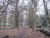
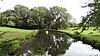
Dollis Brook runs through the London Borough of Barnet in north London. It is a tributary of the River Brent, which is itself a tributary of the River Thames. The Dollis Valley Greenwalk follows almost all of Dollis Brook, apart from a short section at the beginning which passes through private land, and the London Loop follows it as far as Barnet Lane. The name Dollis is probably derived from the Middle English word 'dole', meaning the shares of land in the common field.
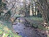
<span class="mw-page-title-main">Folly Brook</span>

Folly Brook is a 2+14-mile (3.6 km) long brook in the London Borough of Barnet. It is a tributary of Dollis Brook, which is a tributary of the River Brent, which is a tributary of the River Thames. Folly Brook is lined for most of its length by narrow strips of woodland and scrub, with a good variety of trees and shrubs. It is one of the best streams in Barnet for small aquatic invertebrates, including several species of caddis fly and a stonefly, which are only found in unpolluted waters.

<span class="mw-page-title-main">London Wildlife Trust</span> English nature conservation charity

London Wildlife Trust (LWT), founded in 1981, is a local nature conservation charity for Greater London. It is one of 46 members of the Royal Society of Wildlife Trusts, each of which is a local nature conservation charity for its area. The Trust aims to protect London's wildlife and wild spaces, and it manages over 40 nature reserves in Greater London. One of its campaigns is to turn London's gardens into mini-nature reserves, and it provides education services for schools. Local groups work on reserves and organise walks.

<span class="mw-page-title-main">Totteridge Fields</span>

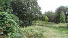
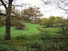
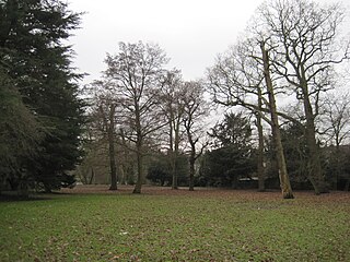
Totteridge Fields is a 97-hectare Site of Metropolitan Importance for Nature Conservation (SINC) in Totteridge in the London Borough of Barnet. The SINC includes the privately owned Highwood Hill, and at the western end is a seven-hectare Local Nature Reserve owned by Barnet Council and managed by the London Wildlife Trust.

<span class="mw-page-title-main">Darland's Lake Nature Reserve</span>

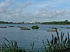
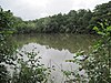
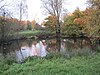
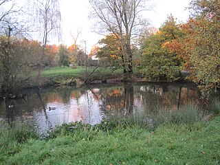
Darland's Lake Nature Reserve is a nature reserve south of Totteridge Village in Barnet, England. It is owned by the London Borough of Barnet and was managed from 1971 by the Hertfordshire and Middlesex Wildlife Trust, and more recently by the borough council. In 2007 the council spent £215,000 on repairing the dam and other works, and then proposed leasing the reserve to the Wildlife Trust. The transfer did not take place and in September 2017 a trust was set up by the London Wildlife Trust and local residents associations which took over the management of Darland's Lake. In 2020 Darlands Conservation Trust launched an appeal to raise £450,000 for excavation to prevent the lake drying up.

<span class="mw-page-title-main">Woodridge Nature Reserve</span>

Woodridge Nature Reserve or Woodridge School Nature Reserve is a 0.7-hectare (1.7-acre) Site of Local Importance for Nature Conservation in Woodside Park, London, owned and managed by the London Borough of Barnet. It was designed as a nature trail for local primary schools, but is now very neglected.

<span class="mw-page-title-main">Rowley Green Common</span>

Rowley Green Common is a six hectare Local Nature Reserve and a Site of Importance Metropolitan for Nature Conservation in Arkley, north London. It is owned by the London Borough of Barnet. It is also registered common land.

<span class="mw-page-title-main">Burtonhole Lane and Pasture</span>

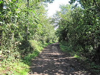
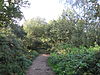
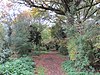
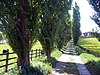
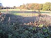
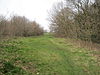
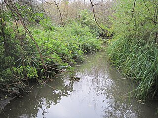
Burtonhole Lane and Pasture is a 6.5-hectare (16-acre) Site of Borough Importance for Nature Conservation, Grade II, between Mill Hill and Totteridge in the London Borough of Barnet. It consists of Burtonhole Lane between Partingdale Lane and Burtonhole Close, a footpath east from Burtonhole Lane towards Folly Brook, two fields south of the footpath, and a narrow belt of privately owned woodland north of the footpath. Burtonhole Brook, a tributary of Folly Brook, crosses Burtonhole Lane and the fields.

<span class="mw-page-title-main">Scratchwood</span>

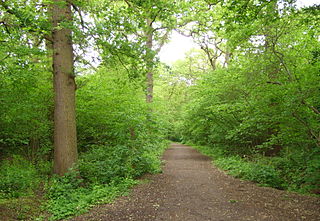
Scratchwood is an extensive, mainly wooded, country park in Mill Hill in the London Borough of Barnet. The 57-hectare site is a Site of Metropolitan Importance for Nature Conservation and together with the neighbouring Moat Mount Open Space. It is a Local Nature Reserve.

<span class="mw-page-title-main">Glebelands Local Nature Reserve</span>

Glebelands is Site of Borough Importance for Nature Conservation, Grade I, in Colney Hatch in the London Borough of Barnet. It is also part of the Coppett's Wood and Glebelands Local Nature Reserve.

<span class="mw-page-title-main">Oak Hill Wood</span>

Oak Hill Wood is a 10-hectare Local Nature Reserve (LNR) and a Site of Borough Importance for Nature Conservation Grade I, in East Barnet, London. It is owned by the London Borough of Barnet, and part of it is a 5.5-hectare nature reserve managed by the London Wildlife Trust.

<span class="mw-page-title-main">Totteridge Green</span>

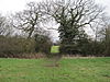
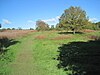
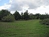
Totteridge Green is a five hectare Site of Borough Importance for Nature Conservation, Grade II, in Totteridge in the London Borough of Barnet. It is also registered common land.

<span class="mw-page-title-main">Totteridge Common</span>

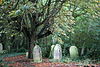
Totteridge Common is a 3.7 hectare Site of Borough Importance for Nature Conservation, Grade II, in Totteridge in the London Borough of Barnet. The nature reserve is the southern verge of the road Totteridge Common, between Totteridge Park and Oak Lodge. It is registered common land owned by the Totteridge Manor Association and comprised the lands of the former Manor of Totteridge which were transferred to the association in 1954.

<span class="mw-page-title-main">Deans Brook</span> Stream in Greater London, England

Deans Brook is a two-kilometre-long stream which runs between Mill Hill and Edgware in the London Borough of Barnet. It is a tributary of the Silk Stream, which is a tributary of the River Brent, which is a tributary of the River Thames.

<span class="mw-page-title-main">Mill Hill Old Railway Nature Reserve</span> Nature reserve in the London Borough of Barnet

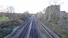
Mill Hill Old Railway Nature Reserve is a 2.3-hectare (5.7-acre) Site of Borough Importance for Nature Conservation, Grade II, in Mill Hill in the London Borough of Barnet.

<span class="mw-page-title-main">Drivers Hill</span>

Drivers Hill is a ten hectare Site of Borough Importance for Nature Conservation, Grade II, in Mill Hill in the London Borough of Barnet. It is owned by the Jehovah's Witnesses, who built their national headquarters, Watch Tower House, on the site in 1955. The house is a major printing works where 120 million Jehovah's Witnesses periodicals were printed in 2002.

<span class="mw-page-title-main">Greenhill Gardens, New Barnet</span>

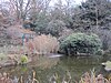
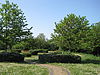
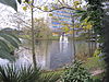
Greenhill Gardens is a 1.6 hectare public park in New Barnet in the London Borough of Barnet. Its main feature is an ornamental lake with a wooded island, which attracts many birds, and it also has a grassed area with scattered mature trees. It is a site of local importance for nature conservation.

<span class="mw-page-title-main">Friary Park</span>

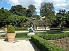
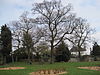
Friary Park is a nine hectare formal Edwardian park in Friern Barnet in the London Borough of Barnet.

<span class="mw-page-title-main">Clarefield Park</span>

Clarefield Park is a small park and Site of Local Importance for Nature Conservation in Brent Cross in the London Borough of Barnet.

<span class="mw-page-title-main">Big Wood and Little Wood</span> Small forested areas in London, England

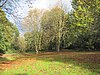
Big Wood and Little Wood are two patches of woodland in Hampstead Garden Suburb in the London Borough of Barnet. They are a Site of Borough Importance for Nature Conservation, Grade 1, and a Local Nature Reserve. Big Wood is 7.3 hectares and Little Wood is 1.2 hectares.

References

  1. Hewlett, pp. 2, 11–13
  2. "Activism for Change". London Wildlife Trust. Archived from the original on 25 October 2012. Retrieved 16 July 2013.
  3. Building Green: A guide to using plants on roofs, walls and pavements (PDF). Mayor of London. 2004. ISBN   1-85261-637-7. Archived from the original (PDF) on 16 August 2012. Retrieved 16 July 2013.
  4. Hewlett, pp. 2–3, 6
  5. "About England's Community Forests". England’s Community Forests. Archived from the original on 17 November 2015. Retrieved 14 November 2015.
  6. Barnet Unitary Development Plan, Chapter 5, pp. 65–67, 83–84
  7. "Sites of Importance for Nature Conservation". Mayor of London. Archived from the original on 19 January 2013. Retrieved 24 February 2013.
  8. Hewlett, pp. 14–15
  9. Barnet Unitary Development Plan, Chapter 5, p. 79
  10. Hewlett et al, Nature Conservation in Barnet
  11. "Budget and Performance Overview and Scrutiny Committee: Number of New Dwellings Started on Regeneration Schemes – Performance Update" (PDF). London Borough of Barnet. 15 March 2012. Archived (PDF) from the original on 5 March 2016. Retrieved 15 February 2013.
  12. "Grahame Park". Greenspace Information for Greater London. 2013. Archived from the original on 18 December 2014. Retrieved 16 August 2013.
  13. Johnson, Boris (25 January 2012). "London Wildweb site". The London Assembly. Archived from the original on 17 September 2013. Retrieved 17 September 2013.
  14. "iGiGL the data portal of Greenspace Information for London". Greenspace Information for Greater London. 2013. Archived from the original on 14 January 2014. Retrieved 14 August 2013.
  15. "Sites of Special Scientific Interest, Search results for Greater London". Natural England. Archived from the original on 24 October 2012. Retrieved 24 February 2013.
  16. Hewlett, p. 53
  17. "Local Nature Reserves, Search Results for Greater London". Natural England. Archived from the original on 27 September 2013. Retrieved 24 February 2013.
  18. "Local Nature Reserves". Natural England. Archived from the original on 23 September 2013. Retrieved 22 September 2013.
  19. "Nature Conservation: Local Sites in Positive Conservation Management in England, 2008/9 to 2012/13". Department for Environment, Food and Rural Affairs. Archived from the original on 19 February 2014. Retrieved 2 February 2014.
  20. 1 2 3 4 Hewlett, p. 27
  21. "Local Nature Reserves". Natural England. Archived from the original on 25 May 2013. Retrieved 7 March 2013.
  22. "Sites of Special Scientific Interest". Natural England. Archived from the original on 14 March 2013. Retrieved 7 March 2013.
  23. "The Common Lands of Greater London: A Biological Survey" (PDF). Department for Environment, Food and Rural Affairs. Archived from the original (PDF) on 2 April 2013. Retrieved 24 February 2013.
  24. "Open Access land". Natural England. Archived from the original on 1 February 2013. Retrieved 25 February 2013.
  25. Hewlett, p. 83
  26. Hewlett, pp. 84–85
  27. "UK Biodiversity Action Plan priority bird species". Joint Nature Conservation Committee, Department for Environment, Food and Rural Affairs. Archived from the original on 13 May 2013. Retrieved 7 March 2013.
  28. Hewlett, pp. 41–43
  29. "Arrandene Open Space and Featherstone Hill". Greenspace Information for Greater London. 2013. Archived from the original on 27 September 2013. Retrieved 16 August 2013.
  30. Hewlett, p. 76
  31. Hewlett, p. 89
  32. "Barfield Allotments Nature Park". Greenspace Information for Greater London. 2013. Archived from the original on 27 September 2013. Retrieved 16 August 2013.
  33. "Barnet Countryside Centre". Greenspace Information for Greater London. 2013. Archived from the original on 27 September 2013. Retrieved 16 August 2013.
  34. "Home page". Friends of the Barnet Countryside Centre. Archived from the original on 24 September 2008. Retrieved 22 March 2013.
  35. "Bell's Hill Burial Ground". Greenspace Information for Greater London. 2013. Archived from the original on 27 September 2013. Retrieved 16 August 2013.
  36. Hewlett, p. 88
  37. "Belmont Open Space, Cockfosters". Greenspace Information for Greater London. 2013. Archived from the original on 27 September 2013. Retrieved 16 August 2013.
  38. Hewlett, pp. 57–58
  39. "Brent Reservoir (Welsh Harp)". Greenspace Information for Greater London. 2013. Archived from the original on 27 September 2013. Retrieved 16 August 2013.
  40. Hewlett, p. 72
  41. Hewlett, pp. 76–77
  42. Hewlett, p. 92
  43. "Clarefield Park". Greenspace Information for Greater London. 2013. Archived from the original on 27 September 2013. Retrieved 16 August 2013.
  44. Planning report PDU/1483/01, Greater London Authority, 11 February 2009, p. 41
  45. "Cricklewood Brent Cross". London Borough of Barnet. Archived from the original on 8 May 2013. Retrieved 18 February 2013.
  46. Hewlett, p. 86
  47. "Clitterhouse Recreation Ground". Greenspace Information for Greater London. 2013. Archived from the original on 27 September 2013. Retrieved 16 August 2013.
  48. Planning report PDU/1483/01, p. 4
  49. "College Farm". Greenspace Information for Greater London. 2013. Archived from the original on 27 September 2013. Retrieved 16 August 2013.
  50. "Coppett's Wood and Scrublands Local Nature Reserve". Greenspace Information for Greater London. 2013. Archived from the original on 22 October 2013. Retrieved 16 August 2013.
  51. "Copthall Railway Walk and Copthall Old Common". Greenspace Information for Greater London. 2013. Archived from the original on 27 September 2013. Retrieved 16 August 2013.
  52. "Copthall South Fields". Greenspace Information for Greater London. 2013. Archived from the original on 27 September 2013. Retrieved 16 August 2013.
  53. "Deans Brook and Stoneyfields Park". Greenspace Information for Greater London. 2013. Archived from the original on 27 September 2013. Retrieved 16 August 2013.
  54. "Drivers Hill". Greenspace Information for Greater London. 2013. Archived from the original on 27 September 2013. Retrieved 16 August 2013.
  55. "East Finchley Cemetery". Greenspace Information for Greater London. 2013. Archived from the original on 27 September 2013. Retrieved 16 August 2013.
  56. "Edgware Way Rough". Greenspace Information for Greater London. 2013. Archived from the original on 27 September 2013. Retrieved 16 August 2013.
  57. 1 2 Hewlett, p. 67
  58. "Edgwarebury Park". Greenspace Information for Greater London. 2013. Archived from the original on 27 September 2013. Retrieved 16 August 2013.
  59. "Folly Brook and Darland's Lake Nature Reserve". Greenspace Information for Greater London. 2013. Archived from the original on 27 September 2013. Retrieved 16 August 2013.
  60. "Friary Park". Greenspace Information for Greater London. 2013. Archived from the original on 27 September 2013. Retrieved 16 August 2013.
  61. Hewlett, p. 52
  62. "Glebelands Local Nature Reserve". Greenspace Information for Greater London. 2013. Archived from the original on 27 September 2013. Retrieved 16 August 2013.
  63. "Greenhill Gardens". Greenspace Information for Greater London. 2013. Archived from the original on 27 September 2013. Retrieved 16 August 2013.
  64. "Hadley Green". Greenspace Information for Greater London. 2013. Archived from the original on 27 September 2013. Retrieved 16 August 2013.
  65. Hewlett, pp. 44–45
  66. "Hendon Park and Northern Line Railway Cutting". Greenspace Information for Greater London. 2013. Archived from the original on 27 September 2013. Retrieved 16 August 2013.
  67. "King George's Fields". Greenspace Information for Greater London. 2013. Archived from the original on 27 September 2013. Retrieved 16 August 2013.
  68. Hewlett, p. 94
  69. Hewlett, pp. 79–80
  70. Hewlett, pp. 64–65
  71. "Mill Hill Old Railway Nature Reserve". Greenspace Information for Greater London. 2013. Archived from the original on 29 January 2016. Retrieved 16 August 2013.
  72. Hewlett, pp. 47–48
  73. Hewlett, pp. 70–72
  74. "Monken Hadley Common". Greenspace Information for Greater London. 2013. Archived from the original on 27 September 2013. Retrieved 16 August 2013.
  75. "The Mutton Brook". Greenspace Information for Greater London. 2013. Archived from the original on 27 September 2013. Retrieved 16 August 2013.
  76. Hewlett, p. 91
  77. "New Southgate Cemetery". Greenspace Information for Greater London. 2013. Archived from the original on 27 September 2013. Retrieved 16 August 2013.
  78. Hewlett, pp. 80–81
  79. Hewlett, p. 80
  80. "Oak Hill Wood Local Nature Reserve". Greenspace Information for Greater London. 2013. Archived from the original on 27 January 2016. Retrieved 16 August 2013.
  81. Hewlett, pp. 91–92
  82. Hewlett, p. 93
  83. "Pymme's Brook". Greenspace Information for Greater London. 2013. Archived from the original on 27 September 2013. Retrieved 16 August 2013.
  84. Hewlett, pp. 32–33
  85. "Rowley Lodge field". Greenspace Information for Greater London. 2013. Archived from the original on 27 September 2013. Retrieved 16 August 2013.
  86. Hewlett, pp. 48–51
  87. "Silk Stream and Burnt Oak Brook". Greenspace Information for Greater London. 2013. Archived from the original on 27 September 2013. Retrieved 16 August 2013.
  88. "St Pancras and Islington Cemetery". Greenspace Information for Greater London. 2013. Archived from the original on 27 September 2013. Retrieved 16 August 2013.
  89. "Sunny Hill Park and Hendon Churchyard". Greenspace Information for Greater London. 2013. Archived from the original on 27 September 2013. Retrieved 16 August 2013.
  90. Hewlett, pp. 72–73
  91. "Black Poplar". Natural England. 25 January 2010. Archived from the original on 27 September 2013. Retrieved 23 March 2013.
  92. "Totteridge Common". Greenspace Information for Greater London. 2013. Archived from the original on 27 September 2013. Retrieved 16 August 2013.
  93. Hewlett, pp. 62–64
  94. "Totteridge Fields and Highwood Hill". Greenspace Information for Greater London. 2013. Archived from the original on 24 September 2015. Retrieved 16 August 2013.
  95. "Totteridge Green". Greenspace Information for Greater London. 2013. Archived from the original on 27 September 2013. Retrieved 16 August 2013.
  96. Hewlett, p. 84
  97. "Upper Dollis Brook". Greenspace Information for Greater London. 2013. Archived from the original on 27 September 2013. Retrieved 16 August 2013.
  98. "Woodridge School Nature Reserve". Greenspace Information for Greater London. 2013. Archived from the original on 27 September 2013. Retrieved 16 August 2013.

Sources